GNSS (all systems) Archives - Page 133 of 153 - Inside GNSS - Global Navigation Satellite Systems Engineering, Policy, and Design

GNSS (all systems)

February 10, 2012

GNSS Vulnerability: Present Dangers and Future Threats

National Physical Laboratory entrance

This free one-day event at the British National Physical Laboratory in Teddington (London) on Wednesday, February 22 will present results of current jamming detection, and consider emerging threats such as meaconing and spoofing.The seminar runs from 9:30 a.m. to 5:30 p.m.

Interested participants must pre-register online.

Todd Humphreys, director of the Radionavigation Laboratory at the University of Texas-Austin will deliver the keynote, "PVT security: privacy and trustworthiness."

Read More >

By Inside GNSS
January 19, 2012

GNSS Hotspots | January 2012

One of 12 magnetograms recorded at Greenwich Observatory during the Great Geomagnetic Storm of 1859
1996 soccer game in the Midwest, (Rick Dikeman image)
Nouméa ground station after the flood
A pencil and a coffee cup show the size of NASA’s teeny tiny PhoneSat
Bonus Hotspot: Naro Tartaruga AUV
Pacific lamprey spawning (photo by Jeremy Monroe, Fresh Waters Illustrated)
“Return of the Bucentaurn to the Molo on Ascension Day”, by (Giovanni Antonio Canal) Canaletto
The U.S. Naval Observatory Alternate Master Clock at 2nd Space Operations Squadron, Schriever AFB in Colorado. This photo was taken in January, 2006 during the addition of a leap second. The USNO master clocks control GPS timing. They are accurate to within one second every 20 million years (Satellites are so picky! Humans, on the other hand, just want to know if we’re too late for lunch) USAF photo by A1C Jason Ridder.
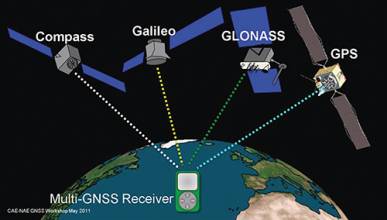
Detail of Compass/ BeiDou2 system diagram
Hotspot 6: Beluga A300 600ST

1. ICE BREAKER
Nome, Alaska USA

√ Two 2 1/2 pound GPS-guided UAVs that tolerate extreme cold helped bring fuel to snowbound Nome, Alaska over two weeks in January. On daily photographic missions, the Aeryon Scouts helped University of Fairbanks researchers map ice thickness in the frozen harbor so a Coast Guard icebreaker could slowly guide a Russian fuel tanker close enough to pump the fuel to shore.

Read More >

By Inside GNSS
[uam_ad id="183541"]
January 17, 2012

ICCE 2012 Special Session: Satellite Navigation Technologies

Saigon Morin Hotel in Hue, Vietnam

A special session on Satellite Navigation Technologies will be held as part of the 2012 International Conference on Communications and Electronics (ICCE) at the Saigon Morin Hotel in Hue, Vietnam on August 1-3.

Because South East Asia will be covered by all of the global and regional satellite navigation systems by 2015, the region will experience the multi-GNSS environment at its edge.

Read More >

By Inside GNSS
After Longitude – Modern Navigation in Context

Cadets with sextants circa 1930 (from National Maritime Museum collections)

The "After Longitude" symposium covers what happened in between Harrison’s clocks and geospatial PNT. It is sponsored by the British National Maritime Museum and the Royal Institute of Navigation.

The event takes place on March 22 and 23 at the National Maritime Museum in Greenwich. 

Speakers on Thursday, March 22 will cover the earlier history of navigation. On Friday, topics include:

Read More >

By Inside GNSS
January 16, 2012

2012 International GPS/GNSS Showcase

The 2012 International GPS/GNSS Showcase will take place at Chulalongkorn University, Department of Survey Engineering, in Bangkok on January 17.

The event promotes cooperation and research on GPS and GNSS applications in the Asia Pacific region.

Read More >

By Inside GNSS
FIG /IAG Technical Seminar: Reference Frame in Practice

Monte Mario, the highest hill in Rome

A special seminar for geodesists will take place in Rome, Italy on May 4 and 5, just before the 35th FIG general assembly and working week.

The conference venue is the Cavalieri hotel on Monte Mario near the Vatican.

It is organized by the International Association of Geodesy (IAG), the surveyors’ international association (FIG) and the UN’s International Committee on GNSS (ICG).

Read More >

By Inside GNSS
[uam_ad id="183541"]

Hexagon 2012

A number of user conferences for customers of Hexagon AB’s precise measurement brands and products will be combined in the Swedish corporation’s second international conference this summer.

Read More >

By Inside GNSS

Advanced Receiver Processing of GNSS Signals: NavtechGPS

European Space Agency’s ESTEC in Noordwijk

NavtechGPS will offer a four-day public venue course from March 5 though 8 at the European Space Agency’s Space Research and Technology Center (ESA/ ESTEC) in Noordwijk, Netherlands.

"Advanced Receiver Processing of GNSS Signals" (Course 541) will be taught by John Betz, MITRE and James Sennott, Tracking and Imaging Systems, Inc.

Read More >

By Inside GNSS
January 14, 2012

2012 International Satellite Navigation Forum/ NAVITECH

Plenary session at a previous Satellite Navigation Forum.

The sixth International Satellite Navigation Forum will take place during the NAVITECH exhibition at the Expocentre Fairgrounds in Moscow, Russia on April 17 and 18, 2012.

The purpose of the forum is to discuss GLONASS and other GNSSes in the economy of Russia, developing commercial and civic uses for GLONASS, Russian national policy on the use of GLONASS, regional systems, new equipment and services and the development of single international standards in the field of satellite navigation.

Read More >

By Inside GNSS

Winging It

FIGURE 1: Competitive group skydiving is currently judged by overlaying a grid on a photo and evaluating location of divers within its cells. Photo by Mark Harris.

»NovAtel Inc. wingsuit video

In 1589, at the age of 25, Galileo Galilei toiled up the 294 steps of a 55-meter bell tower in Pisa, Italy, where he was tutoring math students at the time.

According to his pupil and later biog­rapher, Vincenzo Viviani, Galileo carried with him two cannonballs, one twice the weight of the other. When he reached the top of the tower, he went to the lower balcony of the tilted structure and dropped the two balls simultaneously.

Read More >

By Inside GNSS
January 12, 2012

2012 Indoor Positioning and Indoor Navigation (IPIN)

UNSW, the conference venue, is 4.3 miles (7 km) from Sydney city center.

The 2012 International Conference on Indoor Positioning and Indoor Navigation (IPIN) will take place at the University of New South Wales in Sydney, Australia From November 13 to 15.

The keynote, by Google’s Waleed Kadous, is "The Indoor Tipping Point: Lessons from Indoor at Scale." 

Read More >

By Inside GNSS
IGM_e-news_subscribe