July 11, 2012
Concorde El Salam Hotel
14th IAIN World Congress: International Association of Institutes of Navigation
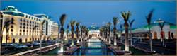
Concorde El Salam HotelThe biennial International Association of Insitutes of Navigation (IAIN) World Congress will take place in Cairo, Egypt from October 1 to October 3, 2012, in conjunction with MELAHA 2012, the 6th Arab Institute of Navigation conference and exhibition.
The conference venue is the Concorde El Salam hotel in the tranquil Helipolis suburb, a 10 minute drive from the airport
The theme is "Seamless Navigation: Challenges and Opportunities."
By Inside GNSS