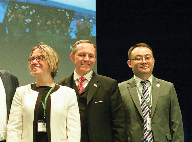
This year’s Munich Satellite Navigation Summit featured notable speakers and some notable absences. European, American and Chinese, but not Russian, representatives of respective GNSS programs updated attendees on progress and concerns.
At the Munich Satellite Summit opening plenary, Paraskevi Papantoniou, acting director for Space at the European Commission, discussed steps forward in a ‘crisis context’: “We continue to work toward our main EU objectives, of which there are three: the establishment of new data services, achieving net zero emissions and digitalization of the economy. We have some key space initiatives, including the development of new data services, and we have IRIS squared.” IRIS2 is the new European multi-orbital satellite constellation, put together in record time and offering enhanced communication capacities, including broadband, high-speed internet, to governmental users and businesses.
“We have launched the Galileo high accuracy service [HAS],” Papantoniou said, “with accuracy level of a few decimeters, for compatible receivers worldwide. This is the first ever free, global, precise positioning service and we’re inviting receiver manufacturers and app developers to use it.” Add the free OSNMA Galileo authentication service and the now running encrypted public regulated service (PRS) and you have a nice array of GNSS-alone-based services to brag about, if you’re the European Commission.
“We’ve been testing and tuning the OSNMA for the last few years,” Papantoniou said, “and we are confident that it is reliable and performing well. Our plan is to officially declare initial operations by the end of this year, but we know some manufacturers are already implementing this service, for both indoor and outside apps, for example trucks in Europe using the smart tachograph.”
Security Sooner Rather Than Later
As for the PRS, Papantoniou said, “We plan to declare PRS initial service next year. Together with ESA [European Space Agency], EUSPA [European Agency for the Space Program] and with industry, we are moving full speed. This is the last mile for us. In the current crisis context, it is important to have this governmental service fully operational.” Here, we suppose, Papantoniou, by ‘crisis context,’ was referring to the war in Ukraine.
“And of course,” Papantoniou said, “next to everything I’ve mentioned, in parallel, we are developing the second generation of Galileo satellites, with new and robust features, relying on ESA for design and also supervising industry. All of this ensures that Galileo will remain the top GNSS in the world, for ground, sea and air applications, but also providing services for space applications, for the GNSS space service volume.”
The absence of Russians, not only in Munich but more essentially at the European spaceport in Kourou, French Guyana, is indeed a crisis-level problem for the EU. As everyone knows by now, the Union has allowed itself to become heavily reliant on Russia’s Soyuz launch services over the years. Finding a way to get into space is now an immediate concern for the EU space program, while political principles continue to constrain its options.
“We want to rely on European suppliers for our flagship programs. This is enshrined,” Papantoniou said. “At the same time, in our EU space program regulation, one of the key objectives is to ensure autonomous access to space, through European Union providers. This is how we launch our satellites. There is also a strong governmental component, for example with the PRS, so we need to have the right security assurances. We are working very closely with our European service provider Arianespace, to see when we will be able to launch our next Galileo satellites, but for now, today, we are in a difficult situation, in a crisis situation.”
A Place for High Accuracy
Representing the U.S. GPS program, Harold ‘Stormy’ Martin, director of the National Coordination Office for Space-Based PNT in Washington, responded to the announcement of the new Galileo HAS: “The U.S. has long held the position that high-accuracy, precise point positioning [PPP] services should be provided by commercial services, so for decades U.S. companies have built PPP systems to meet the needs of their users. The U.S. belief is that the commercial market is best suited to adapt to those changing customer needs and provide the best product, so that customers can buy the level of accuracy that they desire, even if that desire changes over time.”
The Galileo HAS is delivered via the E6 radio frequency band, but the U.S. Federal Communications Commission (FCC) has not granted access to the Galileo E6 signal in the U.S., arguing that doing so could constrain its spectrum management in the future. The FCC last ruled on this in 2018, and its position continues to be a point of contention for the Galileo program.
“Spectrum use in the U.S. is a complicated issue,” Martin said, “involving multiple government agencies and commercial interests that are ultimately adjudicated by the FCC, which is an independent body. We can’t predict what the FCC would do in any given situation, but for context, E6 is not specifically allocated for radionavigation service in the U.S., and we do not have a GPS signal in the E6 band, so we can’t provide the protections for using Galileo E6 safely in that band. In the U.S. spectrum allocation process there is an allowance for submission of a reconsideration, but there is no guarantee that there will be a different outcome.”
A Place for Russia?
As widely reported, China and Russia signed contracts in 2022 to host ground stations for their respective GNSS, BeiDou and GLONASS. Beijing will place new ground monitoring stations at different locations in Russia, while Moscow will do the same in China. The two sides also recently signed a statement on the joint provision of support services to their customers. New ground infrastructure will likely boost the performance of both Chinese and Russian systems, enabling them to exploit new GNSS-based applications in areas such as precision farming, transportation and unmanned vehicles. Improved PNT services also will certainly benefit Chinese and Russian military users. Chinese-Russian GNSS cooperation is part of a broader partnership in space, which seemed to gather pace after the Western backlash against Russia’s 2014 invasion of Ukraine.
Jiang De, of the China Satellite Navigation Office in Beijing, was asked by session moderator Claus Kruesken to explain China’s ongoing cooperation with Russia, even as that country engages in aggressive warfare in Europe. His answer, though not exactly to the point, was an answer: “BeiDou adheres to the principle of cooperation,” he said. “China’s BeiDou is the world’s BeiDou, and so we cooperate with Russia, just as we promote cooperation and negotiation on satellite navigation applications and satellite communication with other systems, especially on the issue of compatibility and interoperability. I also believe that cooperation between different systems provides better services and applications to the global users. Again, we are not neglecting multi-lateral cooperation. We are doing joint performance assessment with other systems, and we are pushing to join more international organizations. We are implementing education and training programs to cultivate talents across the world. In a word, BeiDou has always promoted the capability, construction and technology development of satellite navigation.”
Stormy Martin told Inside GNSS he felt no awkwardness in sharing a stage with China at what could be seen as a fragile time in U.S.-Chinese relations. “I think it’s important to realize that there are a lot of users out there that use all of these systems every day,” he said. “They may not realize it, but if you go into the guts of cell phones, for instance, a lot of them have a chip that uses GPS, GLONASS, BeiDou and Galileo. Now, in different countries, different parts of that chip may be activated or may not. It depends on exactly what location they’re in and what the manufacturer of the cell phone decides to enable, but there are people all over the world that use all of these systems, so it’s important to focus on those customers. What can we do to make our systems better for them, because they rely on us for safety-of-life response, fire, ambulance, police, safety of aviation, in the air, and then all of the commercial uses which have changed our lives dramatically.” So the American and Chinese delegations, at least in Munich, seemed not to be of a mind to bicker. “And meanwhile,” Martin said, “we can continue to hope the world becomes a more peaceful place.”
Galileo PRS Push
As it waits for the world to become more peaceful, the European Union is forging ahead with its plans to beef up GNSS security. The characteristics and architecture of the Galileo PRS have already been outlined elsewhere. Fabien Frossard, service engineering manager at EUSPA, said, “The Galileo dual frequency, E1 and E6, certified and accredited PNT service, what we call the PRS, is managed by EU member states, accessible to them as well as to third countries and international organizations, subject to conditions.” Third countries currently enjoying access to the PRS include Norway and the U.S., and we have it on good authority that Great Britain also will be granted access in the near future, subject to the outcome of ongoing negotiations.
“We have been in the initial service phase since 2016, when we started to broadcast the signal in space,” Frossard said. “Right now, we are preparing the operational qualification of the new PRS release. That’s to say we are about to finalize the deployment of system build 2.0. And of course we manage the PRS access control from the Galileo Security Monitoring Centers in France and in Spain.”
Frossard outlined a number of current tasks being undertaken by EUSPA in its push toward PRS full operational capability. One of these entails providing PRS expertise to member states. “And we are doing the same on the other side for industry,” he said. “We are also helping to fund and coordinate R&D projects. We are now deploying across Europe a Galileo robust operational network [GRON]. This is a classified network used to disseminate the PRS keys all across Europe, giving users access to PRS signal.”
Next steps include supporting more R&D projects, for example toward the development of new PRS receiver
prototypes. One project, designated P3RS2, has already produced a prototype. “This was our first one,” Frossard said. “It’s a sort of shoe box unit, and we’re now going deeper, step by step, to reduce the form factor. We have another one under development, with the Leonardo-designed project P3RSE. This is a compact, dual-constellation receiver, much smaller than the first one.” The new prototype is designed for both land and maritime tactical platforms. It is tamper proof and it hosts Galileo PRS compact secure receiver type I (GSRT1) using Galileo OS and PRS, and GPS C/A, and there is an option for military GPS (SAASM).
“We are also preparing a radio frequency constellation simulator [RFCS],” Frossard said, “for which we have published a tender. This will simulate the constellation signals in space in different environments, as received at a specific position and date, to test and validate receivers and security modules before mass production, and for the investigation of incidents.” The unit will have full simulation capabilities in all Galileo bands, plus GPS and others.
Finally, a new project with Airbus and Fraunhofer is developing a test vector generator. “This is an ongoing project,” Frossard said. “It will give us a simulation tool for the whole industry that can be used by member states to simulate PRS orders and messages, for the development of PRS receivers and security modules.”
More Coming
“For the future, we will continue to support member states’ competent PRS authorities [CPAs],” Frossard said, “and of course we have many activities on the user segment aimed at promoting ease of access to the PRS. We are keen to be supportive to PRS uptake, and EUSPA’s idea is to help member states and the industry to propose innovative solutions for the PRS user segment. Therefore, we are launching a number of actions through the Horizon program [the EU’s R&D funding framework] and to develop PRS-based applications with the competent PRS CPAs.”
Following Frossard, Frank Wilms of FDC and Ronald Nippold of DLR presented work under ongoing EU-funded R&D projects, aimed at developing and demonstrating a range of new PRS-based technologies and applications.
There were many other extremely enlightening presentations given at the Munich Satellite Navigation Summit. In all, the event felt a bit like a class reunion. After an extended break, due to health concerns, the Bavarian capital was found to be everything that it had been before. The summit featured familiar faces and some fresh ones, and in spite of the missing GLONASS delegation, the event was informative and encouraging, and one could hardly have wished for more than that.


