Across Europe, major space- and PNT-related presentations have revealed new details about the Galileo high-accuracy service (HAS), the European LEO PNT project, and key space defense initiatives.
In times past, summer saw the old continent emptying itself, tenants fleeing to beaches and mountains for rest and refurbishment, leaving only us crickets to sing of satellites and signals. This summer, Europe’s space set has been putting on a show. Our round-up of events taking place in June and July starts in Torrejon, Spain, where the Galileo program hosted its first HAS Days. The Galileo HAS has emerged as a key differentiator vis-a-vis GPS, Glonass and BeiDou. Ignacio Fernández of the European Commission, Javier de Blas of the European Union Agency for the Space Programme (EUSPA) and Daniel Blonski of the European Space Agency (ESA) together outlined the state of play.
“The high-accuracy service is working, so please use it,” de Blas said. “As for the HAS roadmap, as we move forward we want to see user segment development, more HAS receivers and more R&D actions. We will publish the HAS reference algorithm, and we will distribute test vectors and supporting materials for ICD implementation.” There will be more HAS-based application development and service performance reporting. “In the mid- and long-term, we will be moving toward full service, service level 2,” de Blas said, “and this will mean increased performance, better accuracy, faster positioning with atmospheric corrections, and finally HAS authentication and error characterization features.”
HAS Details Come to Light
Event attendees were stimulated, as evidenced by their many and incisive questions, during a free-flowing HAS Q&A session. The audience wanted to know more about the HAS reference algorithm.
Q: How will it be shared?
A: “We want to learn from you guys,” de Blas said. “What is your expectation? We’re working on the mathematical formulation of the algorithm, a document that will be made available in the coming months, but we will also make available additional materials. So the question goes back to you. What is the best format? We’re working on a potential implementation, maybe a library. These are options that are on the table, so we are ready for your feedback.”
Q: What is the expected timeline for ionospheric and tropospheric corrections, expected in the service level 2 package?
A: “We’re working intensively on the specifications, the infrastructure requirements to materialize the evolution toward full service” de Blas said. “This will be followed by tendering processes, so we can launch the contracts for the infrastructure development. Typically, this will not take less than two years. There is a HAS info note already published on our GNSS Service Center website, which points to the different roadmap timelines.”
Fernández said, “Aside from the procurement process, we already have a network of stations, the EGNOS RIMS [ranging integrity monitoring stations], already covering Europe, and this is for the moment the main candidate for the monitoring capability we expect to have for the ionosphere.”
“Something to be underscored here, de Blas said, “at program level, at EUSPA we’re looking at the exploitation of the synergies among the different space program components, in particular our GNSS. This is part of the effort to streamline the investment from the member states. We want to better use the existing infrastructure, and the assessment of the EGNOS RIMS stations for the delivery of a Galileo service is part of that.”
Q: Will HAS support all GNSS constellations? Other private services are doing so, which could leave Galileo in a weaker position.
A: “The scope of the HAS is focused on the augmentation of GPS and Galileo,” de Blas said. “Today there are no plans to augment further constellations.”
Q: Will it be possible to know in advance which satellite will broadcast the HAS? Currently only a small minority of Galileo satellites are doing so, which is not an issue under open skies, but in urban environments, it might be.
A: “At the moment we have 24 satellites flying and about 20 uplink stations,” Blonski said. “So not all satellites will broadcast HAS corrections continuously. There is no indication foreseen in the signal in space to say which satellites will be broadcasting HAS. You will be able to determine that by receiving a valid HAS message. If a satellite is not broadcasting or receiving HAS data it will broadcast a dummy message. The current ICD is designed to allow flexibility and expandability, in order to broadcast HAS potentially through all satellites or to enable users also to receive HAS from different satellites and reconstruct the message with a subset of this information.”
Q: Concerning safety-critical applications in the railway sector, have you analyzed the impact of dynamic conditions? What happens to HAS when you’re moving at high speeds?
A: “Generally, it’s acceleration that is more disturbing to high accuracy,” Fernández said. “High accuracy relies on the processing of the carrier phase measurements and these are more sensitive to disruptions than the time of arrival measurement. These disruptions can be obstacles but so can the dynamics in the receiver, mainly related to disruptive accelerations rather than high speed. In the case of trains, it’s not too bad an environment for carrier phase processing. The physical objects around the railway might be of a higher concern.
“Also related to safety of life and integrity, while HAS does not provide integrity, and we have to be very clear about that, it is providing very short updates to the clock corrections, and this allows us to catch clock run-offs in the satellites very quickly, and that would contribute to integrity.”
“We remind everyone that we are already delivering EGNOS services focused on safety of life integrity,” de Blas said. “We are supporting these applications obviously in aviation, but there are also ongoing efforts to bring these capabilities to the maritime and railway domains. High accuracy is addictive. It’s interesting. The more accurate the better, but we should look at the actual needs for each application, and within the overall E-GNSS portfolio, EGNOS is already delivering fantastic capabilities.”
Europe’s LEO PNT Takes Shape
Another topic stirring hearts and minds among the positioning, navigation and timing (PNT) community is the promise of low Earth orbit (LEO) satellite systems. The topic took center stage in Toulouse, at this year’s International Technical Symposium on Navigation and Timing, (ITSNT).
Jean Maréchal, navigation program manager at France’s National Center for Space Studies (CNES), unveiled the European approach to LEO PNT. “GNSS was initially in LEO, with analogue signals, back in the 90s,” he said. “From there, we went to MEO [medium Earth orbit] with digital signals. There are now more than 100 MEO GNSS satellites in orbit, and almost 30 in other orbits for regional services, which is a lot of satellites broadcasting a lot of signals. And now we want to come back to LEO, with even more satellites. Why?”
Part of the answer, he said, is the proven feasibility of LEO constellations as demonstrated in the satellite communications sector. “If it’s just navigation alone, it would be difficult to convince investors to put a lot of money in. We’ve known for several years that if you want to have a LEO constellation you need at least 200, 300 satellites.”
Expectations are high and include augmentation of MEO satellite performance, MEOless services, and more robust service in general. Fast convergence is another prospect, for precise positioning and improved error bounding. “Precision is addictive,” Maréchal said. Where have we heard that before? “We get precision and we want more, and we want good, qualified precision, beyond SBAS performance. SBAS is nice, but SBAS is for planes, and planes need to stay on a runway. It’s different for a car or a train. And then we can talk about LEO performance in urban canyons, at high altitudes, and with low power terminals, IoT [internet of things]. And then of course there’s the Holy Grail of indoor positioning.
“We can also look outside the L band and the S band to UHF or Ku/Ka bands. There could be additional data channels, bidirectional links for improved, two-way PNT. Another Holy Grail is to have one signal doing both satcom and PNT.”
And who wants all that? The list is long and includes digital mobility, rail, road, maritime, aviation, autonomous systems, critical infrastructure, high-latitude users, synchronization services, 5G/6G networks, alert/emergency, asset tracking, meteorological and scientific users. “Maybe it’s a bit too much,” Maréchal said. “It seems we’ve hit a peak of inflated, if not unreasonable, expectations.”
Europe Wants In
What is Europe doing to get its LEO PNT? “The EU multi-annual financial framework (MFF) is now operative for 2021-2027,” Maréchal said. “Before that, up to 2020, the picture was simple. We had Galileo and EGNOS on one side and Copernicus on the other; two programs. Today, we are in the EU Space Program, so in addition we now have GOVSATCOM, Space Situational Awareness/Space Surveillance and Tracking (SSA/SST), and we have the new IRIS2, just approved a few months ago. In all of that, there is no LEO PNT. The next MFF will be 2028-2034. Meanwhile, we see the satellites going up: Xona Space, Geely, Centispace, so we need to do something.”
The major step now, it turns out, is an ESA program called FutureNAV LEO-PNT. “The first ITT [invitation to tender] has been published,” Maréchal said. “The objective is to assess whether the services are good or not and who has to pay for them. Is it a new EU budget or do we foresee a private system and service? This is a fully ESA-funded program. It’s not an EU program, but it’s a European program.”
There appears to be an appetite for LEO PNT among ESA’s member states, with a large number participating, including some non-EU member states. Under the ITT, two demonstrations will be run in parallel, each worth 70 million Euro. One demo will include one light and fast, 30kg Pathfinder A satellite (plus one spare). The other demo will comprise four larger Pathfinder B satellites, 30 to 80kg each.
“The satellites will broadcast RNSS and 5G signals,” Maréchal said, “L and S band, and targeting two-way PNT with handheld user terminals. There will be options to use Ka, C and UHF bands, and it’s open for any other interesting ideas from industry. The final user community will be deeply involved. The target is to assess the services, to find a user community, to look at it not only from a technical point of view but from a business point of view. The price of the terminal will be key. The price of the service will be key.
“This is a very important project for us,” he said, “from a programmatic point of view and from an industrial point of view. At some point there will need to be a decision about including or not a PNT payload onboard IRIS2, as there will be space on those satellites for secondary payloads. For now, we will have to wait for feedback from the private sector, and in 2028 we’ll know more about the EU investment in LEO PNT.”
New Forum, Weighty Discussions
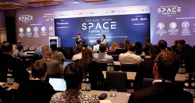
Much attention was paid to the ever rising priority of space and defense at the first edition of the European Space Forum in Brussels. Juan Sanchez Delgado, deputy director, and security and planning director at the Spanish Space Agency (AEE) said there is an urgent need to take action in the face of emerging space threats. “In addition to jamming and spoofing attacks on the ground, we’ve seen anti-satellite systems in action. In 2021, Russia destroyed a satellite in space, leaving 1,500 pieces of debris in orbit, potentially threatening the safety of many space objects, not to mention the astronauts onboard the International Space Station. The situation in Ukraine, with the devastating cyber-attack in the first days of the war, was a wake-up call for all of Europe. We need a change of paradigm. Space is like the Far West right now. We need regulations. We need some limits.”
“We have been very busy in recent weeks and months,” said Benedikta von Seherr-Thoß, Managing Director for Common Security and Defence Policy at the European External Action Service (EEAS). “Among other things, we’ve been busy with the provision of ammunition. One of our most important partnerships is with the U.S., but we are also working to expand dialogues with other entities. NATO, for example, is an increasingly important partner.”
Europe is in a good position in space, she said, and that position needs to be maintained. “Galileo is functioning on a par with other GNSS systems in the world, but there are now real threats and challenges to our space assets.” Von Seherr-Thoß referenced the key 2022 document ‘EU Strategic Compass,’ which lays out an ambitious plan of action for strengthening EU security and defense policy by 2030. The document underscores the importance of the EU Space Program for European security.
Guillaume de la Brosse, Head of Unit Innovation, Start-ups and Economics at the European Commission’s DG DEFIS, is part of a group developing a new proposal for an EU Space Law, under the EU Space Strategy for Security and Defense (EEAS). “In the current tense geopolitical situation, we need to be able to protect, respond and react when it comes to threats to space assets in the EU. This Space Law will include minimum requirements for everything that goes into orbit, including provisions for cyber security. This strategy is not just a piece of paper. When we say respond we mean acts against us will have a cost. There will be a response, ranging from diplomatic statements to sanctions or other. We need SSA, we need SST, and we need to look at our existing EU flagships and ask how we can use them to develop services useful for security and defense. With the Galileo PRS we are almost there.”
Pascal Legai, senior adviser to the ESA Director General, and security coordinator at ESA, responded to de la Brosse: “The risk of a strategy is that it remains an intellectual exercise. The big challenge is implementation, mobilizing all the resources, and under what time frame. Ten years? That’s too late. We need to act quickly. Some facilities for space defense have already been established in different EU member states. They can work together. We need to fill the gap between good intentions and reality.”


