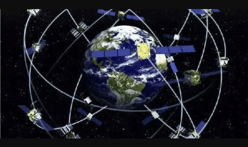
The China Satellite Navigation Office (CSNO) announced completion of two years of testing of BeiDou inter-satellite links, an innovative feature of the GNSS that will reportedly produce greater accuracy for users on Earth. The test campaign encompassed 29 satellites of the third generation (BDS-3) of the now global system.
Since ground stations in China cannot continuously track and control all BDS satellites — the system lacks a fully global ground control network — the inter-satellite links help establish communication among them. Instructions sent by the control center to one satellite in the constellation are transmitted to all.
An intersatellite radio-frequency link in the Ka band, a promising technique also called a crosslink for improving GNSS reliability and integrity, was first featured on satellites launched from March 2015 to February 2016. Inter-Satellite Link (ISL) antennae fitted to the BDS-3 satellites extended the visible arc of the medium-Earth orbit (MEO) satellites and enhanced ground stations’ capability for orbit determination.
In 2015, China stated that one of its MEO satellites was working autonomously and had set up a link with another satellite, successfully testing the autonomous control technology of the Beidou constellation. The inter-satellite link realized communication and distance measurement among satellites, bringing autonomous control of the system a step closer.
Chinese scientists have modeled the inter-satellite measurements and evaluated the ranging performance of the ISL based on the analysis of in-orbit measurement data. A paper by Yifan Zhou published in 2018 in GPS Solutions “used both residual analysis and external data comparison to assess the data. The results show that the ranging precision of the BeiDou intersatellite link is within 10 cm and is determined mainly by the thermal noise of the receiver. Moreover, the drift rate of the group delay of the transceiver channel is within 1 cm per day.”
A 2019 paper by Yufei Yang, Yuanxi Yang, Xiaogong Hu and Jinping Chen in the Journal of Navigation “analyses the ISL-enhanced orbit determination for eight BDS-3 satellites, using the data from ten Chinese domestic stations and 13 international Global Navigation Satellite System (GNSS) Monitoring and Assessment System (iGMAS) overseas stations. The results show that the Three-Dimensional (3D) position Root Mean Square (RMS) error of the Overlapping Orbit Differences (OODs) is approximately 1 m when only ten regional stations are used. When the ISL measurements are added, the 3D position RMS error is decreased to 0·5 m, and the accuracy of the 24-hour orbit prediction can also be improved from 2 m to 0·7 m, which is even better than that of the orbits determined using globally distributed stations. It can be expected that with the subsequent launch of BDS-3 satellites and the increasing number of ISLs, the advantage of the ISL enhanced orbit determination will become more significant.”
According to an open access January 2020 paper, “Basic performance and future developments of BeiDou global navigation satellite system,” by Yuanxi Yang, Yue Mao & Bijiao Sun, published in Satellite Navigation, “Because BDS-3 satellites are equipped with inter-satellite links (ISL), more research achievements have been made in the fields of ISL supported determination of satellite orbit and clock offset. According to the preliminary calculation results, the ranging accuracy of the ISLs of BDS-3 is about 4 cm; if the satellite orbits are determined using only regional station observations, the three-dimensional orbit accuracy of the overlapping arc is about 60 cm; with ISL measurements, the orbit accuracy is about 30 cm, the 24-h orbit prediction accuracy is also raised from 140 to 51 cm, and the radial accuracy can reach 10 cm, as evaluated through laser observations.”
ISLs for ranging, mission dissemination, and command & control are envisioned as part of Galileo’s Second Generation (G2G) from 2025 onwards, but are not currently a feature of any other GNSS besides BeiDou.
In spring 2018, Lockheed Martin submitted a proposal for the GPS III Follow-On (GPS IIIF) program, which will add enhanced capabilities to the satellites. Block IIIF satellites will carry laser retro-reflectors to enable orbit tracking independently of the satellites’ radio signals, which in turn will allow satellite clock errors to be disentangled from ephemeris errors.


