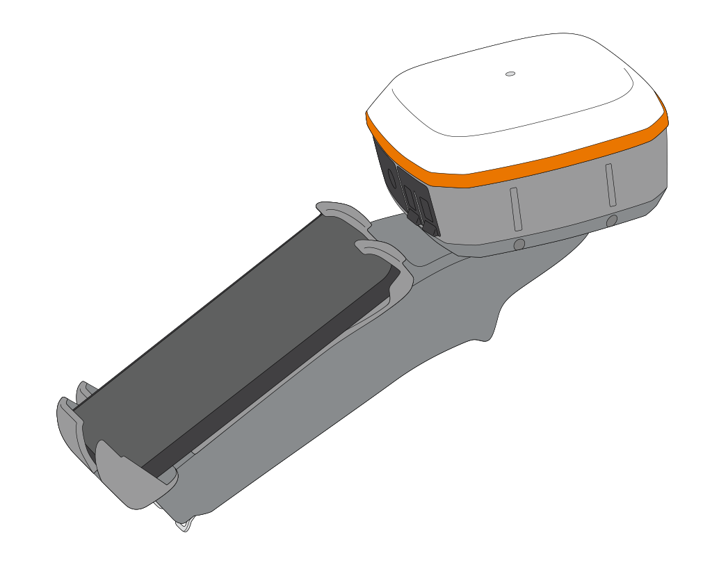
Juniper Systems has introduced a simple but ingenious device, the Geode Grip. It is basically a mounting bracket to which users can attach a GNSS receiver and a smartphone or tablet data collection device, ergonomically designed to be held easily in one hand.
Global navigation satellite systems (GNSS) have revolutionized positioning, navigation and timing (PNT) data collection in all domains in recent decades. But while GNSS is now undeniably a fundamental tool in engineering and construction, in land and hydrographic surveying, the transition in terms of work habits in these long-established fields has been gradual. Survey crews who now hit the ground with light, compact and fully connected high-performance GNSS receivers, continue to include some of the more cumbersome, conventional equipment in their kit as well, such as heavy-duty tripods and survey poles.
A new way appears
Juniper says it’s Geode Grip means users can finally ditch the old survey pole for a more portable, more ergonomic solution. Geode Grip is designed specifically to pair with Juniper’s Geode GNSS receiver, which features real-time, sub-meter, sub-foot, decimeter and centimeter accuracy options, and with the company’s Archer 4 Rugged mobile data collection device or their Mesa Rugged tablets. But the Geode Grip will also accept a variety of other devices made by other manufacturers, including the range of leading smartphones and consumer tablets.
Juniper’s target customer is the GNSS user navigating challenging terrains or conducting precise measurements, where Geode Grip delivers unmatched convenience and reliability. An adjustable hand strap for either left and right-handed carry is also included, enabling easy, one-handed carry and making navigation and geographic information systems (GIS) field data collection simpler than ever.


