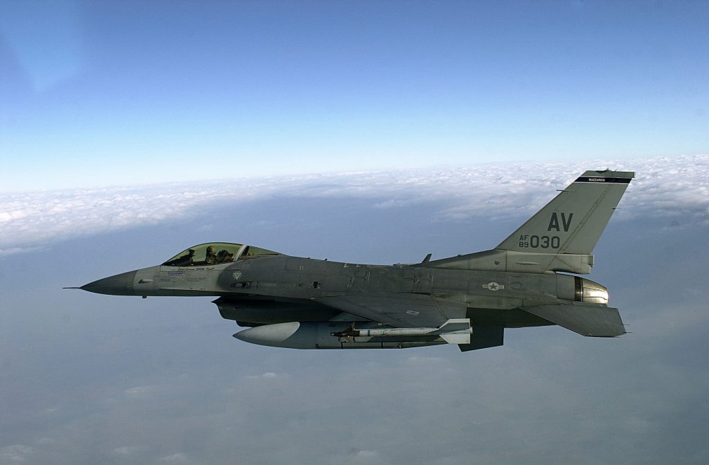
A new magnetic anomaly navigation technique (MAGNAV), researched by the Air Force Institute of Technology (AFIT), will get its wings tested aboard F-16 fightercraft this September. In an effort seeking alternatives to GPS and GNSS, MAGNAV sensors and software will be flown on Air Force Test Pilots School (AFTPS) F-16s over a test range adjacent to Edwards Air Force Base in Nevada.
“We’re hoping [these] realistic testing on realistic platforms will open the doors to further research and funding,” said Air Force Major Aaron Canciani, a lead on the project.
Canciani has worked closely with John Raquet, professor of electrical engineering and Director of the Autonomy and Navigation Technology (ANT) Center at AFIT, located at Wright Patterson AFB, near Dayton, Ohio.
“At the Center, we continue to do lots of work in navigation using non- GNSS means, which is almost always more difficult and less accurate than GNSS, when it’s available,” John Raquet explained in a 2016 profile in Inside GNSS. ANT has investigated the use of magnetic field variations to determine absolute position, by comparing the measured variations to a map, demonstrating this capability indoors, in a ground vehicle, and in an aircraft.
“We have been spoiled by GNSS, and have come to depend on it,” Raquet added. “So, it is important to have alternative navigation signals to fall back on, if and when GNSS is not available.”
Together, Canciani and Raquet authored a 2016 Institute of Navigation paper, “Absolute Positioning Using the Earth’s Magnetic Anomaly Field.” From the abstract:
“Navigation using Earth’s magnetic anomaly field, which is globally available at all times, shows promise to overcome many of [GNSS’s] limitations. We present a navigation framework that uses Earth’s magnetic anomaly field as a navigation signal to aid an inertial navigation system in an aircraft. The filter utilizes ultra-accurate optically pumped cesium magnetometers to make scalar intensity measurements of Earth’s magnetic field and compare them with a map using a particle filter approach. The accuracy of these measurements allows observability of not only the inertial navigation system errors but also the temporal effects of Earth’s magnetic field, which corrupt the navigation signal. These temporal effects are thoroughly analyzed, and we present a simple model that allows near worldwide use of the navigation filter. We analyze the dependencies on altitude and magnetic storm activity in a realistic simulation using data from test flights and magnetic observatories.”
In a follow-up paper in 2017 for the IEEE, they added:
“We validated the navigation system with real data from a flight test over Louisa, VA. Horizontal DRMS errors of 13 m were achieved over an hour long flight at the map altitude of 1000-ft MSL using a magnetic anomaly map created 3 years ago. This result should be considered as a “best case” result when using the presented methods, since the flight test was conducted in ideal conditions. The demonstrated accuracy of the navigation system shows orders of magnitude improvement over previously published magnetic navigation experimental results, indicating that the magnetic anomaly navigation is a promising addition to current global positioning system alternative and backup systems.
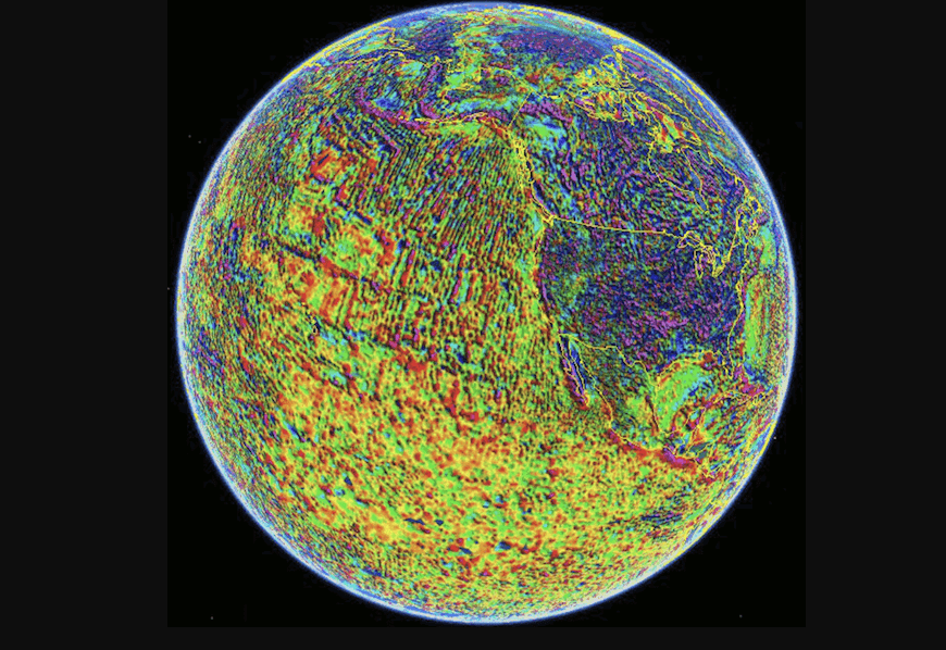
Magnetic features of the Earth’s crust can be used as landmarks for navigation; they are also detectable over oceans — two-thirds of the Earth’s surface.
Magnetic Anomaly Navigation uses scalar magnetometer sensors that measure differences in magnetic fields. Comparing these measurements magnetic field maps can aid in position determination. MAGNAV accuracy can be as close as 10 meters under ideal conditions, though it can range up to a kilometer in different environments or with the lower quality magnetic maps that serve some parts of the Earth’s surface. The military still has a wide spectrum of missions that can benefit even from the lower end of the accuracy spectrum.
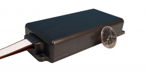
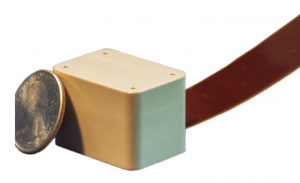
Commercial off-the-shelf scalar magnetometers measure nearly the size of a quarter in some cases and are already in wide use in industry, the military and government agencies. One manufacturer, Geometrics, offers a line of magnetometer products based on recent research in miniaturizing atomic clocks and magnetometers. New devices measure roughly 15cc and require 2W per sensor.
Typical uses listed by the company include:
Novel UAS Applications: Wellhead locating, pipeline tracking, utility surveying, and more
Security and Detection Applications: A small unit size, low power requirements, and high sensitivity allow for perimeter monitoring applications.
Marine Magnetometry Investigations: Customizable architecture allows for integration with autonomous or manned underwater vehicles.
Top Image courtesy NOAA National Centers for Environmental Information (NCEI), part of the National Oceanic and Atmospheric Administration (NOAA).

 Proves Resilient Navigation in GPS-Denied Flight Tests")


