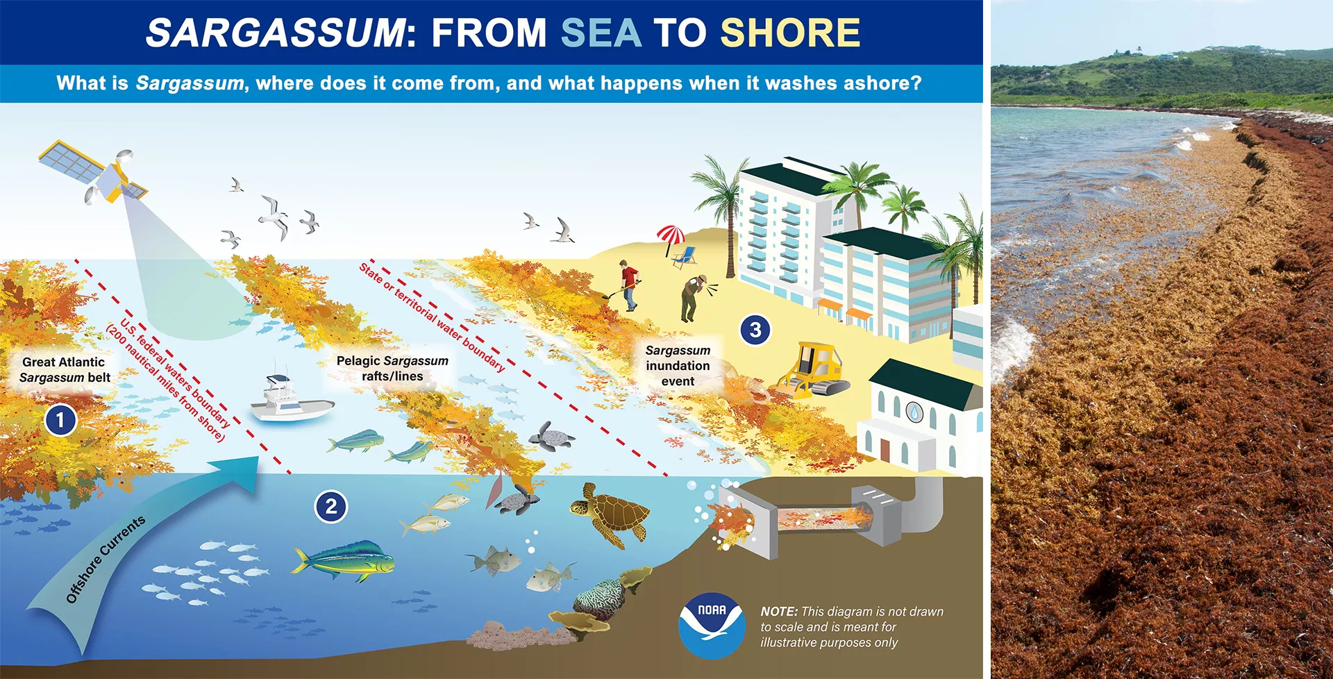
The spread of Sargassum seaweed across the Atlantic Ocean and onto coastal shores has emerged as a multifaceted challenge, presenting significant obstacles not only to human health and economic activities but also to marine ecosystems.
This brown algae, while a critical habitat for marine life in the open ocean, becomes a problematic invader when it accumulates in large quantities on beaches, releasing noxious gases as it decomposes and creating barriers to both sea life and human enterprise. From the deterring effect on tourism due to unsightly, odorous heaps of decaying seaweed, to the navigational hazards it poses to maritime ventures, and the potential health risks from airborne toxins, the implications of Sargassum’s surge are wide-ranging.
In a recent article, Orbiting Insights: Transforming Sargassum Seaweed Detection and Monitoring From Space, researchers from the National Oceanic & Atmospheric Agency (NOAA), National Environmental Satellite, Data and Information Service (NESDIS), detail how low Earth orbit (LEO) satellite observations are being used in mitigation efforts:
“To manage these challenges, researchers have turned to low Earth orbit (LEO) observations. LEO satellites offer extensive and repeated coverage, crucial for monitoring the vast expanses of the GASB [Great Atlantic Sargassum Belt]. Instruments such as the JPSS Visible Infrared Imaging Radiometer Suite (VIIRS) provide daily global coverage useful for tracking large Sargassum mats in the open ocean, while Copernicus Sentinel-2 satellites offer detailed imagery for smaller blooms closer to shore. Data like these are vital for predicting Sargassum inundation events and aiding in effective proactive action and response strategies.”
For a detailed overview of how PNT technology aids in ecology and environmental science efforts, read the full article on the NESDIS site.


