May 31, 2019
Europe Meets India Event Promotes GNSS Research, Industry
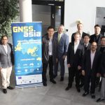
The European Union-funded GNSS.asia H2020 project hosted a major roundtable discussion around the theme of “Europe Meets India” at the recent 2019 Munich Satellite Navigation Summit. The event was aimed at promoting cooperation between the GNSS research and industrial communities in Europe and Asia-Pacific.
By Inside GNSS