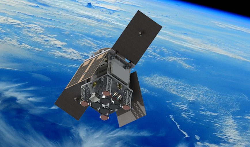
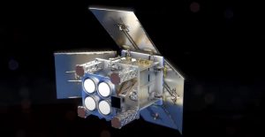
HydroGNSS, a small satellite built and operated by Surrey Satellite Technology Ltd, will measure Earth’s climate variables using GNSS reflectometry. The 40kg satellite, approximately the size of a microwave oven, will take measurements of key hydrological climate variables, including soil moisture, freeze-thaw state over permafrost, inundation and wetlands, and above ground biomass. Knowledge of these variables helps scientists understand climate change and contributes towards weather modeling, ecology mapping, agricultural planning and flood preparedness.
 HydroGNSS comprises two satellites that collect data continually in near-polar orbits, completing a world picture in 14 days.
The first data from the mission is expected to come available in 2024 and will be used to address climate change, improve farming and support wider disaster management.
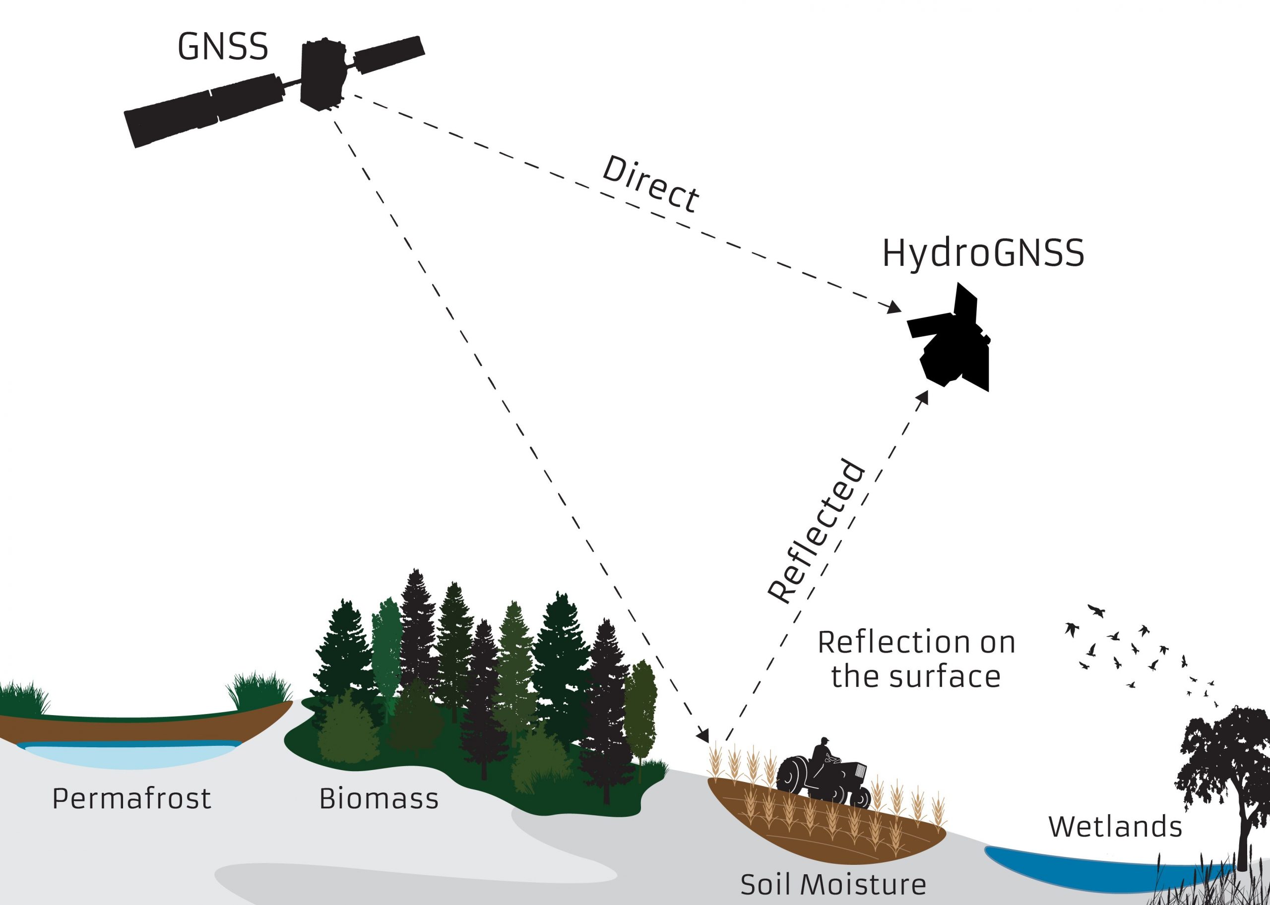
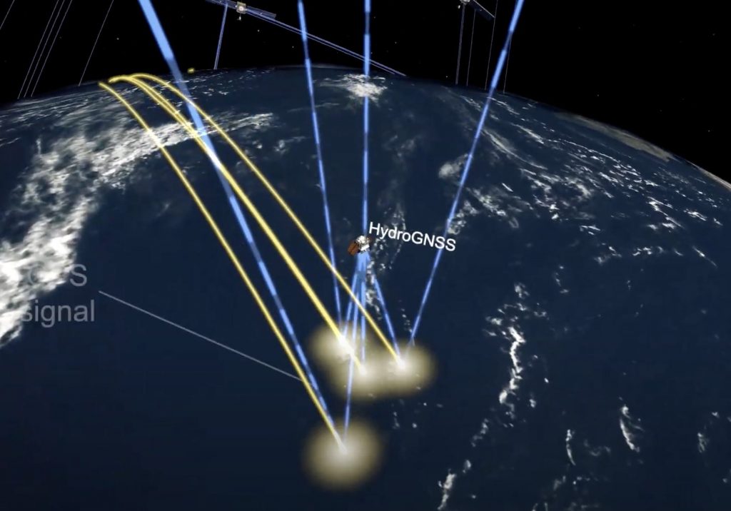
The well-established GNSS reflectometry technique exploits GNSS signals from GPS and Galileo as radar signal sources. These signals are reflected off the land, ice and ocean and can be collected by a low-power receiver on a small satellite in low-Earth orbit, and used to yield important geophysical measurements. The satellites’ downward-looking GNSS receivers intercept reflected signals from the Earth’s or oceans’ surface returning upward. Researchers compare data from distortions in the reflected signals with those received on the satellites upward-facing receivers, getting signals directly from the GNSS satellites above them. Distortions in the reflected signals show how rough the sea is, or reveal other characteristics about the reflecting surface.
Further new techniques will be explored on HydroGNSS, including use of Galileo signals, dual polarization, dual frequency and recovery of coherently reflected components. These new measurements are expected to improve the separation, resolution and quality of the climate variables under observation.
HydroGNSS paves the way for an affordable future constellation that can offer measurements with a temporal-spatial resolution not accessible to traditional remote sensing satellites, according to SSTL. Thus it offers new capacity to monitor very dynamic phenomena and help to fill the gaps in monitoring of the Earth’s vital signs for the future.
Previously, addressing hydrological variables such as these has required sizable and higher-cost satellites with large aperture antennas. The European Space Agency (ESA) selected HydroGNSS as the second Scout Earth Observation small satellite mission. With the Earth System Processes Monitored in the Atmosphere by a Constellation of CubeSats (ESP-MACCS), the first two in a series of Scout missions will demonstrate how small satellites on a budget of less than €30m and a 3-year schedule can play an important role in Earth observation, and be scaled up for future missions.
An SSTL video shows how the reflectometry concept works.
SSTL is working closely with partners at Sapienza, Tor Vergata and IFAC-CNR in Italy, FMI in Finland, IEC/IEEC in Spain, NOC in UK, and University of Nottingham to tackle the scientific and technological challenges involved.


