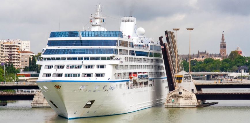
In the Port of Seville, Spain, pilots guiding large ships into docking use a portable pilot unit (PPU) incorporating GNSS corrections from the European Geostationary Navigation Overlay Service (EGNOS) to obtain positioning accuracies of 50 centimeters in situations such as entering and navigating through the harbor lock or in docking and turning maneuvers. The PPU from AD Navigation can be configured in different functional modes and is able to use different sources of corrections over GPS.
PPUs are carried onboard vessels by the harbor-based pilots sent to navigate them in the confined and congested port waters. PPUs can be considered as a more advanced version of the vessel’s Electronic Chart Display and Information System (ECDIS), which provides the pilot with updated and high density navigation charts, traffic management and ship-handling tools.
Located on the lower reaches of the Guadalquivir River, the commercial river port of Seville has an access channel of more than 80 kilometers and a modern lock, allowing the entrance of big merchant vessels and cruises. The largest vessels allowed so far have been passenger ships up to 200 meters and bulk carriers up to 190 meters.
The maximum draught of the river is 7.20 meters and the most demanding maneuvers in terms of accuracy are the ones carried out to cross the so-called “Puente de las Delicias” with a width of 42 meters and the lock, with a width of 40 meters. The limited width and authorized draught of the access channel, together with the increasingly large vessels that require entry to the port, make the pilot’s work even more necessary.
Pilots in the Port of Seville started using PPUs three years ago, when big vessels started requiring access to this inland port. Now, they use PPUs in other situations as well, for instance when facing bad weather conditions or to support anchoring maneuvers at night.
News and photo courtesy of the European GNSS Agency.


