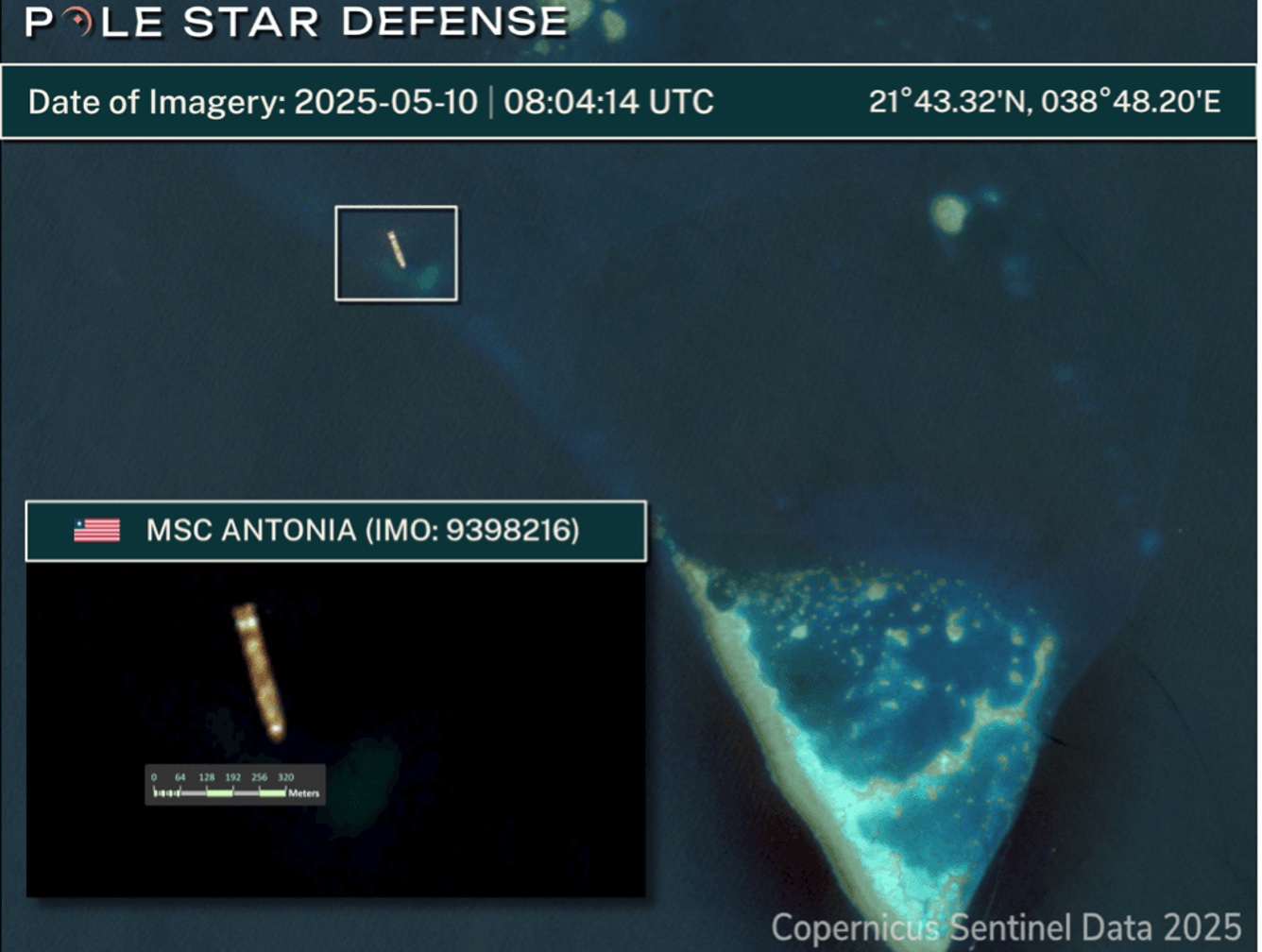
On May 10, the 7,000 TEU container ship MSC Antonia ran aground near the Eliza Shoals south of Jeddah Port in the Red Sea. Emerging analysis suggests the vessel may have been affected by deliberate GNSS interference, renewing attention to the operational impact of spoofing in congested maritime corridors.
Incident Overview
The Antonia, flagged in Liberia and operated by MSC, was transiting from Marsa Bashayer, Sudan, to Jeddah when it deviated from its intended course and grounded in shallow waters. No injuries were reported, but the vessel remains stuck, with tugs mobilized for a potential refloating.
AIS and vessel tracking data indicate abnormal positioning behavior leading up to the incident. Maritime data intelligence providers—including Windward, MarineTraffic, and Pole Star Global—have since released analyses pointing to probable GNSS spoofing or jamming as contributing factors.
GNSS Interference Patterns
Windward’s anomaly detection algorithms identified a sharp deviation in Antonia‘s reported position consistent with spoofing activity. Pole Star Global confirmed this assessment, citing evidence of falsified position data being injected into the ship’s navigation system via counterfeit GNSS signals. Such spoofing can cause ECDIS-reliant navigation teams to misjudge location without immediate visibility of an error.
This type of incident is not unprecedented in the region. Windward’s Q1 2025 maritime risk report noted a surge in spoofing events in the Red Sea and Gulf of Aden. Affected ships reported erratic positional jumps—some as large as 6,300 kilometers—well beyond typical signal degradation or multipath error margins.
Technical and Operational Implications
Although MSC has not publicly confirmed GNSS spoofing as the cause, multiple independent analyses suggest that Antonia’s grounding likely resulted from deliberate interference. The event underscores several persistent concerns for maritime navigation:
- GNSS dependency: Most commercial vessels rely heavily on GNSS as their primary position source, often without cross-verification from radar, visual bearings, or inertial navigation.
- Spoofing detection: Existing shipboard systems may lack built-in alerting mechanisms to distinguish authentic satellite signals from spoofed ones.
- Situational awareness: In contested regions, bridge crews may face additional challenges in interpreting conflicting position information without immediate indicators of signal compromise.
The Red Sea has seen a notable uptick in navigational interference, likely linked to broader regional tensions and asymmetric electronic warfare tactics. While the exact source of the spoofing remains unconfirmed, the trend presents an increasing risk for vessels operating in or transiting through high-traffic maritime chokepoints.


