Last week, PNT leaders, researchers and students gathered at the Hyatt Regency Denver for ION GNSS+, where they had the opportunity to sit in on technical sessions, chat with exhibitors about the latest technologies transforming the field and network with their peers.
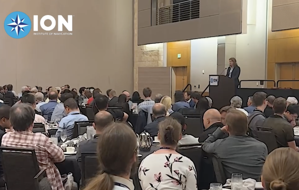
It’s been 50 years since the GPS project began, with pioneers developing what has become the robust, remarkable system so many people rely on today. During the ION GNSS+ Plenary Session, Satellite Division Chair Sandy Kennedy, who is the VP of innovation at Hexagon’s Autonomy & Positioning division, recognized this milestone and those early pioneers, including Brad Parkinson, who was in the audience.
Plenary Chair Dorota Grejner-Brzezinska went on to introduce the presenters, which included Brian “Bam” McClendon, who leads ArGeo at Niantic. In his presentation, “Where Pokémon GO: Building a Dynamic 3D AR Map of the World,” he discussed 2016’s Pokémon GO craze and the mapping story behind it.
McClendon gave background on the 2005 Google Maps launch, and the problems with the map data that came from GPS and Street View. The challenges faced led to the Ground Truth Project, where the goal was to build better quality maps that didn’t solely rely on satellite and aerial imagery. Today, data collected is sent to a machine learning algorithm that provides a precise geographic location, vastly improving accuracy.
In 2014, a Google engineer had the idea to start Pokémon GO in Google Maps as an April Fool’s joke, McClendon said, and it “turned out to be the most popular April Fool’s joke of all time.” Niantic asked players to send in video scans of the areas around Poké Spots, which has led to millions of videos that can be used for mapping that’s precise to the centimeter level.
“The goal is to have as much information around where people play games as possible,” he said. “The mapping solution is crowd sourced and constantly refreshed.”
Collecting geometries at scale allows for high-quality augmented reality game play, McClendon said, improving the quality of the reconstruction as well as the visual position. True world position is an absolute must or the experience doesn’t work.
Shared AR is another application, he said, making it possible for multiple players to see the same thing at the same time. The company is also working on taking geometric meshes and allowing players to co-locate, meaning multiple people can have a shared experience even from different locations.
“Building maps at scale is very hard,” McClendon said. “At Google, we spent a lot of time working on precision. The goal is to allow all devices to have the same experience at the same time.”
John Raquet followed up McClendon’s presentation with “UAV vs. Natural Autonomous Vehicles (NAVs)—Are We Closing the Gap?” Raquet, the director of the Dayton Business Unit of Integrated Solutions for Systems (IS4S), compared where we are with UAV development to birds using various specifications, including range per unit weight, number in formation and cross domain performance.
Though UAVs are making progress, Raquet was able to find a superior bird in almost every category.
“There’s still a sizable gap between the capabilities of UAVs and NAVs that won’t be closed any time soon,” he said. “But NAVs can be a source of inspiration. It’s proof of existence. If something else can do it, we know it’s possible.”
The conference continued with technical sessions on Wednesday, Thursday and Friday. Presenters covered a variety of hot-button topics, including alternative technologies for GNSS-denied environments, advanced processing of terrestrial signals of opportunity, high precision and high integrity navigation, and lunar positioning, navigation and timing, to name a few.
On Wednesday and Thursday, attendees had the opportunity to visit the exhibit hall and talk with vendors about the latest technologies and advancements. Exhibitors included CAST Navigation, GPS Networking, GPS Source, Hexagon | NovAtel, Ideal Aerosmith, LabSat, NavtechGPS, Safran-Electronics and Defense, SBG Systems, Silicon Sensing, Spirent Communications, Syntony, Trimble, Tualcom and Xona Space Systems.
During the conference, NextNav highlighted Pinnacle, which delivers precise, floor-level vertical positioning for 911 calls and other applications, and TerraPoiNT, a resilient position, navigation, and timing (PNT) system that supplements and enhances GPS. The two combined create 3D PNT that can be deployed around cities with a strong signal and high-precision, Co-Founder and CEO Ganesh Pattabiraman said.
The company demonstrated a new dedicated system at the conference that Pattabiraman said is the answer for scaling high-precision applications like autonomous vehicles and drones, as well as electrical grids, timing centers, infrastructure and public safety. It’s a solution that can be quickly and easily integrated in both urban and more rural areas, providing a resilient, precise alternative solution that can be scaled without having to put a transmitter “in every nook and cranny.”
“Many customers were using us for vertical and WiFi and GPS, which are both vulnerable, for horizontal. So there’s a gap,” Pattabiraman said. “To address this, we needed a solution that’s more scalable.”
Earlier this year, NextNav tested its assured PNT TerraPoiNT system with LTE and 5G signals, demonstrating the solution is a viable alternative to conventional GPS and GNSS. With these initial tests, TerraPoiNT delivered accurate 3D positioning and timing information after being integrated with existing cellular signals.
Anello, another exhibitor, talked with customers about its SiPhOG-X3 IMU that’s set to be released at the end of the year or early next. The unit leverages three SiPhOG (Silicon Photonics Optical Gyroscope) units, with each containing its own independent 6-axis redundant IMU sensor. It can operate in GNSS-denied environments and has garnered a lot of interest in areas like drone cargo delivery and other aerial applications, Senior Systems Engineer Kirstin Schauble said.
LabSat announced updates to its LabSat simulator and SatGen software at the conference. SatGen now has an improved dynamics engine and can simulate space scenarios, Technical Sales Engineer Elijah Owens said. Other features include improved route drawing with road, pedestrian, rail and straight-line routing, as well as route drawing and static point using Google Maps, Bing Maps, OpenStreetMap or AMAP. A new user interface offers users intuitive navigation and control.
The new LabSat 4 GNSS simulator was also unveiled, featuring 12-bit I&Q quantization and a flexible 10 to 60 MHz bandwidth. It has a wider dynamic range, more resolution in the signal, improved data transfer and larger storage capacity than its predecessor, Marketing Manager Jennifer Edis said.
StarNav announced PNT results for its receiver using Xona LEO Pulsar signals during a recent test. The 20 cm positioning accuracy results were produced using Safran’s simulator. This is the first test with StarNav receivers, with more planned as additional Xona test satellites are deployed.
“In the beginning, we built a multi-frequency receiver to provide a more robust PNT solution over just GPS,” StarNav CEO Joshua Morales said. “We see value in adding Xona into our receiver box as it gives additional positioning precision and added safety.”
Xona recently launched a privately funded PNT mission progressing from concept to on-orbit in less than 12 months. Since then, Xona has validated the capability of its technology on-orbit and built out a growing ecosystem of GNSS receiver and simulator partners with companies that include StarNav as well as Hexagon | NovAtel, Septentrio, Spirent, Safran and Syntony.
FocalPoint also made an announcement at the show. It has added new functionality to its Supercorrelation technology, S-GNSS, that makes it easy for chipset companies to integrate.
Attendees also had a chance to attend social events, including the Rocky Mountain Jam sponsored by GPS Networking and Inside GNSS. Held at The Black Buzzard at Oskar Blues, talented musicians from the GNSS community entertained a packed house of their peers.
Next year’s ION GNSS+ technical conference will move to Baltimore, taking over the Hilton Baltimore Inner Harbor. You don’t want to miss it, so mark your calendars for Septer 16 to 20.


