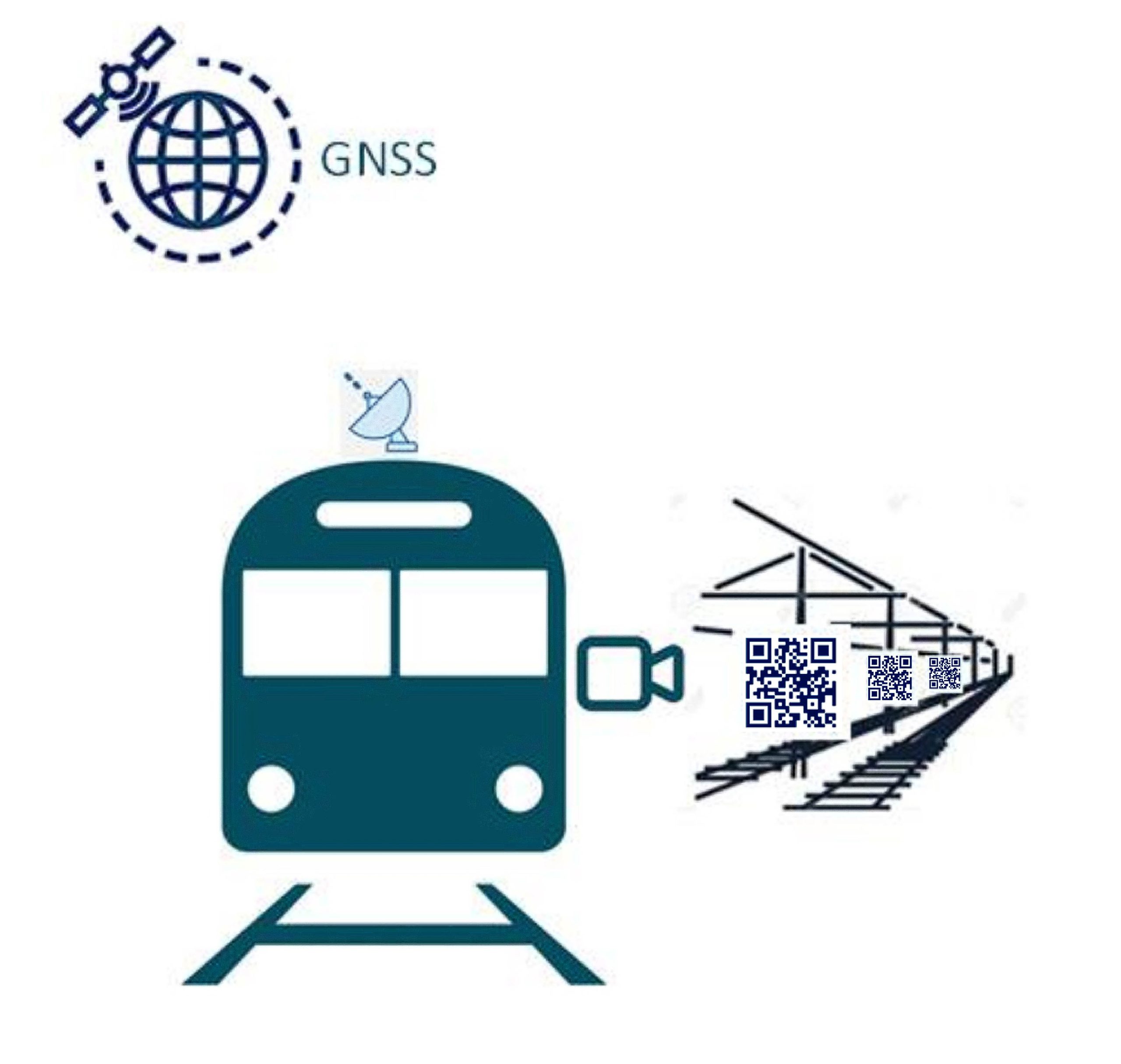
Hardware and software developer Intecs is creating a multi-sensor, GNSS-based platform for obtaining absolute position of trains on rail lines. The system incorporates cameras that read QR codes installed in the area adjacent to the track. The system includes a robust, software-based, data fusion engine that combines GNSS and visual data to determine train position.
Speaking from Intecs headquarters in Italy, Patrizia Nencioni and Stefano Esposito Mocerino explained the problem and the solution. “Knowing the position of the train is of vital importance for correct and safe traffic control,” Nencioni said. To track train positions, the current European ERTMS/ETCS signalling system employs balises. These are electronic beacons or transponders placed between the rails at known positions. A train that loses its position, for example when the on-board system has to be restarted, has to move at low speed until it picks up the next balise signal. Once it has thus re-established its position, it can then accelerate to its standard operating speed.
Because railway belises can be separated by some kilometers, the delay when a train loses its position can be significant, affecting other vehicles on the rail lines. The Intecs system, dubbed AGIS4RAIL (‘assisted GNSS with imaging sensors for rail applications), enables determination of position without waiting for the train to reach the next balise, reducing the time required for it to gain full speed.
Test campaign
A number of field tests of the new system have been undertaken. A crucial set of trials, carried out at an auto racing track, involved a ground vehicle with GNSS antennas on the roof and with cameras pointing to one side, where QR code panels were set up at 10-meter intervals. The vehicle completed 30 laps around the course under different conditions. AGIS4RAIL correctly identified the position of the vehicle at every lap, with the vehicle attaining a maximum speed of 35 km/h, which is 5 km/h above the operating speed of the type of train that would use the new system. The maximum estimated error was 4.76 m, in line with the target of 5 m.
Mocerino said, “We believe our system is capable of delivering improved positioning performance both in terms of availability and integrity.” The use of imaging sensors mitigates all of those well known local effects that can degrade the performance of GNSS-only-based positioning systems, such as multipath. AGIS4RAIL also provides resiliency against jamming and spoofing. The QR-code landmarks can include data for the authentication of the landmark itself. The low cost of a QR code panel when compared to an electronic belise is also to be considered.
Intecs is now actively seeking an industrial partner with whom it will work towards product commercialization. In the meantime, further testing goes on, soon to include trials on-board operational trains in Italy. The AGIS4RAIL project received funding under the European Space Agency’s NAVISP program.


