 One of 12 magnetograms recorded at Greenwich Observatory during the Great Geomagnetic Storm of 1859
 1996 soccer game in the Midwest, (Rick Dikeman image)
 Nouméa ground station after the flood
 A pencil and a coffee cup show the size of NASA’s teeny tiny PhoneSat
 Bonus Hotspot: Naro Tartaruga AUV
 Pacific lamprey spawning (photo by Jeremy Monroe, Fresh Waters Illustrated)
 “Return of the Bucentaurn to the Molo on Ascension Day”, by (Giovanni Antonio Canal) Canaletto
 The U.S. Naval Observatory Alternate Master Clock at 2nd Space Operations Squadron, Schriever AFB in Colorado. This photo was taken in January, 2006 during the addition of a leap second. The USNO master clocks control GPS timing. They are accurate to within one second every 20 million years (Satellites are so picky! Humans, on the other hand, just want to know if we’re too late for lunch) USAF photo by A1C Jason Ridder.
  Detail of Compass/ BeiDou2 system diagram
 Hotspot 6: Beluga A300 600ST

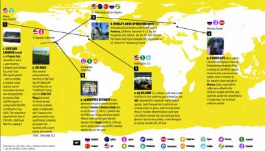
1. NAVSTAR GETS THE AX
Seal Beach, California
1. NAVSTAR GETS THE AX
Seal Beach, California
√ The Atlantic magazine unearthed a piece of GPS history this week almost exactly 22 years after an ax attack on NAVSTAR satellites in Seal Beach, California. In May 1992, two antiwar activists climbed over a fence and hacked at satellites stored in a Rockwell Collins plant. They called themselves the “Harriet Tubman Sarah Connor Brigade,” after the real Civil War heroine and the virtual heroine of Terminator fame. Their press release said, “NAVSTAR satellites are designed to give U.S. nuclear weapons increased accuracy for a pre-emptive first strike. . . Civilian users have only partial access to NAVSTAR data, most of which is transmitted in a military code.” Little did they know that, post-prison and post selective availability, their middle-aged selves might well depend on GNSS technology for everything from mobile apps to driving directions to ATMs.
2. NOT A LEVEL PLAYING FIELD
North Carolina to Massachusetts
√ In an 88-year-old volley between geologists and oeanographers, precision GNSS was used by both disciplines to confirm that sea levels on the East Coast of the United States are lower on the north end by 30 or 40 centimeters, Science News reported. Using GPS, researchers measured sea surface heights along the coast relative to the center of the Earth. They compared that with a reconstruction of the shape of the sea at rest —the geoid—and used satellite gravity data to figure out the variations in sea level caused by winds and tides. What does that mean to the rest of us in this era of global warming? Since the oceans are predicted to rise faster than average between Cape Hatteras, North Carolina and Boston, Massachusetts, this new data will help make predictions more accurate.
3. BAD TIMING
Teddington, United Kingdom
√ Thompson Reuters sells market data access to elite clients just a little earlier than most of us can get it — by early, we mean in the blink of an eye. A couple of years ago, they accidentally released embargoed Institute for Supply Management (ISM) manufacturing information 15 milliseconds too early because of a timing glitch in their system, giving their clients time for 28 million dollars in trade before anyone else knew about it. Teeny tiny bits of time like that have become so important to the world’s financial systems that GPS atomic clocks aren’t even good enough. The National Physical Laboratory, Britain’s measurement institute and home of their cesium fountain atomic clock, NPL-CsF2, offers a commercial precise time signal that operates independently of GPS and “eliminates susceptibility to jamming, spoofing, urban canyon effects and solar storms.” Makes you long for the days when a breath and a sneeze didn’t interrupt the course of the global economy.
4. THE BRONX IS UP BUT THE BATTERY’S DOWN
Manhattan, USA
√ No matter how grimy the taxi or grumpy the driver, you could always count on New York cabbies to know Manhattan like the backs of their hands. No longer. The Times reported that the challenging 80-question test for cab drivers no longer asks much about geography, except for 10 map-reading questions. GNSS as a real-time navigation aid or in a mobile app-based service like Uber has changed the industry profoundly.
The owner of a Queens yellow cab company said, “With GPS, you don’t need to know where anything is anymore.” Customers weren’t so relaxed about it – a typical online comment on the New York Times website said “the thing that separates taxis [most] from Uber is the taxi drivers’ superior knowledge of the city’s streets. . . this is competitive suicide.”
Images and Credits
“Let Us Beat Swords into Plowshares,” bronze sculpture by Russian artist Yevgeny Vuchetich in the garden of the United Nations Headquarters in New York City. The Seal Beach action was associated with the Plowshares civil disobedience movement. (Image in public domain)
The European Space Agency’s Gravity field and steady-state Ocean Circulation Explorer (GOCE) mission of (2009-2013) delivered the most accurate model of the ‘geoid’ ever produced. The colors represent deviations in height (–100 m to +100 m) from an ideal geoid. Blues are low and reds/yellows are highs. (ESA image)
New York City taxi (image by Joseph Plotz) Wikicommons
The cesium fountain clock, NPL-CsF2, which keeps the United Kingdom’s atomic time, is located at the National Physical Laboratory in Teddington. (NPL image)


