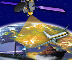
The European Commission (EC) expects to declare in October that the European Geostationary Navigation Overlay Service (EGNOS) — which provides satellite-based augmentation signals for GPS and Galileo — is operationally ready as an open and free service for non-safety-of-life (non-SoL) applications, according to a press release from the GNSS Supervisory Authority (GSA).
The European Commission (EC) expects to declare in October that the European Geostationary Navigation Overlay Service (EGNOS) — which provides satellite-based augmentation signals for GPS and Galileo — is operationally ready as an open and free service for non-safety-of-life (non-SoL) applications, according to a press release from the GNSS Supervisory Authority (GSA).
As does the U.S. Wide Area Augmentation System (WAAS) over North America, EGNOS’s Open Service provides Europeans with improved accuracy of GPS. For the past several months, EGNOS has demonstrated excellent signal quality throughout Europe, the EC says.
Ongoing monitoring of the augmentation signal shows it improves the accuracy of GPS to within one to two meters and is available more than 99 percent of the time.
In announcing the availability of the Open Service, the EC will indicate that this level of performance is available for the long term and that the signal can be used without any charges.
Receiver manufacturers and application developers will be able to add EGNOS capability to their products without the need for authorization or receiver-specific certification for non-SoL equipment.
A second key milestone will be achieved in 2010, when the European Satellite Services Provider (ESSP) is expected to be certified in compliance with the Single European Sky regulations. The EC will then declare the readiness of EGNOS’ Safety-Of-Life Service. Founded by seven European air navigation service providers, ESSP is based in Toulouse, France.
Certification is necessary to use the EGNOS Safety-Of-Life Service in industry segments where lives are at stake. Once certified, EGNOS will be available for use in civil aviation as a navigation aid. In particular it can be used for non-precision approaches (NPA) and for approaches with vertical guidance (APV).
A third service, the EGNOS Data Access Server (EDAS), is currently undergoing testing. EDAS is a terrestrial commercial data service that disseminates EGNOS data collected from its three satellites and network of ground stations in real time. Companies have been beta testing the service since 2008.


