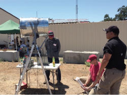
Figures 6 & 7: Single Antenna, Dual Use
Return to main article: "Single Antenna, Dual Use"
By Inside GNSSGlobal Navigation Satellite Systems Engineering, Policy, and Design
Return to main article: "Single Antenna, Dual Use"
By Inside GNSS
Return to main article: "Single Antenna, Dual Use"
By Inside GNSS
Return to main article: "Single Antenna, Dual Use"
By Inside GNSS The Raquet family
Return to main article: John Raquet: A Family Affair
COMPASS POINTS
Engineering specialties
Navigation; navigation by signals of opportunity; sensor fusion/integrated avionics; GPS; navigation warfare; software development; stochastic estimation.
Favorite equation
eiπ = –1
By Inside GNSSWhen China joined the GNSS club in 2007, it turned a satnav triumvirate into a quartet.
But some of the limelight needs to fall a little further from center stage — out there where the Indian Regional Navigation Satellite System (IRNSS) and Japan’s Quasi-Zenith Satellite System (QZSS) are not waiting idly in the wings.
By Inside GNSS
At one time, GPS was expected to supplant a wide range of navigation technologies in the world’s positioning, navigation, and timing (PNT) portfolio. But an unexpected thing happened along the way.
By Inside GNSS John and his wife, Cindy.
With an imposing 6’2” physique and a disarming grin, John Raquet rises above the crowd. To colleagues he’s a top-flight engineer and university professor, and director of the Air Force Institute of Technology (AFIT) Autonomy and Navigation Technology Center. But he is also a former all-star basketball player, a preacher, sometime soccer coach, former military officer, and, most definitely, a family man.
By Inside GNSS

Ubiquitous location-aware mobile devices, mainly GPS-enabled smartphones, have led to a boom in location-based services (LBS), which have been revolutionizing businesses and lifestyles. Common uses of LBSs include asset tracking, location-based advertising, emergency roadside service, turn-by-turn navigation, and real-time traffic & road information sharing.
By Inside GNSS
It is by now well known that GNSS-based localization in built-up urban environments can be extremely inaccurate. This is a fundamental problem that hardware enhancements cannot solve.
A GNSS receiver estimates 3D location and timing from pseudoranges from four or more satellites, assuming that these pseudoranges correspond to direct line-of-sight (LOS) paths from each satellite. In urban canyons, however, the signal from a satellite to the receiver suffers from multipath propagation and shadowing.
By Inside GNSS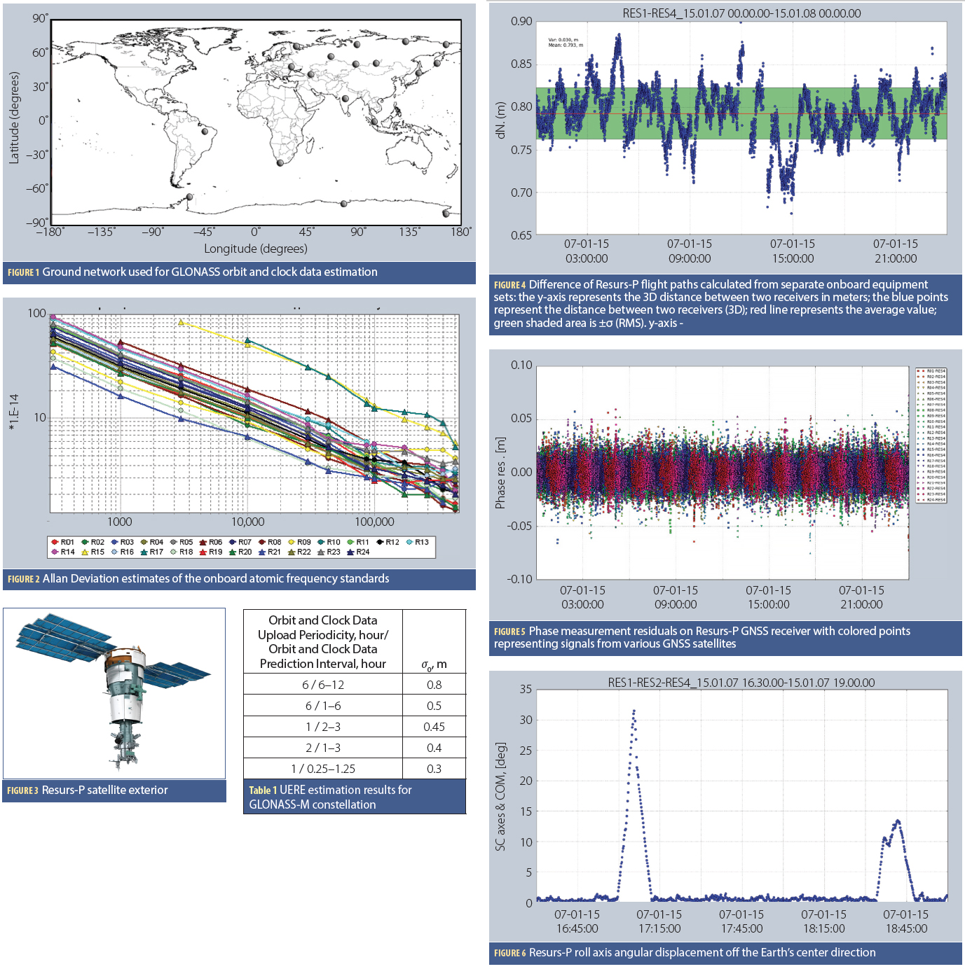 Figures and Tables
The current stage of GLONASS evolution is aimed at meeting future user requirements of which the most important is the improved accuracy of positioning.
During the implementation of the GLONASS Space Segment Modernization Program (2012–2015), the GLONASS team is facing the situation in which it is not feasible to launch new navigation satellites because the existing constellation is comprised of GLONASS-M satellites operating beyond their guaranteed design lifetime. Nine more GLONASS-M satellites are in ground storage.
By Inside GNSS
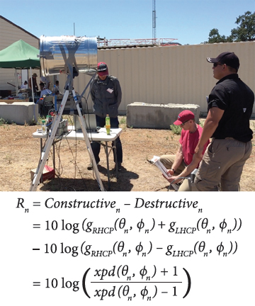
A GNSS single-antenna system can be compared to a single-pixel camera. Electromagnetic waves traveling 20,000 kilometers from every overhead direction can reach us. Yet once at the antenna, this diverse set of information is collapsed into a single magnitude and phase value, then sent off to the receiver so that value can be extracted.
By Inside GNSS
Return to Working Papers article: "More Than We Ever Dreamed Possible"
By Inside GNSS
Return to Working Papers article: "More Than We Ever Dreamed Possible"
By Inside GNSS