November 13, 2016
Equations
Satellite Selection
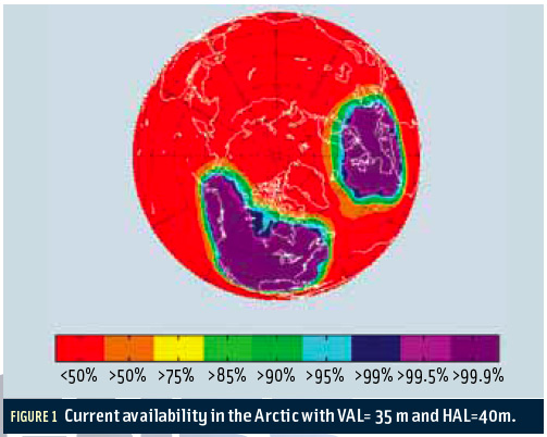
EquationsThe advent of multiple constellations provides the opportunity to eliminate geometry weakness as a source of satellite-based augmentation system (SBAS) unavailability. GPS users occasionally encounter areas where an insufficient density of satellites exists to support all desired operations. This most often occurs when a primary slot satellite is out of service. However, adding one or more constellations easily compensates for this geometric shortcoming. In fact, we may now experience the opposite problem of having more satellites that can be tracked by a receiver.
By Inside GNSS