product design

June 4, 2009

Applanix Introduces New Aerial Digital Photogrammetric System

Applanix
has introduced the POSTrack 410 flight management and direct
georeferencing system designed for use with the latest generation of
medium-format airborne digital photogrammetric camera.

The POSTrack 410 incorporates Applanix’s POS AV GNSS-inertial navigation
system (INS) and POSPac Mobile Mapping Suite (MMS) office software,
featuring the IN-Fusion technology and SmartBase module. This system
can process both GPS and GLONASS signals as well as those from
satellite-based augmentation systems.

Read More >

By Inside GNSS

Changes in Store for U.S. Military GPS Equipment Development and Acquisition

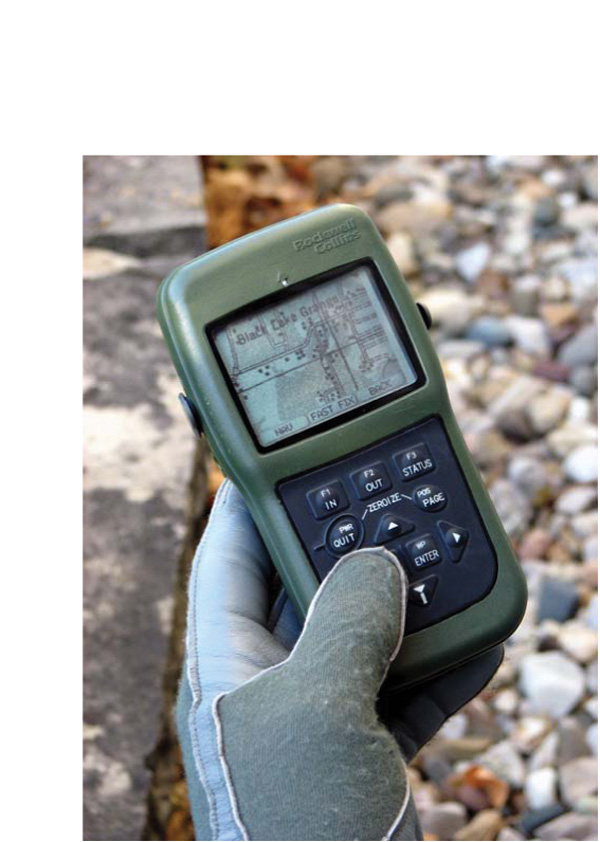
DAGR 2008. Rockwell Collins image

Development and acquisition of military GPS user equipment (MGUE) are taking on new dimensions across the board — institutionally, procedurally, and technologically.

Along the way, the changes could redefine relationships within the Department of Defense (DoD) and between the agency and industry.

At the agency level, a proposal is forthcoming to “stand up” a positioning, navigation, and timing (PNT) user equipment joint program office (JPO) that would incorporate UE responsibilities (and budgets) now exercised by the GPS Wing (GPSW).

Read More >

By Inside GNSS
June 3, 2009

Pacific Crest Picks GNSS Industry Veteran to Head OEM Effort

Pacific Crest Corporation has  appointed GPS/GNSS industry veteran Don Speedy to head business development and sales for North America. With more than nine years of successful experience in business development and OEM GNSS, geographic information systems (GIS) and survey sales, Speedy will be responsible for driving strategic partnerships in OEM GNSS and data link communications while maintaining regional relationships.

Read More >

By Inside GNSS
[uam_ad id="183541"]
May 13, 2009

Ready, Set, Go! The 2009 European Satellite Navigation Competition is open for ideas

Galileo Master’s award winners 2008

Submit the best idea for a brand new satellite navigation application or device and you just might win the 2009 Galileo Master’s Award – €20,000 in prize money and lots of support to make your idea a reality.

But that’s not your only chance – you can try for one of the eight special topic prizes or one of the 17 different regional prizes, together worth €500,000 in cash and start-up assistance.

The competition began six years ago in Bavaria, Germany, but it has expanded to include many other regions of Europe as well as Australia, Israel, and Taiwan.

Read More >

By Inside GNSS
April 27, 2009

Companies Announce GPS/Wi-Fi Collaboration

Ekahau Inc. has announced that its Wi-Fi location tracking software is being integrated into GPS receivers designed by NavSync Ltd. to enable customers to continuously track asset in indoor and outdoor environments.

Wi-Fi–enabled GPS tag combines NavSync’s NavTrac GPS module with Ekahau’s location protocol. The NavTrac module incorporates the CW85 16-channel GPS receiver/802.11b/g transmitter combination.

Read More >

By Inside GNSS
April 26, 2009

Loctronix Gains Patent for Its Spectral Compression Positioning, Tracks CDMA, GNSS

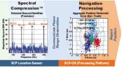
Loctronix SCP technology

[Updated 4/26/09] On March 31, the U.S. Patent Office granted Loctronix Corporation its first patent, which will provide the foundation for its Spectral Compression Positioning (SCP) technology that enables multi-source positioning capability in a single sensor. Subsequently, the company announced that it had successfully achieved meter-level ranging performance using CDMA cellular signals.

Read More >

By Inside GNSS
[uam_ad id="183541"]
April 9, 2009

earthmine Launches 3D Mapping System Driven by GPS, Inertial

John Ristevski

Privacy rebellions such as recently drove a Google Street View crew from Broughton, England, or security-oriented legislation that would require blurred features or position accuracy in commercial imagery is just part of the market environment for 3-D mapping company earthmine, Inc., which is moving out of beta mode into full-fledged operations.

Read More >

By Inside GNSS
March 30, 2009

Geotagging: u-blox Buys Geotate

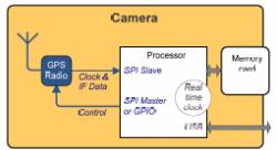
Typical implementation of geotagging in camera. Source: Geotate

In a €5.5-million cash deal, u-blox AG, of Thalwil, Switzerland, has acquired Geotate B.V. and its patented technology and products in the area of software GPS and geotagging GPS.

The acquisition will enable u-blox to expand its position in consumer markets with geotagging solutions for digital camera manufacturers and other portable device manufacturers.

Read More >

By Inside GNSS
March 19, 2009

Hemisphere GPS Reports Record Revenues

Steve Koles, Hemisphere GPS president & CEO

Hemisphere GPS has reported a 35 percent increase in revenues in 2008 — to a company record of US$72.7 million, versus $53.7 million the previous year. According to the company, 2008 growth was driven by strong market fundamentals in agriculture, including higher farm incomes.

Read More >

By Inside GNSS
February 24, 2009

u-blox Launches Mobile Computer Cards

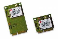
u-blox PCI-5S and PCM-5S

u-blox has announced the immediate availability of a GPS “PCI Express Mini” card. The card enables laptops, netbooks, mobile Internet devices, and “Ultra Mobile” PC OEMs to provide GPS and location-based services such as personal navigation, services/people finder, and geo-tagging.

Sales of mobile PCs with integrated GPS are projected to grow from 3 million units in 2007 to 45 million units in 2011, according to the company.

Read More >

By Glen Gibbons
February 23, 2009

CellGuide Announces the RAMON GPS Module

CellGuide, a Rehovot, Israel–based fables semiconductor manufacturer of highly integrated host-based GPS/GNSS receivers, has introduced the RAMON GPS module.

Measuring 5.4 x 4.6 x 1.1 millimeters, the RAMON module includes both active and passive components in a single fully integrated package, meeting the demanding design and cost requirements of device manufacturers.

Read More >

By Glen Gibbons
1 9 10 11 12 13 16
IGM_e-news_subscribe