
March 20, 2025
Space Force Presses on with R-GPS Constellation
An update on where we are with Resilient GPS, an additional network of smaller, cheaper navigation satellites that would augment existing GPS satellites.
By Brett DavisGlobal Navigation Satellite Systems Engineering, Policy, and Design
An update on where we are with Resilient GPS, an additional network of smaller, cheaper navigation satellites that would augment existing GPS satellites.
By Brett DavisThis acquisition will revolutionise the positioning industry by establishing new benchmarks for accuracy, resilience and scalability to advance the path to full autonomy.
By Inside GNSS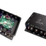
At a special presentation hosted by the European Space Agency (ESA), the Road Sounder project, led by Italian company ARPsoft, unveiled its new road assessment system – a smart, low-cost network designed to continuously monitor road pavement conditions.
By Peter Gutierrez
The Defense Innovation Unit’s (DIU’s) Transition of Quantum Sensing (TQS) program will demonstrate the military utility of quantum sensors to address strategic Joint Force competencies like positioning, navigation, and timing (PNT), as well as anomaly detection.
By Inside GNSS
Adtran has announced that the Turin and Piedmont Internet Exchange (TOP-IX) has launched Italy’s first time-as-a-service (TaaS) solution using Adtran Oscilloquartz technology. Delivered in collaboration with Italy’s National Institute of Metrological Research and other strategic partners, the service leverages Oscilloquartz edge grandmaster devices deployed across TOP-IX’s dedicated fiber network.
By Inside GNSS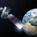
The European Union Agency for the Space Programme (EUSPA) has awarded GMV a new framework contract for the evolution of the Galileo Reference Centre (GRC). The mission of the GRC is to carry out independent monitoring of the Galileo system, providing EUSPA with reports on its operation, the quality of navigation signals transmitted, and the performance of the services obtained at user level.
By Inside GNSS
Xona Space Systems, a provider of advanced commercial satellite navigation solutions announces a new collaboration with Trimble, a global leader in construction, transportation and geospatial technology. Xona and Trimble are pursuing the integration of Trimble correction services with Xona’s PULSAR™ high-performance navigation service.
By Inside GNSS
Collins Aerospace has received approval for Full Rate Production of the Mounted Assured Positioning, Navigation and Timing (PNT) Generation II system (MAPS GEN II).
By Inside GNSS
Quectel Wireless Solutions has launched the LG580P, a multi-constellation, multi-band GNSS module supporting multi-band signals across L1, L2, L5, and L6. This enables real-time kinematic (RTK) positioning and integrates a dual antenna heading algorithm for enhanced accuracy and reliability.
By Inside GNSS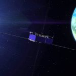
The Federal Communications Commission (FCC) has issued a draft Notice of Inquiry (NOI) that, if adopted, will seek input on the development of alternative Positioning, Navigation, and Timing (PNT) technologies to complement GPS.
By Inside GNSS
Fixposition, a Swiss company specializing in high-precision global positioning solutions, combines computer vision techniques with satellite navigation to deliver accuracy in both open fields and GNSS-challenged environments.
By Inside GNSS
The Air Force Life Cycle Management Center (AFLCMC) Positioning, Navigation, and Timing (PNT) Program Office and Integrated Solutions for Systems (IS4S), in collaboration with AEVEX Aerospace, announce the successful completion of Alternative Positioning, Navigation, and Timing (PNT) flight tests for the Resilient-Embedded GPS/INS (R-EGI) Modular Open Systems Architecture (MOSA).
By Inside GNSSHexagon | NovAtel announced it will enhance its SPAN GNSS+INS (Global Navigation Satellite Systems + Inertial Navigation System) solution by adding ground-penetrating radar sensors. To do so, NovAtel signed a Memorandum of Understanding (MOU) with Massachusetts-based GPR, Inc. to integrate GPR’s WaveSense ground-penetrating radar technology.
By Inside GNSS