military

August 27, 2008

IEC Announces New Miniaturized, Secure GPS Receiver Module

IEC TruTrak Evolution GPS Receiver


L-3 Interstate Electronics Corporation (IEC)
, based in Anaheim, California, has announced its latest miniaturized GPS receiver, the TruTrak Evolution.

A single-board, L1/L2 24-channel secure GPS receiver, the TruTrak Evolution consists of a security module, radio frequency down converter and I/O logic. The receiver employs IEC’s latest key data processor (KDP II) SAASM chipset in the XFACTOR module to provide enhanced GPS security.

Read More >

By Glen Gibbons
August 26, 2008

Xsens MTi-G AHRS Chosen for DoD Vehicles

Fairfax, Virginia–based defense contractor ArgonST has selected the MTi-G GPS-aided Attitude & Heading Reference System (AHRS) from Xsens Technologies, of Enschede, The Netherlands, to help fill a U.S. government contract for a new generation of reference motion trackers for use on a variety of air and ground vehicles.

Read More >

By Glen Gibbons
August 13, 2008

ATK PGK Trials Meet 105mm Artillery Standard

IEC’s TruTrak Evolution GPS Receiver

Alliant Techsystems Inc. (ATK) has announced its successful demonstration of the capability to divert a 105-millimeter (105mm) artillery round using its existing 155mm Precision Guidance Kit (PGK) with minimal modification to the current design.

Read More >

By Glen Gibbons
[uam_ad id="183541"]
July 28, 2008

AFRL GNC Workshop

The U.S. Air Force Research Lab (AFRL) Munitions Directorate will sponsor a workshop on advances in guidance, navigation, and control (GNC) for miniature autonomous systems, October 20–22 in Fort Walton Beach, Florida.

With the assistance of the Institute of Navigation (ION), the workshop is designed to bring together the Department of Defense technical and user community, academia, and industry to riview and discuss the technological trajectory and future challenges of these systems.

Read More >

By Glen Gibbons
June 4, 2008

Faulty Booster Component May Delay IIR-M Launches; L5 Signal Ready to Go

GPS IIR satellite. Lockheed Martin photo.

Suspected faulty components in a Delta II rocket are delaying the launch of the final two modernized GPS Block IIR satellites, possibly preventing the early broadcast of an L5 civil signal that faces a 2009 deadline for being on the air.

According to Air Force officials at the GPS Master Control Station, Schriever Air Force Base, Colorado, and Patrick AFB near the Cape Canaveral launch site, the questionable component is the 40-second timer that triggers separation of the third stage booster from the GPS space vehicle. Affected are both the 20th Block IIR-M, which had been scheduled to launch this month with a civil L5 test signal enabled in the navigation payload, and GPS IIR-21.

Read More >

By Glen Gibbons
May 16, 2008

Lockheed Martin Wins GPS IIIA Contract

A team led by Lockheed Martin Space Systems Company has won U. S. Air Force approval to build the GPS Block IIIA satellites under a contract valued at up to $3.568 billion.

The long-delayed decision was announced May 15. The acquisition covers the first of three sets of Block III satellites currently scheduled to begin launching in 2014.

Read More >

By Glen Gibbons
[uam_ad id="183541"]
May 15, 2008

Overlook Names New President

Doug Taggart

Douglas S. Taggart has been named president of Overlook Systems Technologies, Inc., effective June 1, 2008.

A professional engineering and technical services firm headquartered in Vienna, Virginia, Overlook has extensive experience in GPS and Positioning, Navigation and Timing (PNT) technologies, operations ,and applications, as well as electronic warfare, space and information operations, and space control.

Read More >

By Glen Gibbons

SMC’s Change of Command

Lt. Gen. Michael A. Hamel, commander of the Space & Missile Systems Center at Los Angeles Air Force Base, will turn over responsibilities to Lt. Gen. John T. "Tom" Sheridan on May 16. General Sheridan was formerly the Deputy Director of the National Reconnaissance Office.

Read More >

By Glen Gibbons
May 7, 2008

Applanix Launches POS AV with Integrated Trimble GNSS, Upgraded DSS RapidOrtho

Applanix has announced the availability of a high altitude tactical mapping option for its DSS RapidOrtho system as well as the integration of the Trimble BD960 GNSS receiver module for its POS AV airborne position and orientation system.

With the GNSS module, POS AV products now support GPS L1/L2 and GLONASS L1/L2 processing, both in real-time and post-mission. The BD960 will also be able to receive and process the next-generation GPS L2C and L5 signals.

Read More >

By Inside GNSS
April 19, 2008

GPS III Satellite Contract: An Undeclared Winner?

GPS III conceptual drawing, The Aerospace Corporation

The Air Force has further delayed the announcement of its decision on who will be the prime contractor for the next block of GPS satellites, IIIA. Earlier reports had set the contract award announcement for early April.

On Wednesday (April 23), Anthony Russo, deputy director of the National Coordination Office for Space-Based Positioning, Navigation, and Timing (PNT), told a European Navigation Conference 2008 in Toulouse, France, that "source selection" has been identified. He added, "I had hoped to announce [the results] at this conference, but the process is not complete yet."

Source selection means that the GPS Wing at the Space and Missile Systems Center (SMC) has completed its
evaluation of the bids on the contract and the preferred provider for the new generation of satellites. The Wing — responsible for overseeing the acquisition of GPS space, ground, and military user equipment — has a presentation ready on the IIIA contract award but is waiting to brief the Air Force decision maker, in this case, apparently Air Force Secretary Michael Wynne.

Read More >

By Glen Gibbons
April 17, 2008

Satellite Launch Will Aid DoD GNSS Users to Anticipate Space Weather Effects

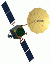
Communication/Navigation Outage Forecasting System (C/NOFS) satellite, General Dynamics

On Wednesday (April 16), a U.S. Air Force team successfully launched the Communication/Navigation Outage Forecasting System (C/NOFS), an experimental satellite designed to monitor the ionosphere and predict conditions that would disturb radio communications, including GNSS signals.

The satellite was ultimately deployed from a Pegasus rocket following an air launch from a Lockheed L-1011 that had taken off from Kwajalein Atoll in the mid-Pacific Ocean. First transmissions from the spacecraft were acquired shortly after it reached orbit.

Read More >

By Glen Gibbons
IGM_e-news_subscribe