Global Navigation Satellite Systems Engineering, Policy, and Design
Global Navigation Satellite Systems Engineering, Policy, and Design
Return to main article: "GAGAN — India’s SBAS"
By Inside GNSS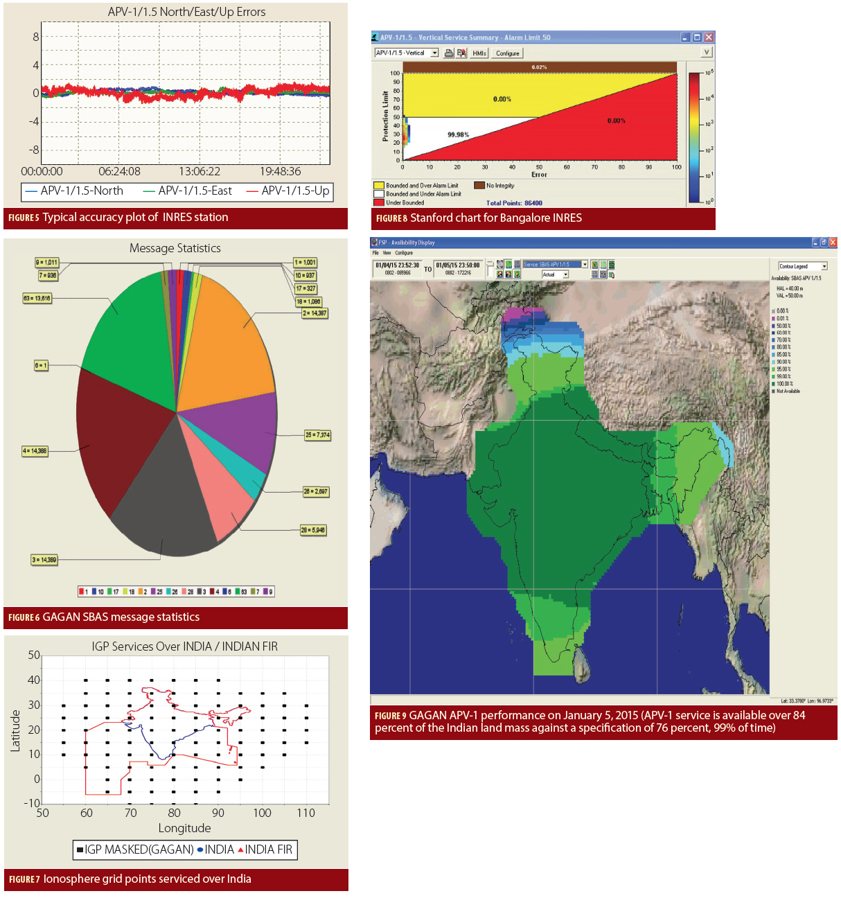
Return to main article: "GAGAN — India’s SBAS"
By Inside GNSS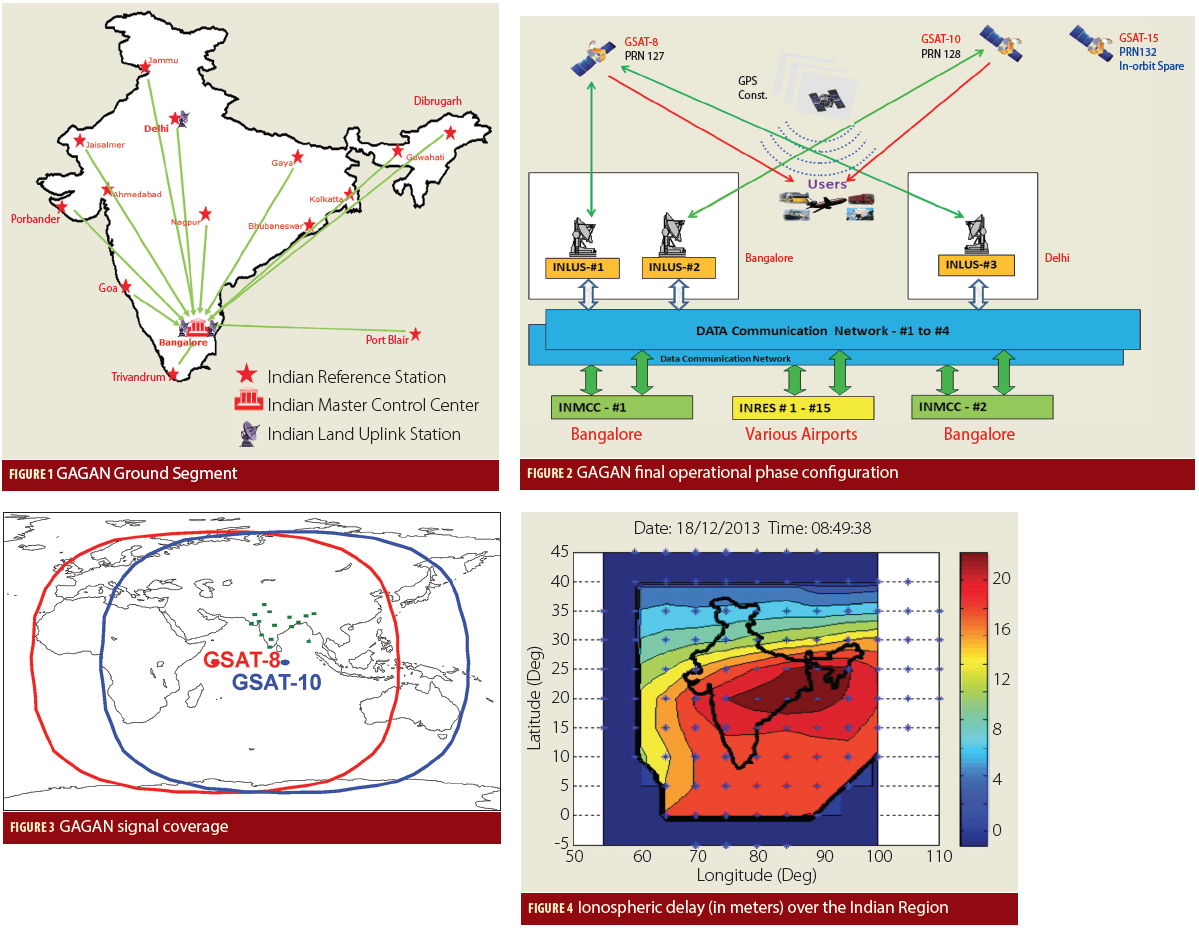
Return to main article: "GAGAN — India’s SBAS"
By Inside GNSS
SBAS and RNSS: The Unsung Heroes of GNSS
Okay, if I had wanted to pander to GNSS fans, I might have called this, “Making Great Greater.”
But there are only so many superlatives that can be lathered on this remarkable technology before simple praise turns into hagiography.
So, it’s time once more to give a little love to those unsung heroes of GNSS: the augmentations and regional navigation satellite systems.
By Inside GNSS
 One of 12 magnetograms recorded at Greenwich Observatory during the Great Geomagnetic Storm of 1859
 1996 soccer game in the Midwest, (Rick Dikeman image)
 Nouméa ground station after the flood
 A pencil and a coffee cup show the size of NASA’s teeny tiny PhoneSat
 Bonus Hotspot: Naro Tartaruga AUV
 Pacific lamprey spawning (photo by Jeremy Monroe, Fresh Waters Illustrated)
 “Return of the Bucentaurn to the Molo on Ascension Day”, by (Giovanni Antonio Canal) Canaletto
 The U.S. Naval Observatory Alternate Master Clock at 2nd Space Operations Squadron, Schriever AFB in Colorado. This photo was taken in January, 2006 during the addition of a leap second. The USNO master clocks control GPS timing. They are accurate to within one second every 20 million years (Satellites are so picky! Humans, on the other hand, just want to know if we’re too late for lunch) USAF photo by A1C Jason Ridder.
  Detail of Compass/ BeiDou2 system diagram
 Hotspot 6: Beluga A300 600ST

Catching thieves in California, Galileo satellites test Einstein, Russian space agency remodel, and 911 training for operators who can’t read maps.
By Inside GNSS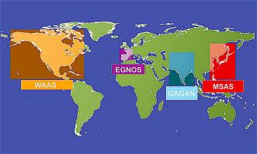
GAGAN — India’s SBAS
Redefining Navigation over the Indian Region
Recognizing the potential benefits of satellite-based augmentation systems, India took the early initiative to create its own SBAS called GAGAN — GPS Aided Geo Augmented Navigation.

Europe’s space community rang in the New Year with two of its brightest annual fixtures: the European Union (EU) Space Policy conference in Brussels and the European Space Agency (ESA) media briefing in Paris.
The events brought out all of the relevant voices and served to illustrate not only the disposition of materiel and troops but also their intent and even the level of morale.
By Peter Gutierrez
Working Papers explore the technical and scientific themes that underpin GNSS programs and applications. This regular column is coordinated by Prof. Dr.-Ing. Günter Hein, head of Europe’s Galileo Operations and Evolution.
With the support of the European Space Agency (ESA), a European team designed a frequency- and time-transfer process and validated its performance in a complex navigation test bed. This two-way time-transfer technology took advantage of the following:
By Günter W. Hein
 Figure 1, 3, 4 & 5
Q: What is Doppler collision and is it a problem in GNSS?
A: Doppler collision is a physical effect in code-division multiple access (CDMA) systems where code measurement errors are observed due to cross-correlation effects. Doppler collision may occur when the Doppler frequency between signals from two different transmitters is smaller than the code lock loop bandwidth.
By Inside GNSS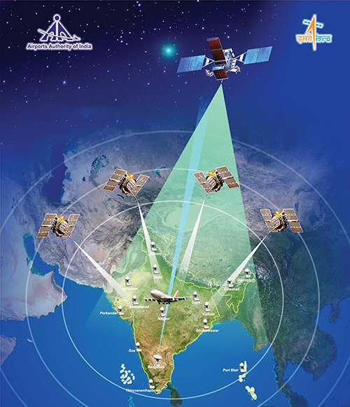
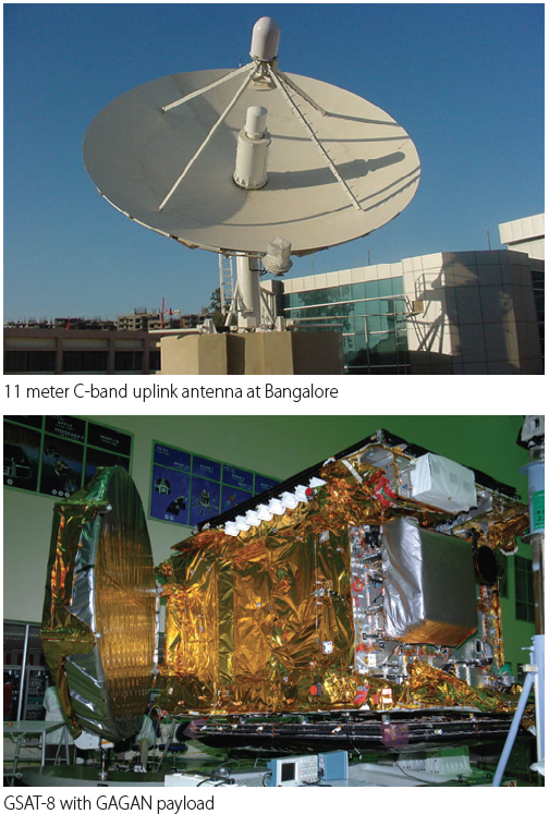
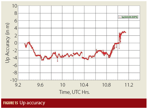
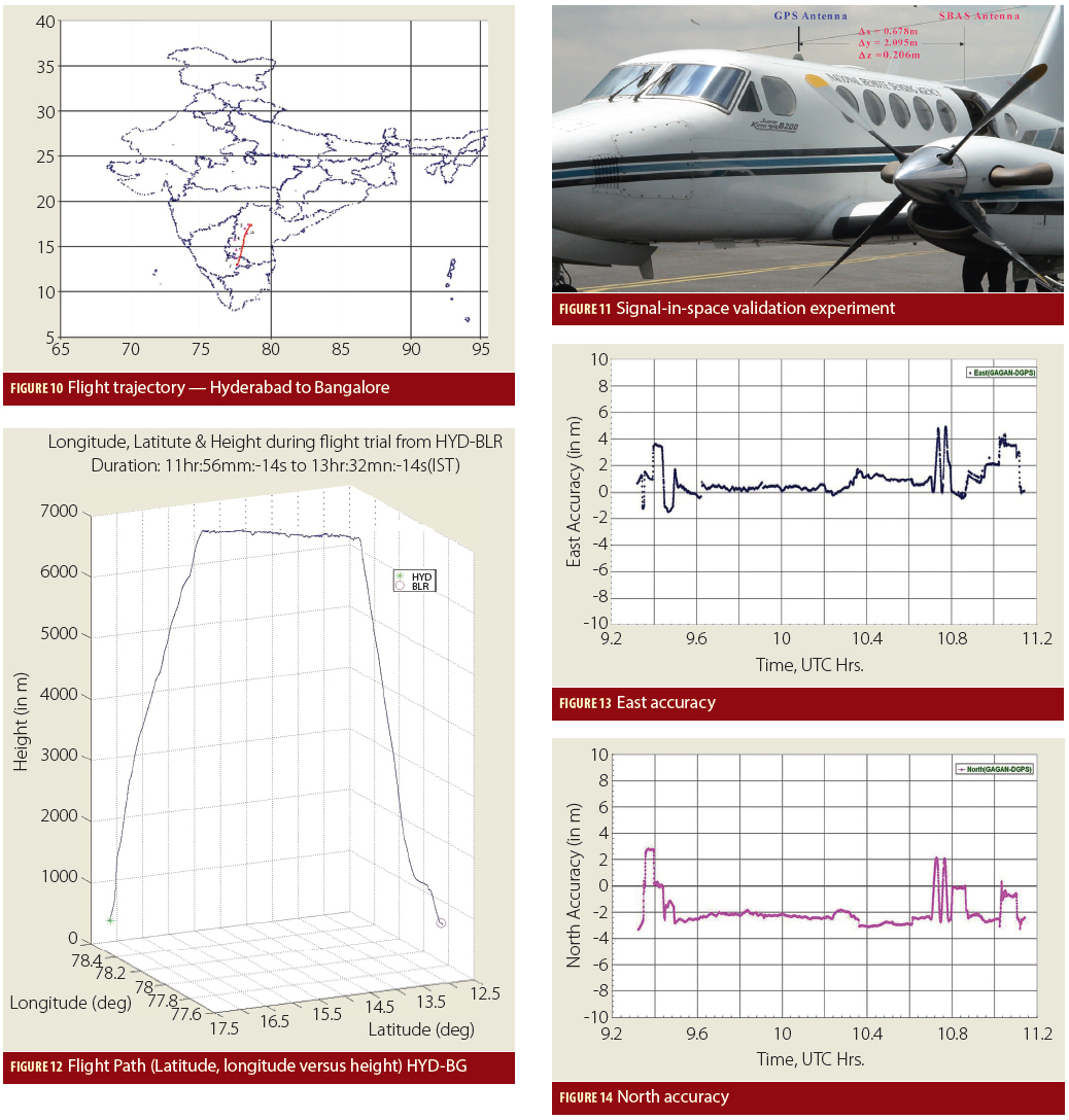
The GPS Aided Geo Augmented Navigation (GAGAN) system was developed by the Indian Space Research Organization (ISRO), together with Airports Authority of India (AAI), to deploy and certify an operational satellite-based augmentation system (SBAS). The system’s service area covers the Indian Flight Information Region (FIR), with the capability of expanding to neighboring FIRs.
By Inside GNSS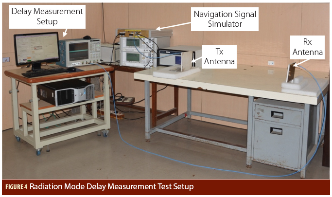
 Figures and Tables
In satellite navigation, the user receiver finds its position by measuring its distance to satellites and knowledge of the satellite position. The distance is measured by ranging, i.e., finding the delay of the signal from the transmitter to the receiver. The delay will comprise of payload hardware delay and the geometric range delay. Hence, the payload delay of the signal from generation to radiation is very important and needs to be transmitted in navigation data.
By Inside GNSS
Small GPS jammers, particularly the “personal privacy devices” readily available on the Internet, pose one of the greatest risks to the nation’s critical infrastructure, according to a now-public Homeland Security assessment.
By Dee Ann Divis