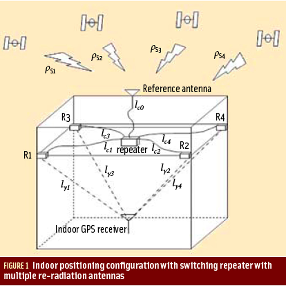
Figures 1, 2 & 3: Peer-to-Peer Cooperative Positioning, Part II
Return to main Working Papers article: "Peer-to-Peer Cooperative Positioning, Part II"
By Inside GNSSReturn to main Working Papers article: "Peer-to-Peer Cooperative Positioning, Part II"
By Inside GNSS
Return to main Working Papers article: "Peer-to-Peer Cooperative Positioning: Part II"
By Inside GNSS
In 2003, China committed to investing €200 million (US$270 million) for the privilege of participating in the development of Europe’s Galileo program. But by 2007 it had been forced out of major decision-making because of security concerns and the collapse of the original financing plan for the program, which was to include public and private money.
By Peter GutierrezIn the 1974 Mel Brooks’ movie, Blazing Saddles, one of the characters — surrounded by his enemies — points a gun at his head and tries to escape by taking himself hostage.
As I recall, he gets away with the absurd move and survives to fight another day. That’s Hollywood!
By Dee Ann Divis
Members of Congress — who have not finished next year’s appropriations, face half a dozen major tax and program fixes set to expire, and have their own re-elections to worry about — must quickly decide how to handle a tsunami of federal budget cuts that experts say could sweep the economy back into recession.
By Dee Ann Divis
Q: What are the tradeoffs between using L1-only and L1+L2 for PPP?
A: Precise point positioning (PPP) is a technique that can compute positions with a high accuracy anywhere on the globe using a single GNSS receiver. It relies on highly accurate satellite position and clock data that can be downloaded from the International GNSS Service (IGS) or obtained in real-time from a number of service providers, using either the Internet or satellite links.
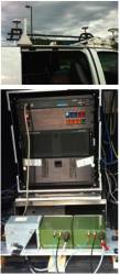
By Inside GNSS TOP PHOTO: Antenna configurations on trials vehicle: Dual GPS antennas for the INS under test and single GPS antenna for the CIMU; BOTTOM PHOTO: Commercial IMU/DGPS system used for reference (left), FOG-based INS configuration (middle), and MEMS-based INS configuration 2 (right)
 The automobile versus the horse and buggy. Cloud computing opposite desktop software. The trend is predictable, yet it is always surprising when one technology takes over the market space of another. After all, television did kill off the radio star.
By Inside GNSSReturn to main article: "Demystifying GLONASS Inter-Frequency Carrier Phase Biases"
By Inside GNSSReturn to main article: "How do GNSS-derived heights differ from other height systems?"
By Inside GNSSAs Desi Arnaz often said to Lucille Ball during an “I Love Lucy” episode on TV, “You’ve got some ’splaining to do.”
I refer, of course, to the untoward and unexpected initiative by the British Ministry of Defense (MoD) to patent the technical innovations that underlie the planned next generation of civil GNSS signals.
By Dee Ann DivisReturn to main Washington View article: "USPTO Nears Approval of Troubling British Patent on New GPS Civil Signal"
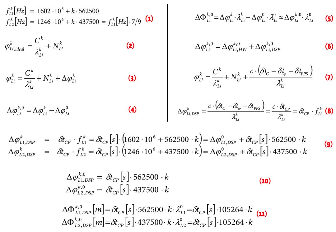
By Dee Ann Divis EQUATIONS 1 -11
GLONASS currently uses a frequency division multiple access (FDMA) technique to distinguish the signals coming from different satellites in the Russian GNSS constellation. The GLONASS L1 and L2 bands are divided into 14 sub-bands, and each satellite transmits in one of these.
The sub-bands are identified by frequency numbers k, from -7 to 6. The GLONASS L1 and L2 carrier frequencies, in hertz, at a frequency number k are defined by: