November 25, 2012
Figures 4 & 5: Non-Gaussian Noises
Return to main article: "Non-Gaussian Noises"
By Inside GNSSGlobal Navigation Satellite Systems Engineering, Policy, and Design
Return to main article: "Non-Gaussian Noises"
By Inside GNSS
View the Equations for this article
Various designs of inertial/GNSS integrated navigation systems exist, with different architectures depending on the quality of sensors, the mission, the dynamics of the vehicle, and the non-linearity of the dynamics model, measurement model, or both.
By Inside GNSS
Return to main article: “Vector Delay Lock Loops”
By Inside GNSS
Q: What are the tradeoffs between using L1-only and L1+L2 for PPP?
A: Precise point positioning (PPP) is a technique that can compute positions with a high accuracy anywhere on the globe using a single GNSS receiver. It relies on highly accurate satellite position and clock data that can be downloaded from the International GNSS Service (IGS) or obtained in real-time from a number of service providers, using either the Internet or satellite links.
By Inside GNSS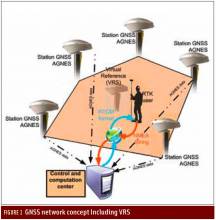
Return to main article: "How do GNSS-derived heights differ from other height systems?"
By Inside GNSS
FIGURE 2: Example of a national geoid (upper diagram) and a correction surface for the transformation from the new orthometric height system to the old height system (lower diagram). Country is Switzerland. Geoid undulations range from 45 to 55 meters in ETRS89 and from -5 to +5 meters in the national System CH1903+. Lower diagram: Correction surface to transform from the new orthometric height system (LHN95) to the old height system LN02 with corrections from -0.10 to 0.55 meters.Q: How do GNSS-derived heights differ from other height systems?
A: Height estimation using GNSS always seems to be trickier than horizontal coordinate estimation.
Why?
On the one hand, the GNSS technique has error sources that are more critical in the vertical direction. Height estimates are weaker because of a combination of satellite geometry, the presence of strong correlations to other parameters, such as atmospheric delays, and the antenna phase center model applied during data analysis.
By Inside GNSS
Q: What is Coarse Time Positioning and how does it work?
A: Coarse time positioning is used to provide a position fix using inaccurate time information when tracking sufficiently weak GNSS signals such that the navigation message cannot be extracted reliably. This article presents the key aspects of coarse positioning, including some of its challenges. To start, however, we begin by looking at the role of time within a GNSS receiver.
By Inside GNSS
Return to main article: "Code Tracking and Pseudoranges"
By Inside GNSS
FIGURE 2: Pseudorange computation based on transmission. On the left side, the satellites are transmitting mes¬sages synchronously. On the right side, the four subframes are received asynchronously, due to the different propagation time. The TLM word is taken as a referene. The time differences ?i are computed on the basis of the relative arrival times of the front of the first bit of the TLM word.Q: How can pseudorange measurements be generated from code tracking?
A: Every GNSS receiver processes the received signals to obtain an estimate of the propagation time of the signal from the satellites to the receiver. These propagation times are then expressed in meters to solve for the user position using trilateration.
By Inside GNSS
Return to main article: “Network RTK and Reference Station Configuration”
By Inside GNSS