201611 November/December 2016

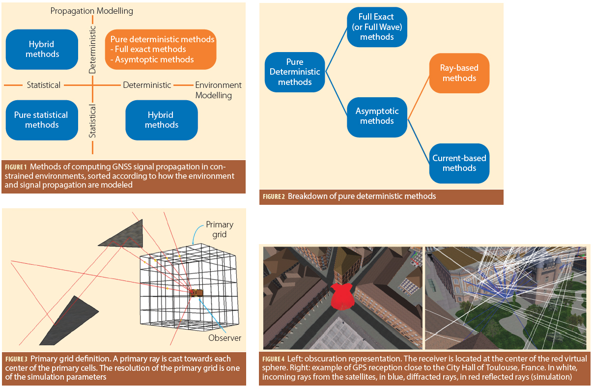
Challenges of Ray-Tracing for GNSS Applications

Q: What are the challenges of ray-tracing for GNSS applications?

A: Simulating the propagation and reception of GNSS signals in complex environments is a challenging task. Indeed, the user always has to trade off between the computation time and the reliability of the output. Moreover, the motion of GNSS satellites, atmospheric effects, and building geometry are always difficult to model.

Read More >

By Inside GNSS

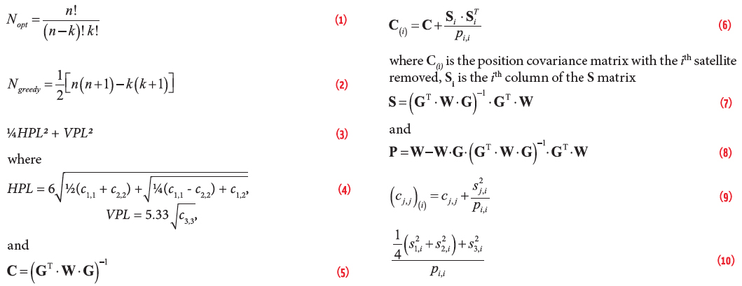
Satellite Selection

Equations

The advent of multiple constellations provides the opportunity to eliminate geometry weakness as a source of satellite-based augmentation system (SBAS) unavailability. GPS users occasionally encounter areas where an insufficient density of satellites exists to support all desired operations. This most often occurs when a primary slot satellite is out of service. However, adding one or more constellations easily compensates for this geometric shortcoming. In fact, we may now experience the opposite problem of having more satellites that can be tracked by a receiver.

Read More >

By Inside GNSS
[uam_ad id="183541"]

Navigating in Space

Figures 1 & 2

Spacecraft in low Earth orbit (LEO), at altitudes below 3,000 kilometers, remain within the main Global Positioning System (GPS) signals’ Earth coverage. Spacecraft employing GPS at these altitudes enjoy signal availability and navigation and timing performance emulating that of terrestrial users.

Read More >

By Inside GNSS
October 31, 2016

RTCA to Weigh Ligado Proposal

Federal aviation officials have asked the RTCA, Inc., standards organization to comment on a plan designed to help prevent a proposed wireless broadband network from interfering with the certified GPS receivers used by aircraft.

Read More >

By Dee Ann Divis
IGM_e-news_subscribe