August 11, 2017
NASA Statement, Website, Address How Total Eclipse May Impact GNSS
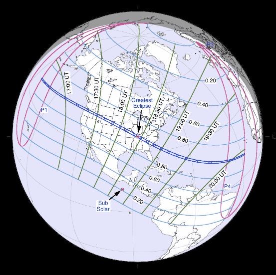
By now, we’ve all heard plenty about the upcoming eclipse of the sun. On Monday, August 21, all of North America will be treated to an eclipse of the sun, and the rare event is creating quite a buzz, so much so that NASA developed a website to offer guidance and has issued a statement about its effect on GNSS users.
By Inside GNSS