December 30, 2025
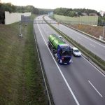
PONTI GNSS-enhanced Monitoring for Safe Overpasses
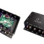
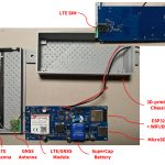
With funding from the European Space Agency (ESA), Space for Life (S4L), formerly Safe Structures Company (SSC), has developed the PONTI Box, a compact, automotive-grade sensor unit that collects high-frequency accelerometer data and precise GNSS timing as vehicles cross bridges and overpasses.
By Peter Gutierrez
![On-site testing and validation of GreenAsph 4.0; Image courtesy Exact Control System[50]](https://insidegnss.com/wp-content/uploads/2025/11/On-site-testing-and-validation-of-GreenAsph-4.0-Image-courtesy-Exact-Control-System50-150x150.jpg)