BeiDou’s Applications, Role in Asia Continue to Evolve
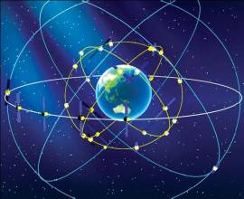
Asia is booming, and China’s BeiDou satellite navigation system seems prepped to boom right along with the growing region.
By Inside GNSS
Asia is booming, and China’s BeiDou satellite navigation system seems prepped to boom right along with the growing region.
By Inside GNSSDon’t miss next week’s exciting webinar on direct georeferencing (DG) and LiDAR when moderator James Poss, Maj Gen (Ret), and an expert panel will address how combining DG with LiDAR technology small and light enough to fit onto a UAS is a breakthrough that brings with it many benefits.
By Inside GNSS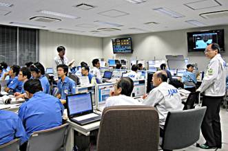 Michibiki launch control room during the first launch in 2010. (JAXA photo)
Officials at the Tsukuba Space Center of the Japan Aerospace Exploration Agency (JAXA) announced that the second satellite in the Japanese Quasi-Zenith Satellite System (QZSS) is scheduled for launch in June.
Designed to boost the accuracy and reception of the existing GPS system for Japan, a new version of a satellite that will orbit directly over the Japanese archipelago was unveiled last week. It will improve the existing GPS and provide a better positioning reading for the people in Japan.
By Inside GNSS
Discussions continue on the pros and cons surrounding the possible privatization of the nation’s Air Traffic Control (ATC), with opponents sharing concerns and a proposal by President Trump aimed at looking into taking the air operations duties away from the Federal Aviation Administration (FAA).
By Inside GNSS One of 12 magnetograms recorded at Greenwich Observatory during the Great Geomagnetic Storm of 1859
 1996 soccer game in the Midwest, (Rick Dikeman image)
 Nouméa ground station after the flood
 A pencil and a coffee cup show the size of NASA’s teeny tiny PhoneSat
 Bonus Hotspot: Naro Tartaruga AUV
 Pacific lamprey spawning (photo by Jeremy Monroe, Fresh Waters Illustrated)
 “Return of the Bucentaurn to the Molo on Ascension Day”, by (Giovanni Antonio Canal) Canaletto
 The U.S. Naval Observatory Alternate Master Clock at 2nd Space Operations Squadron, Schriever AFB in Colorado. This photo was taken in January, 2006 during the addition of a leap second. The USNO master clocks control GPS timing. They are accurate to within one second every 20 million years (Satellites are so picky! Humans, on the other hand, just want to know if we’re too late for lunch) USAF photo by A1C Jason Ridder.
  Detail of Compass/ BeiDou2 system diagram
 Hotspot 6: Beluga A300 600ST

1. ANTARCTIC OASIS
Antarctic Peninsula
 A view of San Francisco from the Municipal Pier. Wikimedia Commons photo by Blake Everett.
The Automated Vehicles Symposium 2017 convenes industry, government, and academia from around the world to address complex technology, operations, and policy issues. With a mission to inform and engage, to support progress towards safe, automated mobility, the symposium will take place from July 11-13 in San Francisco, with Ancillary Meetings July 10 and 14. Abstracts for the poster sessions are due by Friday, April 7, 2017.
By Inside GNSS
The annual Joint Navigation Conference (JNC) is a military positioning, navigation and timing (PNT) event hosted by the Institute of Navigation (ION) on behalf of the U.S. Department of Homeland Security. The ION 2017 JNC advance conference program is now available online.
By Inside GNSS
NovAtel today unveiled its Oceanix Nearshore correction service at Ocean Business 2017 in Southampton, UK.
Oceanix Nearshore, a subscription-based GNSS correction service for Precise Point Positioning (PPP), provides exceptionally reliable sub-decimeter positioning for marine applications such as dredging, hydrographic survey, mapping and coastal patrolling, according to NovAtel.
With a robust infrastructure, Oceanix precise corrections data is generated utilizing a network of more than 80 strategically located GNSS reference stations globally.
By Inside GNSS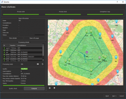 Qinertia INS/GNSS post-processing software. Photo source: SBG Systems.
 Rueil-Malmaison, France-based SBG Systems will unveil Qinertia, its in-house post-processing software, at the Ocean Business show, April 4-6 at Southampton, U.K.
After the survey, this full-feature software is designed to give access to offline real-time kinematic (RTK) corrections, and process inertial and GNSS raw data to further enhance accuracy and secure the survey.
By Inside GNSSLooking over the initial budget of the Trump administration, we can safely say that the president and his timorous collaborators on Capitol Hill have a maximalist concept of providing for “the common defense” and a minimalist one for promoting “the general welfare,” two of the six missions enshrined in the preamble of the U.S. Constitution.
By Inside GNSS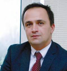 Miguel Manteiga Bautista
The first generation of the Galileo Program, at satellite and ground segment level, has been “an enormous success,” according to Miguel Manteiga Bautista, who recently spoke with Inside GNSS at his office at the European Space Agency’s European Space Research and Technology Centre (ESTEC) in Noordwijk, Netherlands.
By Inside GNSSSpeakers at the 9th Annual Conference on European Space Policy wasted no time in addressing the somewhat worrying failure of several Galileo onboard clocks, as revealed by European Space Agency Director General Johan-Dietrich Woerner at a press briefing earlier in January in Paris. He made clear at the time that the clock failures, while indeed troubling, had had no effect on the operational integrity of the Galileo system.
By Peter Gutierrez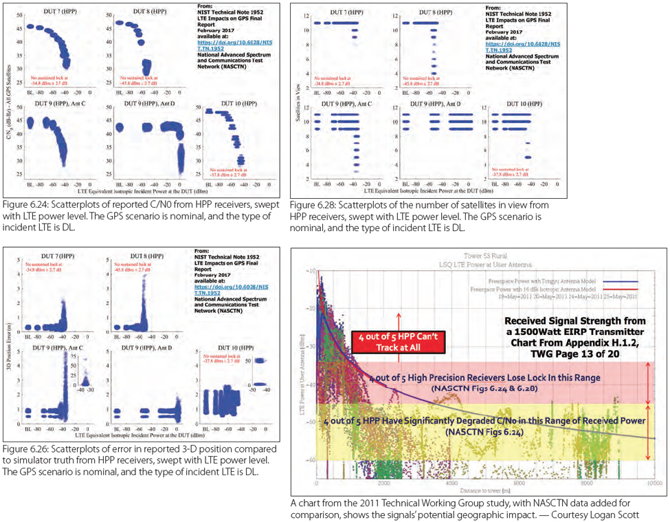 Figures and Charts
The GPS community and Virginia-based Ligado are weighing new and upcoming test results as the standoff over interference with satellite navigation services enters its seventh year.
The dispute centers on the company’s now modified proposal to build a terrestrial wireless network supported by frequencies originally allocated for satellites. Though there had been a move some years earlier to augment the satellite services with ground stations the company’s first plan envisioned some 30,000 high-powered ground terminals.
By Dee Ann Divis