SWW 2016: Space Weather Workshop
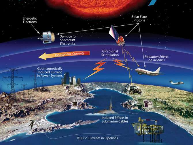
NASA image: effects of space weather on technologyNOAA’s Space Weather Prediction Center will hold it’s annual Space Weather Workshop at the Omni Interlocken Hotel in Broomfield, Colorado (10 minutes from Boulder) from April 26 to 29, 2016.
Billed as "The Meeting of Science, Research Applications, Operations and Users," what began as a small conference in 1996 is now a major event addressing the diverse impacts of space weather on critical technology, including communications, navigation, spacecraft operations, aviation and electric power.
By Inside GNSS