Delivery of First GPS III Satellite Delayed by Ceramic Capacitor Testing
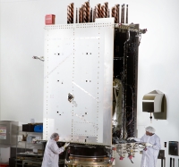
The first GPS III satellite’s delivery will be delayed by four months because of a Lockheed Martin subcontractor’s failure to test a ceramic capacitor.
The satellite, which was expected to be delivered in August, is now scheduled for shipment in December, according to a Bloomberg news article.
By Inside GNSS