July 10, 2018
Curtiss-Wright Highlights A-PNT Solutions for Ground Vehicles in GPS/GNSS-Denied Environments at JNC
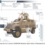
Curtiss-Wright’s Defense Solutions division announced that it will highlight its family of commercial-off-the-shelf (COTS)-based modules and LRU solutions designed for system integrators seeking to rapidly and cost-effectively deploy Assured Position, Navigation and Timing (A-PNT) services at the 2018 Joint Navigation Conference, July 9-11 (Booth #109), the largest U.S. military Positioning, Navigation and Timing (PNT) conference of the year with joint service and government participation.
By Inside GNSS