September 1, 2009
u-blox Launches Ultra-Low Power u-blox 6 for Battery-Driven Applications
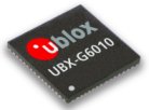
Thalwil, Switzerland–based embedded GNSS receiver provider u-blox has announced the upgrade of its core CMOS technology to u-blox 6, with substantially reduced power requirements as the result of new "intelligent," user-selectable power management features. According to the company, these innovations enable significantly extended battery life for power-critical GPS applications.
By Inside GNSS