Galileo

July 3, 2012

Mission Accomplished: ESA Turns Out the Lights on GIOVE-A

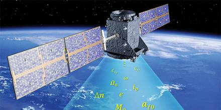
With the first two Galileo in-orbit validation (IOV) spacecraft working well, the European Space Agency (ESA) has decided to end the mission of its pioneering GIOVE-A satellite that had long exceeded it original purpose and design life.

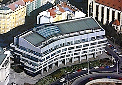
Meanwhile, with the next Galileo launch approaching, ESA has expanded its Radio Navigation Laboratory (RNL) to meet the testing needs of Europe’s GNSS program.

Read More >

By Inside GNSS
[uam_ad id="183541"]
June 26, 2012

GISSA Ukubuzana 2012

The Geo-Information Society of South Africa will hold its 2012 conference and exhibition, GISSA Ukubuzana*, on October 2, 3 and 4 at the Emperors Palace Convention Centre, Jones Road, Kempton Park in Gauteng. A free shuttle bus is available every 20 minutes from Johannesburg’s O.R. Tambo (ORTIA) airport to the convention center.

The theme is "An African Dialogue: Geomatics for Infrastructure Development and Service Delivery."The keynote speaker will be Dean Angelides, ESRI’s corporate director for international operations.

Read More >

By Inside GNSS

June 23, 2012

GNSS and Positioning for the Future Workshop

A seven day workshop on GNSS and Positioning for the Future will be held at a Jutland (North Sea) resort in Denmark from August 27 through September 2, 2012. It is open all those with an interest in satellite positioning and navigation but limited to the first 50 registered participants.

The workshop will cover GNSS basics, new satellite navigation systems, arctic navigation, intelligent transportation systems and environmental monitoring, with lectures by international experts in those fields. The program and full list of lecturers are available on the event website.

Read More >

By Inside GNSS
June 18, 2012

Spirent Launches New Entry-Level Multi-GNSS Simulator

Spirent Communications has announced the launch of its new eight-channel GSS6300M Multi-GNSS simulator designed for integration, verification, and production testing where a quick and accurate functional test is needed.
 
The platform supports simulation of signals from individual or combined GPS/SBAS, GLONASS, and Galileo constellations with up to 24 channels are supported with 8 channels of simulation per constellation.
 

Read More >

By Inside GNSS
June 8, 2012

New Navigator Seminar

The Royal Institute of Navigation will hold a new navigator seminar and networking opportunity at the University of Nottingham on June 14, 2012 for new navigators, engineers, scientists and surveyors who are seeking careers in the industry.

Masters and doctoral level students will present on navigation and positioning topics, advanced undergraduates and postdocs will be in attendance. A number of industry and government representatives will exhibit or attend to listen to new research and meet the new talent.

Read More >

By Inside GNSS
[uam_ad id="183541"]
May 27, 2012

IP Rights and Wrongs

As Desi Arnaz often said to Lucille Ball during an “I Love Lucy” episode on TV, “You’ve got some ’splaining to do.”

I refer, of course, to the untoward and unexpected initiative by the British Ministry of Defense (MoD) to patent the technical innovations that underlie the planned next generation of civil GNSS signals.

Read More >

By Dee Ann Divis
May 26, 2012

Stanford and Aalborg Announce Summer Workshop on GNSS Positioning for the Future

A number of GNSS experts from the United States, Denmark, Norway and China will lead a weeklong workshop on the future of satellite-based positioning technologies from August 27 through September 2 at the Slettestrand Holiday Center in North Jutland, Denmark.

The topics range from GNSS basics and Intelligent Transportation Systems to new GNSSes, new receivers and indoor navigation as well as environmental monitoring and arctic navigation. The event is organized by Stanford and Aalborg universities.

Read More >

By Inside GNSS
May 24, 2012

How do GNSS-derived heights differ from other height systems?

Q: How do GNSS-derived heights differ from other height systems?

A: Height estimation using GNSS always seems to be trickier than horizontal coordinate estimation.

Why?

On the one hand, the GNSS technique has error sources that are more critical in the vertical direction. Height estimates are weaker because of a combination of satellite geometry, the presence of strong correlations to other parameters, such as atmospheric delays, and the antenna phase center model applied during data analysis.

Read More >

By Inside GNSS
1 54 55 56 57 58 74
IGM_e-news_subscribe