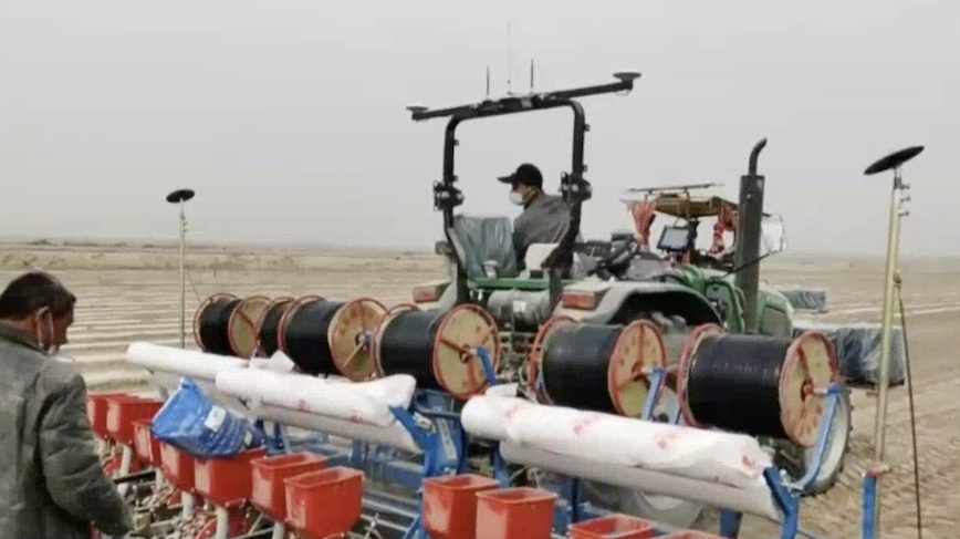
Chinese government television is carrying live coverage of GNSS-guided cotton-seed drilling in the fields of the Xianjiang Uygur Autonomous Region, a vast area of deserts and mountains in northwest China.
“As spring comes to an end and temperatures gradually rise, the spring sowing and planting season in China’s Xinjiang Uygur Autonomous Region has begun. In southern Xinjiang, large cotton fields are taking advantage of the BeiDou Navigation Satellite System for their high efficiency. Our reporters are in different locations in Xinjiang for the live sowing events.”
According to a JiangSu BDS Application Industry Institute presentation, the use of the Chinese GNSS has increased land production by 20%, increased land utilization by 10%-20%, reduced “leak” by 10%-20%, improve dthe efficiency of agricultural machinery by 20% over standard agricultural practices, reduced manpower costs by 30%, improved the critical time of operation, as during the spring sowing season crews can work 24 hours, day and night.
The Xianjiang Uygur Autonomous Region is home to many ethnic minority groups, including the Turkic Uyghur people. No mention is made in the coverage of the current international controversy regarding persecution of these indigenous peoples.
Image courtesy CGTN.


![On-site testing and validation of GreenAsph 4.0; Image courtesy Exact Control System[50]](https://insidegnss.com/wp-content/uploads/2025/11/On-site-testing-and-validation-of-GreenAsph-4.0-Image-courtesy-Exact-Control-System50-150x150.jpg "GNSS Powers 'Green Asphalt' Road Recycling")
