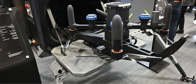
The Association of the United States Army’s (AUSA) annual conference highlighted the growing popularity of small unmanned aircraft as well as the need to develop and refine counter-UAS systems to go up against them—all of which must operate in GPS-denied or degraded environments. Many, if not all, of the systems featured rely on precise positioning, especially in the GPS-denied environments frequently encountered on the modern battlefield.
During the conference, VectorNav introduced two new members of its GNSS/INS family to help meet such needs, the VN-210-S and VN-310-S. Both bring new GNSS capabilities and improved performance, according to the company.
The VN-210-S combines VectorNav’s IMU—composed of a three-axis gyroscope, accelerometer and magnetometer—with a new, triple-frequency GNSS receiver. The 448-channel from Septentrio (hence the S in the name) adds new capabilities, including L5 frequencies, Moving Baseline RTK with centimeter-level accuracy, and support for OSNMA message authentication and interference mitigation.
The VN-310-S also incorporates the IMU and teams it with two 448-channel GNSS receivers, along with support for OSNMA authentication and interference mitigation. For both systems, this means improved positioning performance in congested radio frequency environments or GNSS-denied areas.
Both are packaged in a precision milled, anodized aluminum enclosure designed to military standards and are IP68-rated. For ultra-low size, weight and power applications, VectorNav introduced L5 capabilities to the VN-210E (Embedded) when using an externally integrated L5-band GNSS receiver.
The VN-210-S and VN-310-S development kits are available for immediate purchase in low quantities, with full production and additional capabilities expected to be announced early in the first quarter of 2024.
PNTAX 2023
At roughly the same time as the AUSA conference, the Army conducted the fifth annual PNT Assessment Experiment, or PNTAX, which brought together joint and international defense partners and industry to experiment with emerging PNT technologies in an environment with degraded or denied GPS.
Held at White Sands Missile Range inAugust, PNTAX is part of Army Futures Command’s campaign of experimentation and continuous learning, where participants could field-test space-based, ground-based and aerial positioning technologies.
“Experiments like PNTAX provide a valuable opportunity for Soldier touchpoints that directly influence requirements,” said Mike Monteleone, director of the Army Futures Command Assured Positioning, Navigation and Timing/Space Cross-Functional Team (APNT/Space CFT), which hosted the event.
For this year’s PNTAX:
- Soldiers from the 101st Airborne Division conducted terrain walks and feedback for the Dismounted Assured Positioning System.
- Soldiers from the 1st Armored Division conducted their own training objectives, faced with threat-based GPS denied and degraded environments.
- Soldiers from the 10th Mountain Division worked with the CFT’s sensor-to-shooter team in the denied environment to learn from its effects on the links associated with the tactical architecture, while the 2nd Infantry Division conducted a variety of ground maneuver activities that enabled operations throughout the experiment.
- Allied partners from Canada and Australia joined to observe and scope future participation, while partners from the United Kingdom conducted land navigation experiments with their Soldiers. Multinational participants worked alongside their participating Soldiers and U.S. Soldiers to replicate what operations will likely look like in future, combined force settings.
The open-air denied, degraded, intermittent and limited environment at PNTAX was achieved through jamming and a variety of other threat interfaces that resembled real-world, layered approaches Soldiers might face in a multi-domain operating environment.
Next year, the Army intends to expand opportunities for allied partners, increase Soldier training activities and broaden the scope of electromagnetic spectrum experimentation.


