Tersus GNSS has launched the AG993, a modular autosteer retrofit kit for agricultural vehicles that pairs high-precision GNSS positioning with the company’s proprietary TAP (Tersus Advanced Positioning) satellite correction service alongside conventional RTK support. The system targets better-than-2.5 cm accuracy across a 0.2–30 km/h working speed range, with support down to 0.1 km/h and standard automatic headland U-turns.
The core differentiator is TAP, which delivers correction via L-band satellite signal rather than a local base station or cellular network. If RTK correction drops out, the TAPFill function automatically switches to TAP while keeping the positioning result aligned to the RTK coordinate reference frame, preserving guidance continuity. If GNSS signal is lost entirely or quality falls below threshold, the system issues a warning and requires the operator to disengage and manually confirm conditions before resuming.
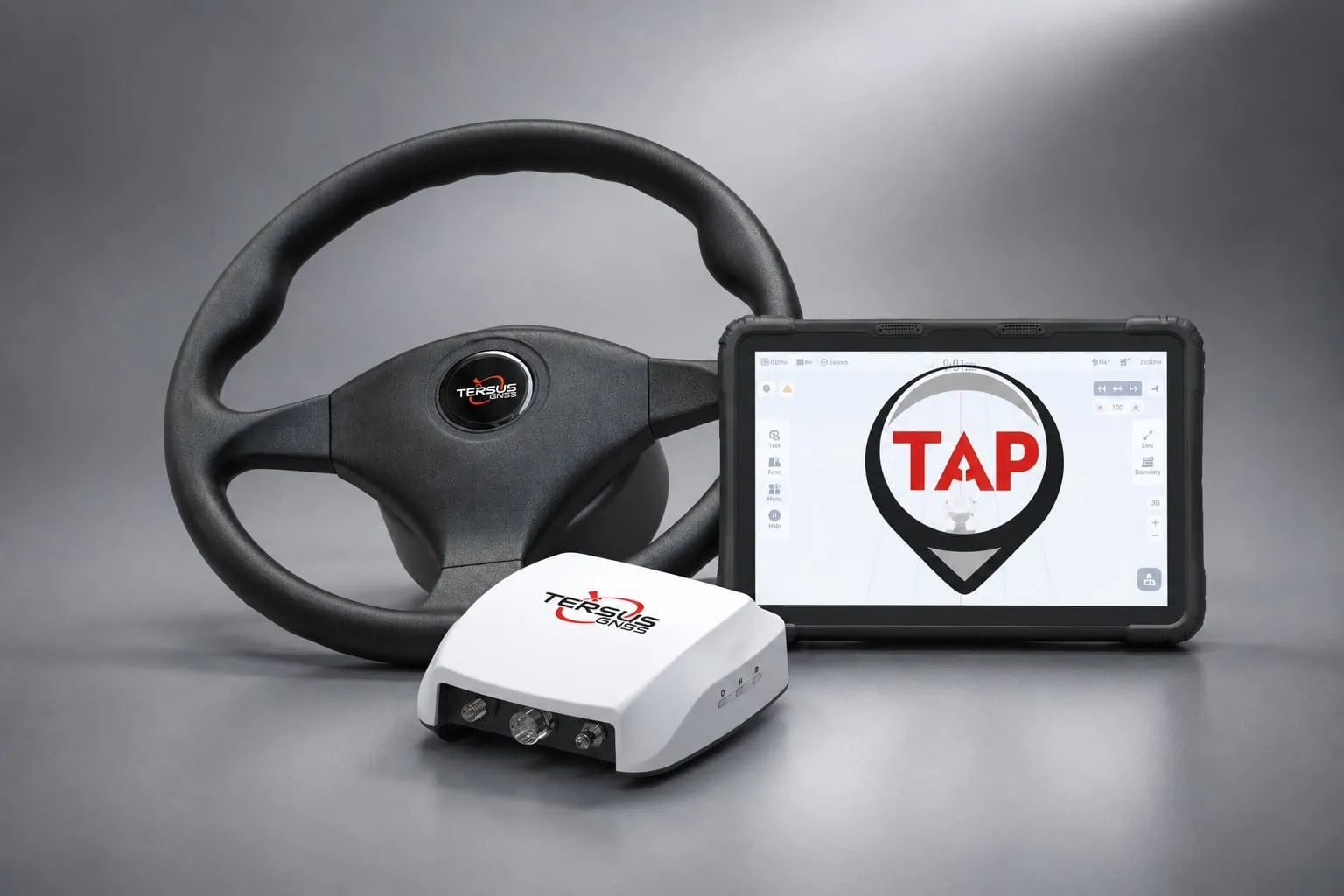
Core hardware includes the GC30 Guidance Controller, TC120 tablet terminal (10.1″, IP67), TES30 electric steering motor, camera, and vehicle-specific brackets. Tersus says the kit is compatible with over 90% of ag vehicles across brands, with installation recommended through trained personnel or authorized dealers. The system supports all major constellations — GPS, GLONASS, BeiDou (BDS-3), Galileo, QZSS, SBAS, IRNSS — plus the L-band TAP signal.
Notably, Tersus is also pursuing an open-source-oriented integration path with the AgOpenGPS community, separate from its standard commercial licensing — framed by the company as a way to pair its GNSS/INS fusion and motor-control hardware with community-developed flexibility. ISOBUS VT&TC compatibility and section control for sprayers/seed drills are in development, alongside a 12-inch tablet option. Indicative retail pricing runs roughly $4,000–$8,000, dealer/region/config dependent.
Mark Chen, Tersus’s Director of Digital Media, positioned the AG993 as a stepping stone toward broader autonomy — pointing to ISOBUS Tractor Implement Management, multi-sensor fusion (cameras, LiDAR, radar, IMU) for obstacle detection, and data connectivity with platforms like John Deere Operations Center and agrirouter as the next layers, alongside growing European regulatory/cybersecurity requirements around geofencing and human-machine responsibility boundaries.


