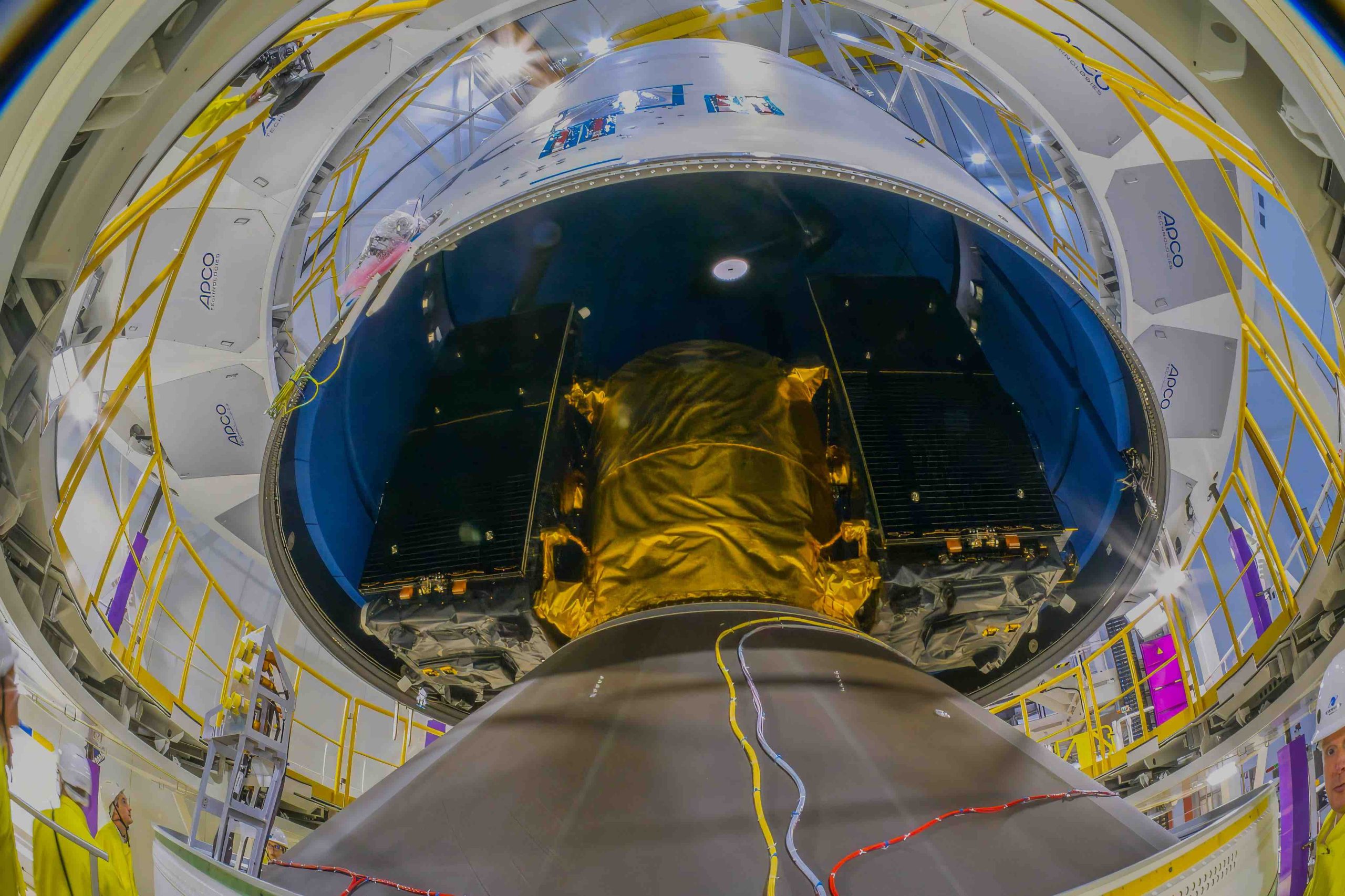
Over the next six issues, Dr. Güenter W. Hein will critically review the development of Galileo, drawing on more than two decades of direct experience with Europe’s satellite navigation system. But this series is not simply a look back. Galileo’s history is also a study in geopolitics, technical ambition, institutional complexity, international cooperation, spectrum management and interoperability—issues that remain central to today’s global PNT aspirations.
Twenty years on, Galileo stands as both a major European achievement and a hard-won lesson in what it takes to build sovereign, resilient and globally relevant navigation infrastructure. Hein will examine the decisions, compromises and challenges that shaped the system, offering readers a rare behind-the-scenes perspective on Europe’s strategic choice to move from dependence to capability—and why that story still matters now.
Highs and lows in the development of the European Satellite Navigation System, Galileo.
For much of the late 20th century, the world had access to only one fully operational global satellite navigation system: the United States’ Global Positioning System (GPS). Conceived in the 1970s as a military asset and declared fully operational in 1995, GPS had by the mid-1990s become indispensable to civilian users worldwide—from pilots and ship captains to farmers, surveyors and ordinary motorists. Yet, beneath the convenience of free, open signals lay a profound strategic vulnerability: GPS was owned, operated and controlled exclusively by the United States Department of Defense (DoD). Washington could, in principle, degrade or deny the signal at will.
This dependency troubled European policymakers and military planners throughout the 1990s. The concern was not merely theoretical. During the Gulf War of 1991, the United States deliberately degraded GPS accuracy through a technique known as Selective Availability, limiting civilian precision to roughly 100 meters. Although Selective Availability was switched off in May 2000, the capability to reinstate it remained. European governments, aerospace industries, and transport authorities recognized that building critical infrastructure—aviation, rail, maritime, precision agriculture, financial timing networks—on a foreign-controlled system was a risk that strategic autonomy could not tolerate.
Early Studies and the Political Will to Act
European interest in an independent navigation capability had simmered since the 1980s. The European Space Agency (ESA) had developed NAVSAT and GRANAS concept studies, and various national programs explored augmentation systems. A concrete step came with the European Geostationary Navigation Overlay Service (EGNOS), developed jointly by ESA, the European Commission (EC), and Eurocontrol from the mid-1990s. EGNOS, which became operational in 2009, could improve GPS accuracy and provide integrity signals for safety-critical applications, but it remained dependent on the underlying GPS constellation. It was a patch, not a solution.
The decisive political turn came in the second half of the 1990s. The European Commission’s 1999 communication, “Galileo: Involving Europe in a New Generation of Satellite Navigation Services,” laid out the case openly: Europe needed its own system, civilian-controlled and commercially oriented, interoperable with GPS but independent of it. The name Galileo, a tribute to Galileo Galilei, an Italian astronomer who made foundational contributions to the science of motion and observation, was chosen to signal both scientific heritage and a new era of European technological ambition. (I believe Kepler would have been the better name. But politics had decided, not technology!)
The Early Days of Galileo: 1999-2000 Political Launch and National Ambitions
The story of Galileo’s political birth is, in many respects, the story of a European pilgrimage. This was the first generated “income” of Galileo: however, not for the space system but for the Galileo Travel Agency! In 1999 and 2000, delegations, lobbyists, industry representatives, and national officials from across the continent converged on Brussels with a shared ambition but—as would quickly become apparent—with rather different ideas about what that ambition should deliver. The atmosphere was one of excitement tinged with opportunism: here was a major program taking shape, and every stakeholder wanted a seat at the table.
The process generated what insiders sometimes called national “wish lists”—catalogues of desired outcomes, preferred industrial workshares, and projected economic benefits that each member state hoped to extract from the new system. These lists were gathered under various headings and studies. The Galileo Overall Architecture Definition (GALA) study was among the most prominent. GALA was intended to define the overall system architecture, but it also became a vehicle through which competing national interests were channelled into the technical debate. The result was a negotiating process as much as an engineering one.
The official justifications advanced for building Galileo were numerous and, on close inspection, of uneven quality. Safety of life, employment creation, industrial spin-offs, enhanced road and rail navigation, search and rescue improvements, integrity, public-private partnership—all were cited, sometimes with statistics that did not survive scrutiny. Several of the arguments were, frankly, either misconceived or greatly exaggerated, and those with a critical eye could see the economic forecasts in particular owed more to political necessity than to rigorous analysis. The need to justify a multi-billion-euro public investment demanded a compelling narrative, and not every element of that narrative was equally well-founded.
Beneath the rhetoric, however, two motivations stood out as genuinely sound. The first was the desire to break the GPS monopoly. At the turn of the millennium, the entire world depended on a single navigation system owned and operated by the United States DoD. The vulnerabilities this created—strategic, commercial and operational—were real, and no amount of goodwill between allies could fully substitute for an independent capability. The second motivation was equally clear-eyed: Galileo was to be Europe’s ticket into the front rank of high-technology infrastructure. Satellite navigation was not merely a useful service; it was becoming the invisible foundation of the digital economy, and Europe’s long-term competitiveness depended on being a provider rather than merely a user of that foundation. These two reasons, strategic independence and technological leadership, were, in the end, the ones that mattered, and they were sufficient.
An American colleague told me: “I thank Europe for the decision to build up its own satellite navigation system: This was the best investment in GPS. We have never seen so many improvements in GPS after a while of stagnation.”
The Lisbon Treaty and European Space Governance
Before continuing the discussion about the early days of Galileo, I must mention an important political move of the European Union (EU) and its Member States. The Lisbon Treaty, which entered into force in December 2009, marked a turning point in European space governance by providing, for the first time, an explicit legal basis for space activities at the Union level. The key instrument is Article 189 of the Treaty on the Functioning of the European Union (TFEU), which authorizes the EU to develop a European Space Policy aimed at promoting scientific and technological progress, strengthening industrial competitiveness, and supporting the implementation of broader Union policies.
On this basis, the EU may establish a European Space Programme and adopt the necessary legislative measures (regulations, directives and decisions) through the ordinary legislative procedure. In terms of the division of competences, however, space occupies a carefully circumscribed position. Although it falls within the category of shared competences, it is in practice treated as a “support or coordination competence.” The Treaty explicitly prohibits the harmonization of national laws and regulations, preserving the legislative autonomy of Member States in the field.
The Treaty recognizes the security and defense dimensions inherent in space activities. Because space infrastructure is frequently dual-use in nature, serving both civilian and military purposes, the Treaty permits, and in certain respects requires, the EU to address these dimensions as part of a comprehensive space policy. This provision has taken on growing practical significance as Europe’s dependence on space-based services for defense, border management, and crisis response has deepened.
Finally, the Treaty also mandates that the Union establish appropriate relations with the ESA, acknowledging ESA’s longstanding role as Europe’s principal space organization and the need for coherent institutional cooperation between the two bodies.
The Treaty also codifies, at least implicitly (and theoretically), a division of labor between the EU and ESA that has evolved over decades of institutional practice. The EU concentrates on space policy, program funding, and the demand side of the equation, defining what services are needed and ensuring they are delivered to users. ESA, by contrast, remains primarily responsible for the supply side: the engineering, infrastructure, and technical development that make those services possible. The two organizations should be complementary rather than competing.
My impression is the ESA underestimated the implications that were arising over the following years and remained silent. At first glance, it seems quite natural for the EU to be responsible for space policy, taking up the needs of the European community and preparing funding for space activities, while the ESA takes responsibility for technical realization. Unfortunately, the boundary between their respective roles has not always been free of friction and has led many people to a perceived disempowerment of ESA in some directories. I will later come back in detail what is meant with this statement.
One of the Treaty’s most consequential constraints is precisely what it does not permit. The EU has no power to impose harmonized space regulations on its Member States: national space law remains firmly within the sovereign remit of each country. This limitation reflects the broader constitutional settlement of the Lisbon Treaty, which sought to expand Union competence in space while simultaneously protecting the regulatory independence of member governments. The practical effect is a patchwork of national licensing regimes and liability frameworks sitting alongside, but not superseded by, European-level policy. In fact, one can still observe space activities in the Member States, which are duplicating efforts of the EC or even competing by building up similar satellite navigation or satellite communication systems.
Since 2009, the EU’s engagement with space has also acquired a markedly more security-oriented character. The dual-use nature of space infrastructure—navigation, Earth observation, and satellite communications all serving both civilian and defense purposes—has increasingly drawn space policy into the orbit of broader strategic autonomy debates. Protecting European space assets from jamming, spoofing, cyber intrusion, and anti-satellite threats has moved from the margins to the mainstream of EU space thinking, reflecting a wider recognition that space is no longer a benign domain but a contested one in which Europe’s ability to act independently depends on the resilience and security of its own infrastructure.
According to its convention, the ESA is limited to “exclusively peaceful purposes.” However, under pressure from the EU, this term has increasingly been interpreted to also allow for “defensive” military aspects (e.g., surveillance or encrypted communications).
The Decision to Build Galileo
The formal decision to proceed with Galileo was taken by the European Council in March 2002, when EU transport ministers gave their approval for the development and deployment phase of the system. This followed years of preparatory studies, feasibility assessments, and political negotiation, and it represented a definitive commitment by the Union to invest in an independent satellite navigation capability. The EC and the ESA were tasked with jointly overseeing the program, with ESA taking the lead on the technical and procurement side while the EC held overall political authority. A dedicated management structure, the Galileo Joint Undertaking, was established in 2002 to coordinate the two institutions and to manage the program’s early phases.
Costs and Funding
The original cost estimates for Galileo were, in retrospect, optimistic. The development and in-orbit validation phase was initially budgeted at approximately €1.1 billion, with overall deployment costs for the full constellation estimated at around €3.2 billion. These figures reflected the assumptions of the early 2000s, including the expectation that a substantial share of the funding would come from private industry through a public-private partnership (PPP) model. Under this model, a private concession holder was to operate the system commercially and recover costs through service revenues, with public funds covering only a portion of the investment.
I live in a town south of Munich. At the same time as the Galileo decision, a family-owned pharmaceutical company that produced generic medical drugs and had about 100 employees was sold to a multinational medical company for more than 6 billion Euro—just two Galileo systems (cost assumption early 2000s)!
Civil Control, Military Reality and the Question of Dual Use
One of the most deliberate and politically significant design choices made for Galileo was the insistence that it be a civilian system under civilian control. This was not merely a technical or administrative detail; it was a statement of principle, and it was intended to distinguish Galileo fundamentally from GPS. The United States’ system had been conceived as a military asset, and its civilian use, however widespread, remained conditional on the goodwill of the U.S. DoD. Galileo, by contrast, was to be governed by the EC, a civilian institution, and its primary purpose was defined in terms of civilian applications: transport, agriculture, timing, search and rescue, and commercial services.
This civilian identity was not, however, synonymous with exclusion of the military. European policymakers were candid from the outset that defense and security forces would be entitled to use Galileo signals, including the encrypted Public Regulated Service (PRS) reserved for government-authorized users. The formulation that became standard in policy documents was straightforward: Galileo is a civil system under civil control, and the military may use it. This formula allowed Europe to maintain its civilian branding while acknowledging the inescapable reality that any global navigation system is of strategic value, and that European armed forces and security agencies would naturally make use of a European system.
What happens to the civil control of Galileo in times of crisis? Most European Member States have a Radionavigation Plan that makes clear that, when it comes to the crunch, the military has the final say. The tension between Galileo’s civilian identity and the realities of national security has therefore never been fully resolved; it has merely been deferred.
The PRS was conceived as a government-controlled, encrypted service for authorized institutions—customs agencies, specialized police units, border control, and similar bodies—with strictly limited access. Some nations, however, lobbied for PRS access to be extended to fire brigades and other local emergency services, apparently overlooking the fact that the number of simultaneous users the system can support is not unlimited, and a large number of users might create a problem for security. The military, meanwhile, was not explicitly named among the intended users—the working formula remained the familiar one: they may use it—even though the PRS was developed to a specification, and at a cost, that closely mirrors a military-grade service. The omission was not accidental; it reflected the political sensitivity of departing too visibly from Galileo’s declared civilian character.
Adding a further layer of complexity, most European nations had already concluded Memoranda of Understanding with the United States for the use of GPS, particularly within the NATO framework. Against that background, Galileo’s PRS was initially regarded by many European military establishments as superfluous—a costly duplication of a capability they already accessed through their American alliance commitments.
The world has changed substantially since those early design decisions were made. The conflicts and wars of recent years and today have made clear Europe can no longer take its security for granted and must rebuild defense capabilities that were allowed to atrophy significantly after the end of the Cold War. In that context, an independent, European-owned global satellite navigation system such as Galileo is plainly a major strategic asset for modern defense—essential for the guidance and operation of aircraft, naval vessels, armoured vehicles, and precision weapons alike.
It is, therefore, even more remarkable that Galileo has not yet been officially designated as a dual-use GNSS. Every other global and regional satellite navigation system—GPS, GLONASS, BeiDou, NavIC—carries an explicit dual-use status. Galileo’s continued omission from that category is increasingly difficult to justify, and the argument for formally recognizing what has always been true in practice grows stronger with every passing year.
A further technical observation is warranted in the context of the PRS. Given that the PRS encryption is not watertight, the signal can be tracked without knowledge of the access code, so-called codeless tracking. One is therefore entitled to ask: What is the justification for the extraordinarily expensive and complex national access key schemes, which differ from country to country? I hope the second generation of Galileo will overcome that problem.
Opening Galileo to the World: International Partners
From an early stage, the EC pursued an active strategy of inviting third countries to join Galileo as partner nations and stakeholders. The rationale was partly financial—contributions from partner countries would help share the costs of development—and partly strategic. A system with broad international participation would be more difficult to challenge or marginalize, and would generate a larger global user base, strengthening the commercial case for European industry.
China was among the earliest countries to engage substantively with the program: A cooperation agreement with the Chinese government was signed in 2003, and China initially contributed funding and participated in technical working groups, though its involvement later diminished as Beijing’s own BeiDou navigation system matured. Israel signed a cooperation agreement with the EU in 2004, becoming one of the first non-European partners to formalize its engagement with the program. Ukraine, Morocco and South Korea also concluded first political agreements in the mid-2000s, each bringing different motivations—industrial participation, regional positioning, or access to high-accuracy services. However, it did not come to the second agreement defining the operational engagement in Galileo. India entered into discussions with the EU during the same period, reflecting the interest of major spacefaring nations in securing a stake in the emerging global navigation landscape.
Together, these early partnerships gave Galileo an international footprint from the outset and underscored the EC’s ambition to build not merely a regional system, but a genuinely global one.
PROF. DR.-ING. HABIL. DR. H. C. GÜENTER W. HEIN, Emeritus of Excellence at Bundeswehr University Munich, draws on more than two decades of first-hand experience to recount the development of Galileo, the European satellite navigation system. His involvement began with national research conducted between 1995 and 2008 at his former Institute of Geodesy and Navigation at Bundeswehr University Munich, funded by the Deutsches Zentrum für Luft- und Raumfahrt (DLR, German Aerospace Center). From 2000 onwards, he represented Germany in various EC Galileo study groups, including the Galileo Signal Task Force, and took part in the EU-US negotiations on GPS/Galileo interoperability from 2000 to 2005. He subsequently joined the European Space Agency as Head of the EGNOS and Galileo Evolution Programme Department from 2008 to 2014. He later served as a member of the Executive Board of Munich Aerospace e. V. and has provided consultancy to leading European satellite navigation companies. Güenter W. Hein is the founder of the Munich Satellite Navigation Summit and the Munich New Space Summit, which were merged in 2026 to form the Munich Space Summit. Through all these roles, he has played a central part in shaping European satellite navigation over the past 20 years.