In a project funded by the European Space Agency (ESA) NAVISP program, a Polish consortium led by INFEO, and including the University of Warmia and Mazury in Olsztyn (UWM Olsztyn), has completed the ARWaterNAV project.
It is aimed at significantly improving inland water navigation through the use of cutting-edge geospatial technology and augmented reality (AR).
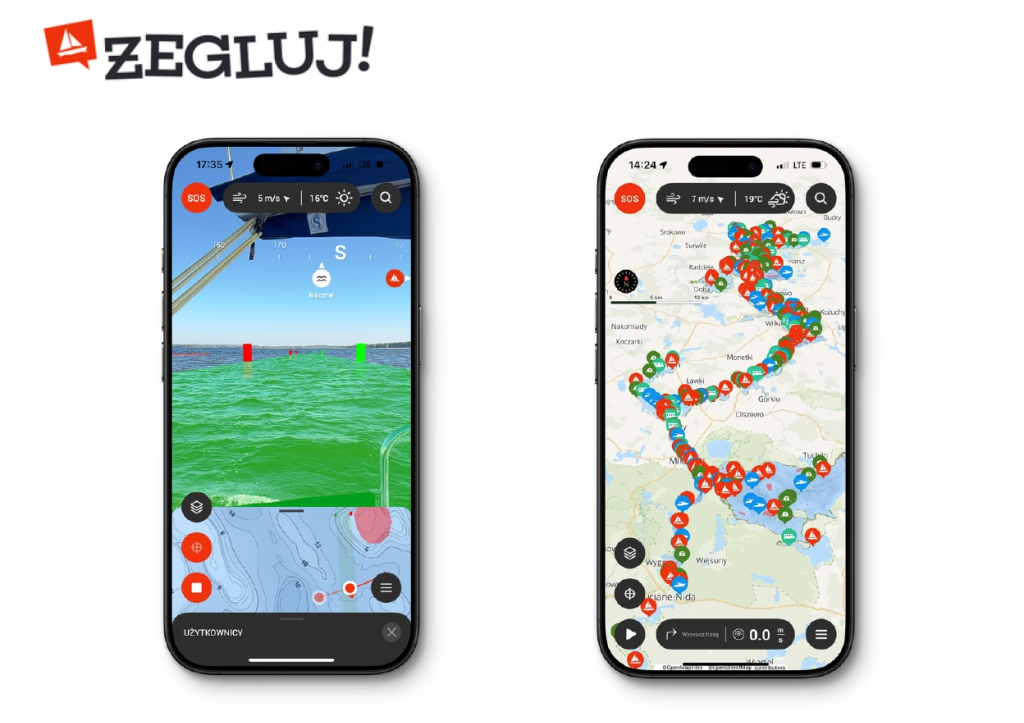
At a recent event hosted by ESA, the project final results were presented by INFEO Owner Marcin Gryszko, and Tomasz Templin and Dariusz Popielarczyk of UWM Olsztyn. “We wanted to enhance the Żegluj [Sail] mobile application,” Gryszko said, “which is our multifunctional navigation platform, already used by sailors on inland waterways.”
The updated system now incorporates a wide range of features aimed at improving navigational safety, efficiency, and usability in complex aquatic environments such as lakes, rivers, and channels. ARWaterNAV introduces a refined positioning engine using GNSS, real-time sensor fusion, and artificial intelligence to analyze navigation data and suggest optimal routes.
Intuitive interface
One of the most prominent innovations is the AR interface, which projects critical navigation information, such as speed, heading, and alerts, directly into the user’s visual field via a mobile device. This intuitive presentation allows users to interpret real-time conditions quickly and make informed decisions, even in challenging environments where traditional maps and instruments may be insufficient. The AR layer also integrates high-definition bathymetric and topographic data, allowing for realistic and accurate visualizations of the subsurface marine environment.
Another major advancement is the route prediction function, which takes into account dynamic environmental and structural variables, such as water level changes, channel widths, and the presence of locks or bridges. Historical navigation data from other users is also leveraged to avoid known trouble spots and improve safety through community-sourced intelligence. Real-time alerts notify users when they approach potential hazards, and a collision warning system provides both visual and audible cues to help prevent accidents.
Other enhancements include live location sharing between users, seamless integration with rescue services, and a dedicated emergency mode for swift coordination in distress situations. The latest version of Żegluj also features an improved interface, optimized battery consumption, and customizable display modes suited for different lighting conditions. Gryszko said the application, available on both Android and iOS platforms, represents one of the most sophisticated tools available for inland water navigation, settings a new benchmark for mobile safety systems tailored to the water tourism sector.


