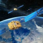
Space Force Presses on with R-GPS Constellation
An update on where we are with Resilient GPS, an additional network of smaller, cheaper navigation satellites that would augment existing GPS satellites.
By Brett DavisAn update on where we are with Resilient GPS, an additional network of smaller, cheaper navigation satellites that would augment existing GPS satellites.
By Brett DavisEditor’s Note: Jon Damush, uAvionix CEO, provides context on existing technological safeguards that can help prevent aircraft collisions like the one near Washington, DC on Jan 29.
By Jon DamushLeveraging Galileo and introducing new GNSS measurements to the current network enables Korea Augmentation Satellite System (KASS) availability below the vertical limit.
By Inside GNSSThis follow-up to a 2007 Inside GNSS article looking at the potential future role for C-band in navigation details how, nearly 20 years later, it’s moved from an interesting idea to critical for resilient position, navigation and timing (PNT).
By Inside GNSSA: Radio frequency interference (RFI) events have grown in frequency and scope to become a paramount concern for commercial, military and (especially) safety-of-life critical applications of GNSS since the Russian invasion of Ukraine in February 2022 and the Hamas attack on Israel in October 2023.
By Inside GNSSEurope’s Galileo navigation system has taken a significant leap forward with the completion of a major upgrade to its Galileo Ground Segment. As one of the most complex ground segments ever developed in Europe, the challenge lay in seamlessly upgrading a system that serves more than four billion users globally—without disrupting service.
By Inside GNSSGuest columnist Sergey Zotov of EMCORE Corporation covers the inconsistencies in inertial grade classification and why it’s time to standardize the terminology.
By Inside GNSSSteve Woolven’s early experience running his family’s resort coupled with his ambitious academic pursuits helped lay the groundwork for a successful career in the PNT industry and his current role as President of Trimble Applanix.
By Peter GutierrezA Global Navigation Satellite System (GNSS) aims to provide Earth-based position and navigation. Spaceborne GNSS receivers have become universal sensors for spacecraft navigation, especially in low Earth orbits (LEOs), often also supporting science endeavors or acting as dedicated science payloads.
By Inside GNSSIn high-performance applications, the debate over quartz and silicon MEMS inertial sensors rages on, but guest columnist David Gaber of Epson makes the case for why products from OEMs versus integrators are superior.
By Inside GNSSA look at how far we’ve come, where we are today and where we’re going in the effort to protect PNT and critical infrastructure when GNSS services aren’t available.
By Dawn M.K. Zoldi (Colonel, USAF, Ret.)A: Receiver Autonomous Integrity Monitoring (RAIM) and Advanced RAIM (ARAIM; known more generally as Solution Separation RAIM, or SS-RAIM) were originally designed to detect, alert and (where possible) exclude faulty measurements caused by Signal-in-Space (SIS) failures.
By Sam PullenLeveraging high-accurate Inter-Satellite Links for communication and ranging among GNSS satellites offers improved and more frequent data dissemination than ground ODTS.
By Inside GNSSNotifications