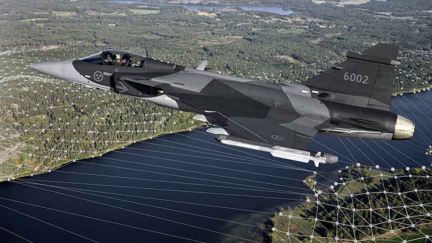
Saab, the Swedish defense and security company, and Maxar recently demonstrated a solution to GPS-denied environments by integrating Maxar’s 3D DATA and Precision 3D Registration (P3DR) technology into the Gripen E, the combat fighter jet that Saab develops and manufactures for Sweden and other countries.
Flying Demo
Saab put this GPS-denied navigation technique to the test with a 2020 Gripen flight demonstration over Sweden, using new algorithms providing real-time and highly accurate positioning based on image mapping, known as 3D-mapping. During the flight demonstration, the Gripen’s GPS was on to monitor the accuracy of the results. data from on-board electro-optical sensors and geo-registration algorithms is compared with a 3D surface model database in the aircraft. The GPS verified that the demonstration’s results were accurate.
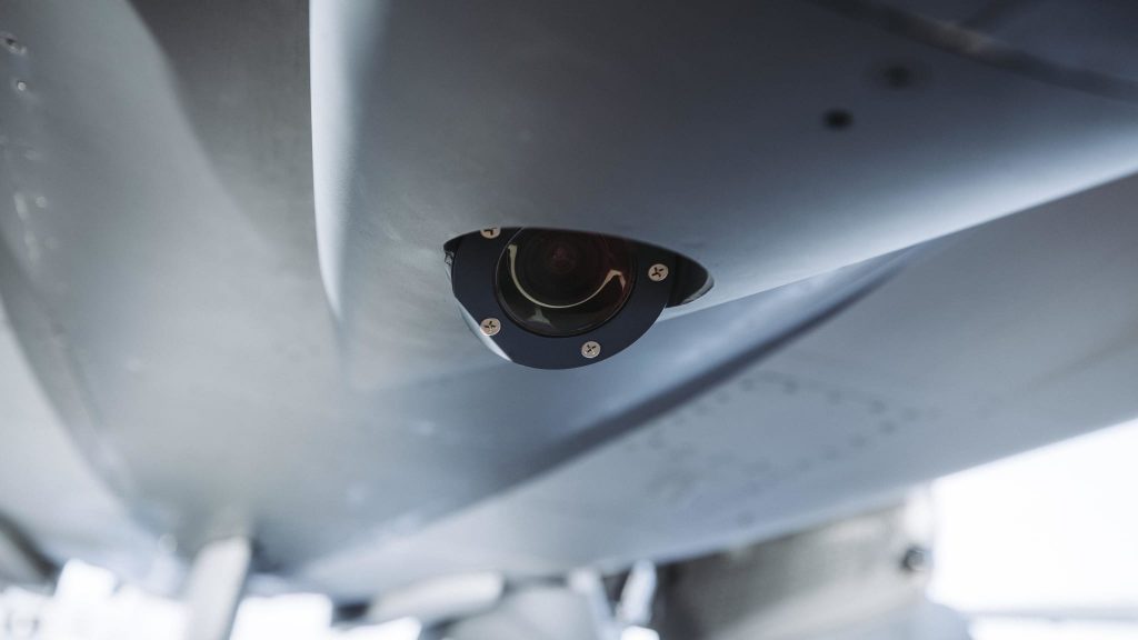
A camera on the jet captures a livestream of its flight path. Maxar’s P3DR compares that incoming livestream to the Maxar 3D Surface Model of the area that is stored on the jet. By matching scenes in the livestream to the 3D data in real time, P3DR can determine the jet’s precise location, enabling the pilot to navigate and carry out the mission without GPS.
The data is produced with a unique automated technology, delivered rapidly and with high precision. It is based on Maxar’s high-resolution, unclassified commercial satellite imagery, without the need for ground control points. Maxar’s 3D Surface Model product is a key input to the company’s Globe in 3D, a worldwide foundation of 3D data with resolution of 50 cm or better and 3 m accuracy in all dimensions.
Maxar’s P3DR is a stand-alone software solution that automatically georegisters imagery from any source to Maxar 3D reference data. This real-time capability enables navigation in a GPS-denied environment, safeguarding against signal jammers in an anti-access area denial (A2AD) environment.

Odometry and Terrain Navigation
The use of image mapping technology of odometry has also been tested previously with good results. Here an on-board sensor observes landscape features ahead and the algorithms generate a more accurate velocity vector and assist the inertial navigation system.
Terrain navigation, in which Saab has a long history, for instance TERNAV, has also been tested previously in different demonstrations and this technology has evolved in-house with new algorithms and database-handling technologies.
Robust positioning with high accuracy
By combining these three technologies (3D-mapping, odometry and terrain navigation), the navigation system will provide the Gripen pilot with a disruptive and unique capability to operate in GNSS-/GPS-denied environments with highly accurate positioning maintained.
“In the world of modern war fighting and amongst others its requirements for zero collateral damage a high precision and robust positioning is key. The tactical navigation technology in GNSS denied environments that Saab now start to conclude will lead to a true game-changer capability in the operational arena,” says Jonas Jakobsson, Gripen Experimental Test Pilot, Saab.
In addition to support the navigation, there are other potential derived benefits of this technology, such as building and executing targeting functions, and facilitating aircraft landings in challenging environmental conditions where normal landing aids are compromised.
This terrain-aided, silent navigation is immune to GPS signal interference like jamming and spoofing efforts, and it doesn’t add to the pilot’s workload while flying. The successful flight demonstration of this capability is a significant step toward ensuring pilot safety during a GPS outage.


