 Trimble R10 rover
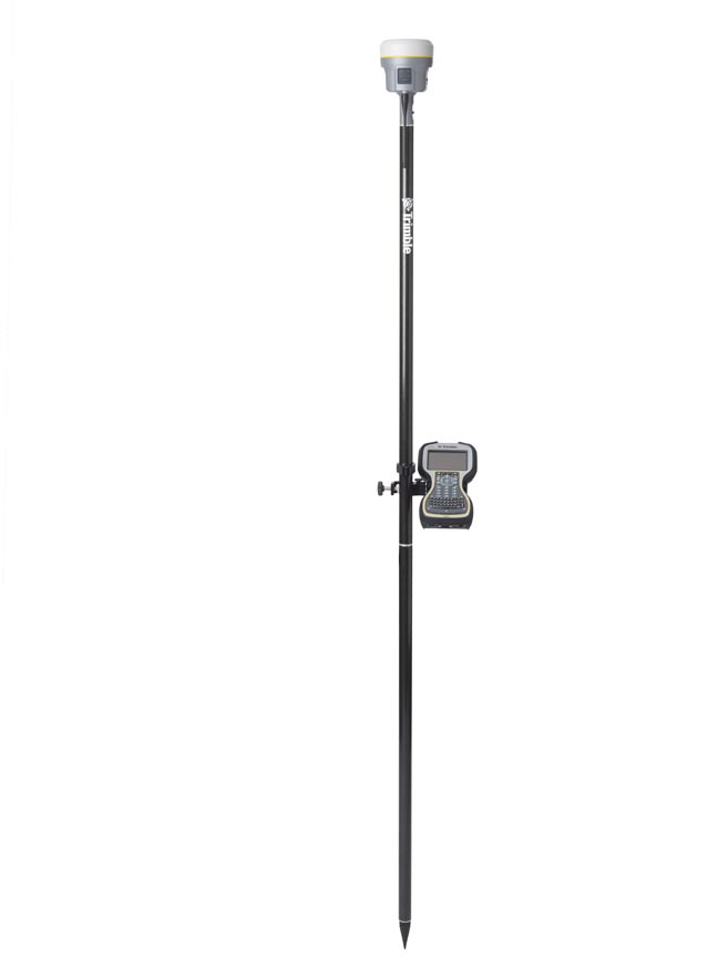
Trimble has introduced its next-generation GNSS surveying solution — the Trimble R10, a small, lightweight receiver that introduces new features and technologies, including Trimble HD-GNSS, Trimble SurePoint, Trimble 360, and Trimble xFill, to provide increased productivity.
Announced at the Intergeo 2012 conference in Hannover, Germany, this week, introduction of the Trimble R10 was accompanied by new versions of its field and office software — Trimble Access 2012.20 and Trimble Business Center 2.80 to extend Trimble’s Connected Site survey solution.
Trimble also announced a new version of its Inpho software products for aerial photogrammetry and laser scanning data production, the TX5 3D laser scanner, the DSS 500 with In-FlightOrtho map production and quality control for aerial mapping, a new version of Trimble RealWorks software, and Spectra Precision GL612 and GL622 grade lasers.
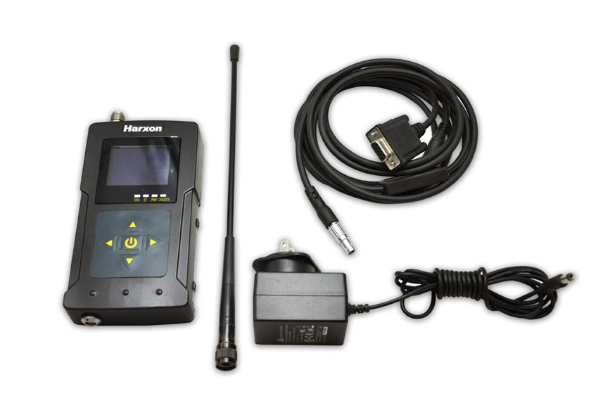
Trimble’s Pacific Crest brand has introduced the new XDL Rover, an advanced, high-speed, wireless data link built to withstand the rigors of GNSS/RTK surveying and precise positioning. The XDL Rover is a lightweight, ruggedized UHF receiver designed for digital radio communications between 403 and 473 MHz in either 12.5 or 25 kHz channels. The radio employs Pacific Crest’s latest generation XDL modem technology while remaining backward-compatible with existing Pacific Crest products.
According to the company, the HD-GNSS processing engine integrated in the Trimble R10 is a new generation of core positioning technology that goes beyond traditional fixed/float techniques to provide a more accurate assessment of error estimates than traditional GNSS processing engines.
Supporting 440 channels with two built-in Trimble Maxwell 6 chips, the Trimble R10’s integrated Trimble 360 technology allows consistent and reliable tracking of available GNSS satellite signals for existing and currently planned GNSS constellations and augmentations.
Powered by Trimble RTX technology, xFill leverages a worldwide network of Trimble GNSS reference stations to deliver position information via geostationary satellites. According to the company, xFill seamlessly “fills in” for real-time kinematic or Virtual Reference Station (VRS) corrections in the event of a temporary connection outage, such as a radio black spot, so that users experience less downtime in the field.
Trimble has extended its Trimble SurePoint technology, a cornerstone of the successful S-Series total stations, to the new R10 GNSS surveying system to simplify survey data collection workflow by providing faster measurements, increased accuracy, and greater quality control. SurePoint constantly monitors the pole tilt and protects surveyors from collecting erroneous data by only allowing data to be stored when the survey pole is plumb. Simultaneously, pole tilt angle values are stored for every point collected to ensure data traceability.
The Inpho 5.5 software includes unmanned aerial system (UAS) data processing and LPMaster, a new software product specifically designed for the production of Trimble Harrier aerial LiDAR and imaging data.
Also at Intergeo 2012, Trimble’s Spectra Precision Surveying Business introduced the ProMark 120 and ProMark 220 GNSS receivers, the T41 data collector, Layout Pro field and office software as well as other updated products.

