Topcon Positioning Systems has announced strategic partnerships with Bentley Systems and Worldsensing to embed its advanced GNSS technology into their software and connectivity solutions, enhancing geospatial data accuracy and operational efficiency across industries.
“These strategic collaborations signify our commitment to driving technological adoption through innovation and partnership,” said Ian Stilgoe, Vice President of Emerging Business at Topcon. “By integrating our GNSS technology with Bentley Systems’ infrastructure engineering software and Worldsensing’s IoT connectivity solutions, we’re not only streamlining workflows but also pioneering new applications and market expansions.”
With Bentley Systems, Topcon’s web-based GNSS processing engine will be incorporated into Bentley’s iTwin IoT monitoring solutions, offering users enhanced real-time geospatial intelligence for better decision-making and operational effectiveness. “This integration empowers users to merge cost-effective geospatial monitoring with extensive sensor data, advancing the capabilities of infrastructure digital twins,” commented Steve Bentley, Senior Director of Infrastructure IoT at Bentley Systems.
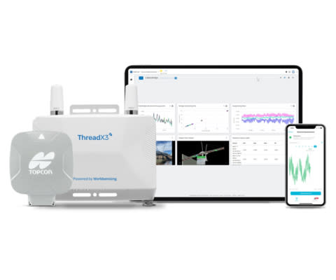
Meanwhile, Worldsensing is integrating Topcon’s AGM-1 GNSS receiver with its Thread X3 broadband product to create a new Accurate Positioning System, aimed at monitoring geohazards like rockfalls and landslides in environments such as pit mines and rail embankments. “This solution allows for proactive risk management and enhances the safety and productivity of mining and rail operations at a reduced cost,” Stilgoe added.
David Deprez, Managing Director of Worldsensing, emphasized the importance of these integrations in addressing the challenges of IoT deployments: “Our goal is to make IoT implementations more accessible and efficient for GNSS monitoring, and our collaboration with Topcon is pivotal in achieving this.”
The new solutions, available in the United States, Canada, Australia, and EMEA, with plans for expansion to Latin America, aid monitoring and management of critical infrastructure and natural hazards through enhanced GNSS technology.


