By Miguel Amor, Chief Marketing Officer
Hexagon’s Autonomy & Positioning division
I had my first interaction with a geodetic GPS receiver in the early ’90s. In my freshman year of college, a professor demonstrated how to use two single-frequency receivers to achieve centimeter accuracy for post-processing observations. I didn’t know at the time that I would spend the next 30 years deeply involved in and contributing to this innovative positioning technology.

Chief Marketing Officer
Hexagon’s Autonomy & Positioning division
At the time, it seemed revolutionary to me that we could obtain centimeter-level coordinates in a global reference framework without the labor-intensive traditional methods of geodetic and topographic observations. I remember how groundbreaking it was when I heard that it was mathematically and technically possible to make these observations in real-time in kinematic mode—and that this theory would be a reality very soon.
At that moment, the possibility of what would become the RTK technique was thrilling, and I began to imagine what future work would be like for my fellow students and me. Consciously, I was witnessing the beginning of corrections technology that would revolutionize the science of geodesy and land surveying. I couldn’t have imagined the impact of corrections 30 years later for all kinds of sciences and activities requiring such precise positioning.
A few years later, the first RTK equipment was established for users to achieve centimeter positioning in real-time. My earliest experience working with an RTK system was only comparable to the first call I received on my first mobile phone—curiously, also in the mid-late ’90s.
More or less simultaneously, I experienced the benefits of the newly developed PPP technology using geostationary satellites. PPP was an exciting technology too, although the precision was far from that necessary for surveying and geodetic work, and the convergence time was still too long to be productive in many applications.
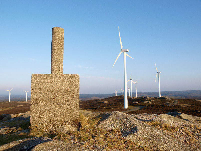
Despite the advantages of these emerging RTK and PPP technologies, geodetic and topographic work often still required direct observations of geodetic monuments. This work was both laborious and logistically complex. My legs still ache when I recall the long days carrying heavy GPS equipment, hiking for miles along the crest of a mountain range, conducting GPS observations of geodetic monuments and moving UHF radios to different areas to stake out locations of future wind turbines.
For corrections technology to best serve geodesy, we needed to answer the following question: How do we achieve centimeter-level coordinates instantly anywhere in the world within a global geodetic reference framework without local communication infrastructure?
It seemed the answer could be found in combining the benefits of RTK and PPP technologies. This was my dream and the dream of many geodesists and surveyors; easy to dream, but not so easy to achieve!
Fast-forward 30 years. In January, Hexagon’s Autonomy & Positioning division announced improvements to the TerraStar-C PRO correction service that makes it possible to obtain 2.5 centimeters in less than three minutes anywhere in the world.
Between that early dream and today, GNSS technology has evolved, including developments across GPS L2C and L5, network RTK, Galileo, GLONASS, BeiDou and others. PPP technology is reaping the benefits of these innovations. By leveraging all new GNSS constellations and all frequencies available while overcoming significant and challenging new developments in the PPP algorithms in both the server and client, the dream has come true. We call it RTK From the Sky technology.
What would the person writing these lines have given during one of those mountain hikes to be able to obtain a point with 2.5 centimeter precision with a global reference framework in less than three minutes without external communications?
A lot!
I never would have imagined how the same GNSS technology now enabling instant centimeter positioning would also be a critical innovation for the development and future of our society. The reliability, productivity and safety of agricultural tractors, construction machinery, hydrographic vessels and many other autonomous vehicles across innumerable applications are now possible, thanks to that dream of geodesists and surveyors.
Billion-dollar investments in autonomous technologies, arguably one of the biggest revolutions in human history and the key to a sustainable future, will rely on this technology that originated from the dream of instant centimeter positioning anywhere in the world.
My congratulations and heartfelt thanks to my colleagues for making it possible for this dream to come true: RTK From the Sky!
(Top image: Wind turbine locations staked out by Miguel Amor in the mountains of Spain.)


