
The Trimble GuidEx Machine Guidance System uses an integrated GNSS and inertial navigation system (INS) to compute a virtual reference point and precise heading, pitch and roll. This provides quick and efficient navigation along route corridors or to specific target areas, while providing local awareness using customer-provided mapping or engineering data to create exclusion and inclusion zones. The system can be installed on almost any platform from utility terrain vehicles (UTVs) to heavy equipment, on- or off-road.
GuidEx provides streamlined design-stakeout navigation to eliminate the need for advance survey stakeout operations, enabling machine operators to navigate to an exact point without stakes or surveyors. An example application would be natural resource exploration such as core sampling operations.
Corridor navigation allows users to efficiently complete a range of tasks including clearing paths for access routes, snow plowing and more. With comprehensive local machine data logging, contractors can capture a range of data including position, time and speed.
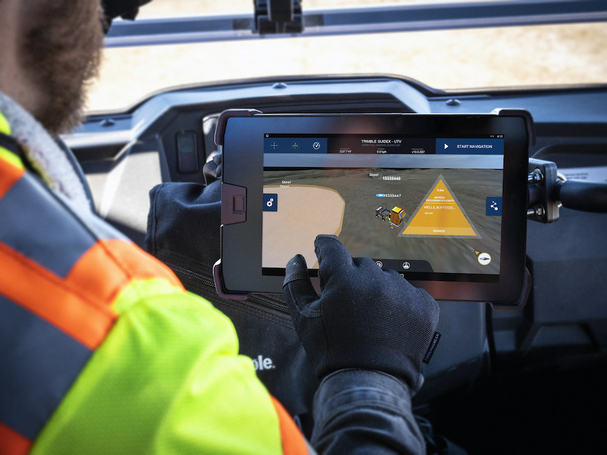
To ensure work is done exactly where it should be, proximity and zone breach alarms can be set based on custom exclusion and inclusion zones. Trimble GuidEx provides crossline navigation along predefined routes via an integrated software-based lightbar viewed on the display, including visual and audible alarms when operators breach user-defined distances from a centerline. The system also provides point and pad navigation information with intuitive navigational arrows, supported by a wide variety of data recording settings.
The Office Connection
Compatible with virtually any machine type, Trimble GuidEx connects equipment to the office to keep everyone aligned. Operators and supervisors can send mapping data to and from the machine and office to avoid rework. Reliable guidance data allows contractors to track machines by time or user-defined event triggers for a more accurate representation of the machine utilization cost of a project. Trimble GuidEx can leverage real-time kinematic (RTK) and CenterPoint RTX correction services for enhanced high-accuracy positioning.
Components
• Rugged 10-inch (25.4 cm) Trimble TD520 Display touchscreen Android tablet
• Trimble BX992 GNSS Receiver with advanced 336 channel GNSS
• Configurations for NMEA output, Pulse Per Second (PPS) and trigger event support
• Optional SNM modem for cell / Wi-Fi activities and SNR on-machine UHF radio for Real Time Kinematic (RTK) operations
Functions and File Types
• Aerial imagery in a wide variety of formats
• ESRI shape files—can be configured for use as either exclusion or inclusion zones
• Digital elevation models to provide a clear picture of surroundings
• CSV files for design point targets
• Warnings can be set for machine pitch and roll threshold breaches
• Proximity and zone breach alarms are displayed on screen and recorded to the log database for reference
• Option for single or dual antenna solution


