 Trimble Catalyst Works with Android Devices
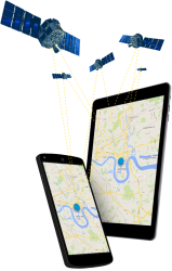
Trimble has released Catalyst, a software-defined GNSS receiver that works with Android handhelds, smartphones, and tablets. The receiver, announced at the Trimble Dimensions conference in Las Vegas, Nevada, provides on-demand GNSS, geolocation capabilities to transform consumer devices into high-accuracy mobile data collection systems, the company said.
Trimble has released Catalyst, a software-defined GNSS receiver that works with Android handhelds, smartphones, and tablets. The receiver, announced at the Trimble Dimensions conference in Las Vegas, Nevada, provides on-demand GNSS, geolocation capabilities to transform consumer devices into high-accuracy mobile data collection systems, the company said.
The rise of smartphones and tablets as mobile information field tools allows more workers and consumers to have positioning technologies for geospatial data use and collection, Trimble said. In addition, the new GNSS receiver is designed to be integrated into a wide range of applications providing a dual-frequency, multi-constellation receiver, the company said.
Catalyst receives dual-frequency signals from the Trimble DA1 digital antenna. The small size and light weight of the antenna makes it ideal to store in a car glove box or backpack, the company said.
Users can add a Trimble Catalyst subscription for the flexibility to choose the level of accuracy to suit their application needs from meter-level to centimeters, the company said. The Trimble Catalyst subscription service, which the company calls Positioning-as-a-Service, allows users to download applications, depending on their business needs, the company said.
For GNSS corrections, the unit selects the best available correction service, based on the user’s location and subscription level, the company said. These corrections are powered by Trimble RTX technology and the Trimble VRS Now networks, the company said.
The company said the first Catalyst service includes the Trimble TerraFlex cloud-based mapping and GIS field software. TerraFlex, a cloud-based product for geospatial data collection, allows standardized data flow, the company said.
Also at its Dimensions conference, Trimble announced that the GCS900 Grade Control System is now available with xFill technology to sustain real-time kinematic (RTK) positions during correction outages. The company said xFill uses Trimble RTX technology, to "fill in" for RTK corrections in the event of temporary radio or Internet connection outages.


