Among other things highlighting the need for resilient positioning, navigation and timing (PNT) is noted GNSS interference across Eastern Europe, particularly in geopolitically sensitive maritime regions.
Supported by the European Space Agency (ESA), the RIPTIDE Phase 2 project has field-tested an integrated ‘Monitor & Protect’ demonstrator tailored to operations in the Black Sea and Lower Danube Basin.
Led by GMV Innovating Solutions Romania, with the Romanian Space Agency Research Centre and the Romanian Maritime Hydrographic Directorate, the project addressed jamming and spoofing risks affecting ports, shipping lanes and coastal infrastructure. The goal was to design, implement and validate an alternative PNT capability that complements GNSS.
RIPTIDE Phase 2 implements a demonstrator that integrates GNSS monitoring, trusted or verified navigation messages distributed via AIS/VDES ASM, and VDES-R/R-Mode ranging. At the authority level, coastal interference monitoring is combined with VDES transmitters that provide alternative ranging signals and trusted navigation data. At the vessel level, multi-constellation GNSS is augmented by VDES-R positioning and onboard interference detection, enabling autonomous operation when GNSS is degraded.
Targets achieved
Project results were presented at a recent ESA-hosted event by Florin Mistrapau, Vladimir Kosjer and Calin Ciobanu of GMV Romania, together with Petrica Popov of the Romanian Maritime Hydrographic Directorate and Irina Stefanescu of the Romanian Space Agency Research Center.
Partners undertook requirements engineering, system architecture definition, laboratory integration and Black Sea trials. A core element is the Monitor & Protect workflow, which cross-checks GNSS interference indicators, navigation message integrity and PVT consistency. When anomalies are detected, the system switches to VDES-R positioning, maintaining continuity of service.
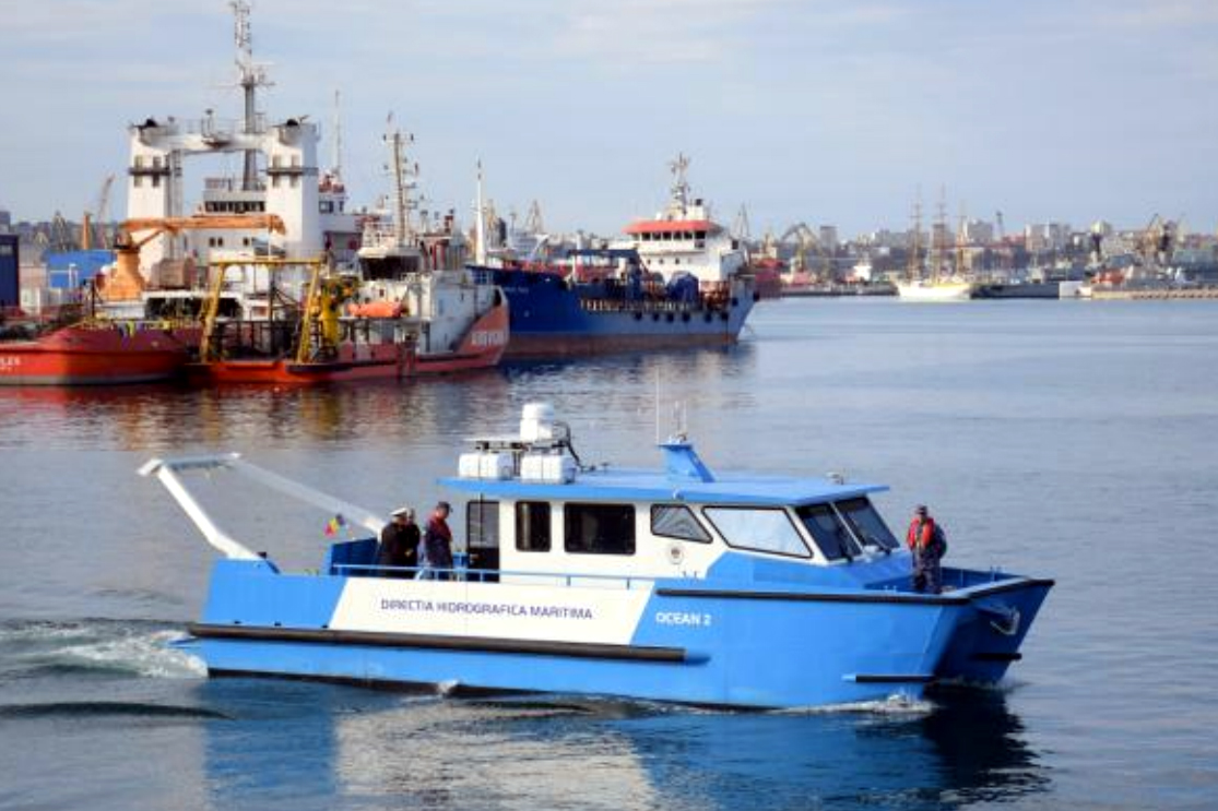
Live trials aboard MHD’s Ocean 2 research vessel confirmed resilience under real GNSS jamming and spoofing conditions. VDES-R/R-Mode delivered position errors below 10 metres during strong interference, while Monitor & Protect cross-checks detected spoofed and degraded GNSS scenarios. Performance was further validated through emulated localized degradation and coordinated attack campaigns using Skydel-based spoofing, achieving technology readiness level (TRL) 6.
Analysis also revealed correlation between carrier-to-noise density, pseudorange quality and VDES-R positioning accuracy. Beyond maritime navigation, the consortium identified a list of potential applications including search and rescue, emergency management, aviation and drones, and road and rail transport.
Funded under ESA’s NAVISP program, RIPTIDE Phase 2 shows how combining alternative ranging, trusted data distribution and intelligent monitoring enhances maritime resilience, offering a blueprint for hybrid PNT systems capable of maintaining safe navigation during GNSS interference.


