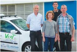
 From left, François Peyret, Valerie Renaudin, Miguel Ortiz, David Bétaille
PART I: Using a Reference Vehicle for Solving GNSS Localization Challenges
PART I: Using a Reference Vehicle for Solving GNSS Localization Challenges
Global navigation satellite systems have significant potential in the development of intelligent transport systems and associated services. Nevertheless, a major technical issue with respect to safety-critical and liability-critical applications (civil aviation and urban tolling, for instance) is the quality of positioning service — not only in terms of accuracy, continuity, and availability, but also integrity, which expresses the level of trust in the positioning solution.
In strongly constrained environments, such as city centers, the propagation phenomena in the area surrounding a GNSS antenna — specifically, diffraction and multipath — are responsible for severe errors on the raw observables (pseudoranges and Doppler measurements) measured by receivers. In this context, the standard method of computing a position and the associated protection level coming from the civil aviation community is no longer applicable.
Extremely active research is focusing on hybrid positioning systems based on GNSS integrated with other sensors to cope with the weaknesses of pure satellite systems in signal-challenged environments. In this context, many research laboratories and industrial companies are proposing various solutions.
When the time comes to assess these positioning systems in the predominately urban environments for which they have been designed, they face the difficult problem of establishing the true trajectory against which the technical performance can be measured. Generally, test designs envisage a kinematic dual-frequency GNSS system — real-time kinematic (RTK) or post-processed kinematic (PPK) —because of its well-known accuracy.
Sadly, however, a kinematic trajectory based on phase-differential GPS is even less available than the code-only solutions in the signal-challenged environments of interest. The optimal reference system for this kind of research, therefore, is a system providing both accuracy and availability, best achieved through hybridization of RTK or PPK GNSS positioning and inertial navigation technology.
This article presents the design and research applications of a test vehicle carrying the reference system owned by the GEOLOC laboratory of the Components and Systems Department of the French Institute of Science and Technology for Transport, Development and Networks (known by its French acronym, IFSTTAR).
After a general introduction of the vehicle and its main objectives, we describe the Vehicle for Experimental Research on Trajectories (VERT), especially the Reference Trajectory Measurement System that constitutes one of the main components of the vehicle. We then describe several applications of the VERT as a system for providing reference data, introducing at the same time key elements of the processing software involved.
Our discussion next moves to two recent, standard-use cases of the VERT at IFSTTAR. The first research application of the reference trajectory assesses the accuracy and integrity performance of various GNSS systems in road environments. The second deals with estimation of true pseudorange observables to model the distribution of pseudorange errors and to study the issues associated with non-line-of-sight (NLOS) signals in urban environments.
Finally, we extend the interest in this kind of reference vehicle to other ongoing and more prospective areas, such as for support of standardization and certification in critical domains, including electronic fee collection.
Behold the VERT
The GEOLOC laboratory designed and deployed specific positioning and navigation instrumentation in a reference vehicle, that is, the VERT, for assisting ongoing research on precise car geolocalization. It also widened the scope of future research, especially for improving the performance level of GNSS positioning in dense urban environments.
The functional specifications document defines the VERT as an instrumented vehicle. Indeed, it is equipped with a reference trajectory system, including a GNSS receiver, a navigation-grade inertial navigation system, and an encoder, for estimating accurate positions and attitude angles of the car both in post-processing mode and in real time.
The vehicle can be further equipped with external sensors, other tracking systems, or navigation systems for assessing performance. Advanced driver assistance systems (ADAS) and vehicle-to-vehicle (V2V) or vehicle-to-infrastructure (V2I) systems can also be embedded in the VERT. The two main goals of this reference vehicle are acquiring synchronized data from multiple sensors in order to conduct research on novel road geolocalization methods and algorithms and then to demonstrate their implementation in real time.
The article starts with a description of the first objective including experiment preparation, data collection, and post-processing strategy before addressing novel research algorithms and methods developed with the assistance of the VERT.
Among a large variety of cars, the Renault Clio3 (see the accompanying photo) was chosen as a suitable candidate for the VERT for several reasons. This small city car is designed to run on the narrow streets common in European cities, which represent a real challenge for accurate GNSS navigation systems mainly due to multipath and attenuation effects. The Clio3’s expansive trunk offers a large space for mounting multiple sensors, including the ones to be tested. Mechanics found a conventional gasoline engine technology (TCE 100ch) to be more convenient than the diesel version.
Additional benefits come from sensors already embedded in the car. Gyroscope data is made available thanks to an embedded dynamic trajectory control system, also known as the ESP (Electronic Stability Program). Additional dynamic data, namely speed and odometer readings for each wheel, is also obtained from the antilock braking system (ABS).
The Reference Vehicle: A Technical Description
The VERT was designed as a mobile laboratory dedicated to very precise estimation of car trajectory. This design eases installation of new sensors to be tested while providing an accurate reference trajectory for comparison purposes. Figure 1 shows the system components classified into four categories while Table 1 provides additional descriptions of these items.
Reference Trajectory Measurement System (RTMeS). The core element of the RTMeS is the inertial navigation system (INS), which performs real-time coupling of data from a tri-axis accelerometer, a tri-axis fiber optic gyroscope, an odometer, and a dual-frequency GNSS receiver. (See Figure 2.)
Distance-traveled data can be provided either by one of the odometers embedded in the vehicle rear wheels or by a higher performance optical odometer specifically mounted for the experiment. A dedicated converter device fuses distance measurements with pulse per second (PPS) cycle and the direction of travel of the car.
All data are loosely or tightly coupled in a differential mode with post-processing software used to estimate a final trajectory. Real-time trajectory estimation is also possible thanks to a real-time kinematic solution.
Inertial Navigation System. The INS incorporates a high grade tri-axis pendulum accelerometer and a tri-axis fiber optic gyroscope. The RTMeS couples inertial data from these sensors with carrier phase differential GNSS positions to achieve 0.01 degree RMS estimates of the roll, pitch, and yaw angle, 3.5-centimeter accuracy in the horizontal plane, and 5-centimeter accuracy along the vertical axis — when the satellite configuration and the physical environment of the vehicle’s operation are favorable.
Unsolved phase ambiguities, however, can decrease the RTMeS positioning accuracy. In the worst-case scenario, no GNSS position can be computed. In this case, the navigation-grade INS keeps working but in a dead-reckoning mode only.
The resulting position estimate relies solely on inertial sensors, which introduces a drift error. The RMS of the drift error after 120 seconds equals 0.01 degree for the attitude angles. Table 2 shows the estimated positioning accuracies in post-processed and real-time modes based on data collected with the INS manufacturer in 2007. The sidebar “INS Assessment” (located at the end of this article), describes the steps in this exercise.
The INS unit is rigidly attached to the car body. As depicted in Figure 3, a solid aluminium plate fixed in the trunk of the VERT has been used for this purpose.
GNSS Dual-Frequency Receiver. A GNSS dual-frequency receiver tracks GPS L1/L2 and GLONASS L1/L2 signals and is able to provide an RTK solution at 20 hertz. The receiver is a high-end geodetic GNSS receiver. More details about its phase differential solution performance can be found in the technical sheet and documentation. (See Manufacturers section at the end of this article.)
Thanks to its internal memory card, the receiver can work in an autonomous mode. Indeed, rover data are stored on the internal compact flash memory card while the receiver satellite tracking status is monitored in real time with dedicated software.
GNSS signals, recorded with the VERT, are post-processed in a differential mode. Base station GNSS data are extracted from the French permanent reference network (RGP), which is maintained by the French National Institute of Geographic and Forest Information (IGN). An additional, local base station may be deployed for covering raw data outages in the permanent network.
Optical Encoder. This sensor measures speed and distances traveled using optical correlation. It works on dry and wet roads. Its expected performance is 0.1 percent of the total traveled distance with 1.5-millimeter resolution, according to the manufacturer’s specifications. The best performance is obtained when the sensor is mounted on the front of the car in order to avoid water splashes. A 35-centimeter separation between the sensor and the road level is recommended.
Other Sensors. A list of additional sensors that have been tested with the VERT vehicle is presented in a table in the Manufacturer section. These include inertial sensors, a variety of GPS and GNSS receivers, cameras, and digital converters.
Data Acquisition Equipment. Data acquisition plays a central role in the VERT, which collects multiple sensor observations in addition to the RTMeS data. Two computers comprise this equipment: one computer system dedicated to the RTMeS and one more powerful to the device under test (DUT).
The most challenging function that the data acquisition equipment must accomplish is the time synchronization of raw samples from multiple sensors. Indeed, except for GNSS receivers, time sampling of sensor data is usually performed with an internal clock system, which is not related to any absolute time reference. Consequently, the main acquisition computer is in charge of simultaneously time stamping all incoming data.
However, how is it possible to timestamp all observations with an absolute time reference? A dedicated middleware has been chosen for this task. It processes all asynchronous data for synchronizing them with coordinated universal time (UTC). Finally, the data acquisition equipment also includes a high isolation GPS L1 & L2 splitter for sharing the signal tracked on one antenna with multiple receivers.
Acquisition of Multi-Sensor Data with the VERT.
As previously stated, the VERT has two main objectives: acquisition of multi-sensor data for research purposes and real-time demonstration of research results. This section describes how IFSTTAR uses the VERT to attain the first objective, for which the sensor data (both from the reference system and from the test system under test) are post-processed for the purpose of the study.
Road Path Identification. Preparation for data collection usually starts with the identification of a specific road path. The choice strategy may depend on the presence of urban multipath, dense foliage areas, or even open sky zones.
Once global criteria have been set, the trajectory of the car is precisely defined. This definition is particularly important because the data collection may be performed by a different person than the one who planned the experiment. As shown in Figure 4, a GPS navigation device coupled with the road path already outlined in Google Maps is used in IFSTTAR for assisting the driver.
With the use of the online mapping feature, the car trajectory can be constrained with waypoints. Once the waypoints are defined, a file generated by a dedicated PHP script can be copied/pasted into the compatible GPS navigation device.
During the data collection, the driver only needs to follow the navigation instructions improving onboard safety. Despite this preparation process, we recommend a dry run in order to identify any map discrepancy or software incompatibility between Google Maps and the GPS navigation device.
GNSS Data Collection Planning. Once the trajectory has been defined, an appropriate data collection period must be chosen. The satellite availability may also strongly depend on the experiment’s surroundings. Mission planner software can be used for computing the multiple constellations’ satellite availability and dilution of precision (DOP) indicators.
This operation can either assess the quality of the reference trajectory or set poor satellite tracking conditions for testing GNSS receivers. Particular ephemerides may also be required if specific satellite signals are under study, for example, Galileo or GPS L5. Identifying the satellite sunrise, sunset, and zenith times complete the preparation.
Measurement Point of Interest. The preparation phase should include identification of the physical measurement point used to calculate the reference trajectory. Among others, the GNSS antenna phase center, the IMU measurement point, and the optical center of the camera are all possible choices.
The lever arm between the outer point and the measurement point of the INS must be accurately surveyed. The car body and surrounding equipment may obstruct this process. In IFSTTAR, we survey this point with a total station. The use of external known target points eases the surveying of the (X,Y,Z) coordinates in the INS reference frame (P, X1, X2, X3). Figures 5 and 6 illustrate this step.
PART II: Road Testing the VERT: A Data Collection Campaign
All VERT data collection is performed with the RTMeS, which demonstrates its key role but also underscores the fact that all operations must be carefully conducted in order to successfully collect data. In the worst-case scenario, if no data is available, the experiment must be repeated.
We will now describe a four-hour data collection campaign conducted in Toulouse, France, in July 2012, including the strategy adopted for filtering as well as the various post-processing steps required to achieve the best possible reference trajectory. We chose a road path that included the downtown area and small narrow streets where GNSS data was sampled with a frequency of five hertz.
First, however, we will briefly summarize the INS alignment needed before data collection could begin. This alignment includes two main steps: coarse and fine alignments.
The coarse alignment comprises a static phase (e.g., 300 seconds) in an open-sky environment. A slow and constant car motion without turns may also suit the process. Known attitude angles are the outcomes of coarse alignment.
The fine alignment, which is based on an internal Kalman filter, is then performed with fast motion and turns for rapidly converging to accurate IMU bias error estimation. The alignment is completed when the standard deviation of the heading angle is below a predetermined threshold (e.g., 0.1 degree). The operational phase, that is, the navigation mode of the INS, now begins and the data collection can start. Note that the upper bounds of the INS for estimated speed and height are 180 kilometers per hour and 4,000 meters, respectively.
Post-Processing of the Reference Trajectory. The receiver was configured for tracking multiple satellite constellations. Figure 7 shows the satellites visible to the rover receiver and clearly demonstrates the benefit of adding GLONASS satellites to GPS for increasing the number of satellites tracked.
Several processing strategies are possible for estimating the reference trajectory. The algorithms are either solely based on GNSS data or hybridized GNSS and inertial data. Table 3 details the four main options along with their advantages and drawbacks, which we will next compare in terms of “accuracy availability.”
Note that the term “accuracy availability” incorporates periods when no solution is available directly in the cumulative distribution function of the positioning accuracy. Indeed, during these periods, the positioning error is set equal to infinity. We define the estimated error cumulative distribution function, including infinite error during positioning outages, as the “accuracy availability.”
GNSS Precise Point Positioning (PPP). Figure 8 shows the software-based phases of PPP estimation in blue with the dataset inputs and outputs in white.
Estimating the PPP trajectory requires precise satellite clock and ephemeris data. This data can be obtained from automatic downloads of the files from several ground control networks via the Internet, the European Space Agency (ESA) website providing one of these websites.
Figure 9 shows the availability and quality factor of the post-processed solutions, which reveal that this strategy is not sufficient for obtaining ambiguity-fixed solutions and, moreover, that signal availability is really poor downtown. The mean availability over the entire path equals 82 percent. For the PPP positioning, the sampling frequency is limited by the one of the receiver, i.e., five hertz for this dataset.
Figure 10 shows the previously defined PPP 3D positioning accuracy availability for the entire dataset and for the interval zero to one meter, respectively. Ten centimeters is considered as being the desired level of accuracy of a reference trajectory when studying the performances of a positioning system capable only of a meter accuracy in the best conditions. Consequently, all figures that show the accuracy availability are also zooming in on the zero to one-meter interval. The asymptote observed at 82 percent in the left panel indicates that 18 percent of the dataset does not provide a solution.
GNSS Post Processed Kinematic (PPK). In contrast to PPP estimation, the PPK solution combines the GNSS rover data with those of a local base station (Figure 11). For our experiment, we used one-hertz GPS and GLONASS data from the RGP TLMF station (at the National Center for Meteorological Research in Toulouse). Precise clock and ephemeris data from ESA are again used for improving the overall accuracy.
The processing frequency is limited by the smallest sampling rate of the rover and the base station. Because the data from the Toulouse base station were recorded at one hertz, the final solution is obtained at the same frequency.
Figure 12 shows the solution availability and quality of the PPK solution. Globally, the quality of the positioning accuracy is improved from the PPP solution, but the availability of position solutions over the course traveled by the VERT remains about the same (84 percent).
Figure 13 shows the previously defined PPK 3D positioning accuracy availability for the entire dataset and for the interval zero to one meter, respectively. The curve reaches its asymptote at 84 percent.
When compared to the PPP, PPK shows a larger percentage of small standard deviations of the positioning accuracy. For example, about 50 percent of the estimated standard deviations are below 10 centimeters, whereas only 15 percent of the PPP solutions met that criterion.
Loosely Coupled PPK/INS/ODO. Loose coupling of PPK GNSS, inertial, and odometry (ODO) data is only recommended when the quality of the PPK solution is high enough. The hybridization is sensitive to outliers and requires assessment of the quality of the estimated position prior to integrating them in the post-processed solution. Figure 14 shows the steps in integrating this data.
We decided to follow the INS manufacturer recommendations and used only PPK GNSS solutions with a standard deviation below one meter (Figure 15). Next, post-processing steps are performed employing an extended Kalman filter. Forward and backward smoothing is also applied to the inertial signals and the previously estimated PPK trajectory.
Two lever arm dimensions are required to hybridize the data: first, between the antenna and INS measurement points, and second, between the odometer and INS measurement points. Inaccurate lever arm dimensions will drastically decrease the positioning accuracy.
Figure 16 shows the loosely coupled solution with a color coding corresponding to the error in the East component. One can see that a solution is now always available and that the accuracy remains below one meter. Indeed, only a very few areas appear with accuracy of 50 centimeters or more, and they are all located in the heart of the city center, or hyper-center, with its narrow streets and tall buildings that block more of the satellite signals. Finally, the loosely coupled trajectory is estimated at the highest possible frequency, i.e., 100 hertz, which corresponds to the INS sampling frequency.
Figure 17 shows the loosely coupled 3D positioning accuracy availability for the entire dataset and for the interval zero to one meter, respectively. In comparison with the PPK accuracy availability, one can see that 10-centimeter accuracy is also obtained for 50 percent of the solutions (shown in right-hand panel) but that the accuracy availability improves to 100 percent availability at an accuracy level of six meters.
Tightly Coupled GNSS/INS. A tight coupling strategy may be chosen for fusing inertial and GNSS data in challenging environments, especially when the satellite visibility is low. Instead of fusing GNSS positions, which requires the tracking of a minimum of four satellites, the tightly coupled solution directly combines raw GNSS data (pseudoranges and Doppler) with IMU samples. Consequently, even when only one satellite is tracked, a hybrid position can be computed, increasing the overall accuracy and reducing the period in inertial-only navigation. Figure 18 illustrates the processing applied to the data collected in Toulouse.
As shown in Figure 19, the quality and availability of the tightly coupled solution is improved compared with the loosely coupled trajectory. This is particularly visible in the challenging conditions of the city hyper-center.
Figure 20 shows the tightly coupled 3D positioning accuracy availability for the entire dataset and for the interval zero to one meter, respectively. Similar to the loosely coupled solution, 10-centimeter accuracy is obtained for 50 percent of the data (seen in right panel), but the overall accuracy is greatly improved — with 100 percent of the position solutions achieving two-meter accuracy instead of six meters as with the loose coupling method.
The noticeable improvement that occurs in the zero to one-meter interval is related to a smaller period of post-processed inertial-only data compared with the loosely coupled solution. Figures 21 and 22 illustrate this phenomenon. Here the error on the positioning accuracy is computed at the one sigma confidence level with the loosely and tightly coupled strategies, respectively. They confirm that the standard deviations of the tightly coupled solution do not exceed 50 centimeters almost all the time.
We should mention that the setting of the post-processing software may affect these outcomes. Indeed, the Kalman filter may be optimistic in the computing of the covariance matrices and, therefore, the accuracy of the navigation solution may be worse than estimated. Furthermore, following the manufacturer’s recommendation, odometer data have not been considered for the tight hybridization results presented in the preceding discussion.
Nevertheless, we performed a tight processing of INS, GNSS, and odometer data to ensure the completeness of the work. Its effect on the accuracy of the final trajectory was marginal, and sometimes the global error even increased slightly. This abnormal result is mainly due to the fact that the post-processing filter is assigning a low weighting factor to the odometer, which is considered of lower quality.
Future work on improving the integration of odometer data in the tightly coupled processing should be performed for improving the estimated trajectory.
Comparison of the Four RTMeS Processing Methods
Figure 23 shows the accuracy availability estimated for all four RTMeS processing methods previously described, i.e., PPP, PPK, loosely coupled PPK/INS/ODO, and tightly coupled GNSS/INS. The results further validate the interest of tightly fusing INS data with GNSS signals for improving both the accuracy and solution availability because a 100 percent availability of two-meter standard deviation positioning accuracy is achieved with the latter method.
PART III: Applications of the VERT: EGNOS, Urban Integrity, and Beyond
IFSTTAR’s reference vehicle has already been employed for real-world projects. This section describes the results of a few of these and provides a look at prospective future uses of VERT.
In 2009, the French Ministry of Transport financed the project “EGNOS On The Road” (EOTR) that was conducted by IFSTTAR and M3System in partnership. The goal of the project was to evaluate the benefit of the satellite-based augmentation system (SBAS) EGNOS — European Geostationary Navigation Overlay Service — in road applications using satellite localization.
The benefit of EGNOS in air transport has been demonstrated. EGNOS transmits atmospheric corrections and alerts of GPS satellite “health” status within six seconds of a problem arising, but also performs an integrity monitoring of the user’s estimated position. Indeed, the Minimum Operational Performance Standard (MOPS) for GPS/WAAS Airborne Equipment published by RTCA Inc. defines the computation of a horizontal protection level (HPL), which guarantees the integrity of the satellite-based positioning for civil aviation. The suitability of MOPS for road transport had yet to be tested.
During the EOTR project, the benefit of EGNOS in terms of accuracy and integrity (i.e., adequacy of the HPL indicator estimated as defined by the MOPS) was compared with GPS standalone solutions in diverse road environments. (See the article by F. Peyret et alia in Additional Resources.)
EOTR Project Progress. Several test scenarios have been defined for testing the use of MOPS and EGNOS in road transport:
- environmental conditions: suburb, urban, forest, open sky.
- kinematic positioning modes: fast kinematic (manual drive), slow kinematic (GNSS odometer simulation), static (parking)
- antenna types: geodetic antenna, external patch antenna, patch antenna inside the vehicle
- various grades of GNSS receivers: high grade, differential GPS, low-cost
- EGNOS “Signal In Space” (SIS) and EGNOS augmented signal messages downloaded from EGNOS Message Server (EMS).
Benefit of the VERT in EOTR. The VERT has been used for embedding all required GNSS receivers and antennas to be assessed in the test scenarios. IFSTTAR used RTMeS to post-process reference trajectories for each element under study: a DGPS antenna, the two low-cost indoor and outdoor antennas, and the high-end receiver antenna. Road tests over seven days between April and June 2009 collected 10 hours of data. Among them are:
- three low-cost receiver datasets at four hertz: outdoor patch antenna, patch antenna behind the wind-screen, and a geodetic antenna
- DGPS data at one hertz
- high-end receiver data at one hertz
- reference trajectories at 100 hertz.
EOTR Results. The VERT was used to estimate the following performance criteria:
- GPS and EGNOS position solution availability
- horizontal positioning error (HPE): mean, 50%, 95%
- horizontal protection level (HPL): mean, 50%, 95%
- very safe: percentage of time without integrity loss (HPE < 0.75*HPL)
- Near-Misleading Information (Near-MI): percentage of time during which integrity loss could occur (0.75*HPL <HPE <HPL)
- Misleading information (MI): percentage of time during which integrity loss occurs (HPE>HPL).
The estimated parameters are shown in Figures 24, 25 and 26.
The HPE, displayed in blue in Figure 24, enabled the identification of local outliers in order to determine particular environmental factors that are decreasing the accuracy of the estimated solution. The protection level, i.e., HPL, which is shown in red in the same figure, has been calculated following the MOPS. Therefore, we expect it to be possible to bound the true error (HPE) estimated with the RTMeS embedded in the VERT.
In order to assess this hypothesis, Figure 25 shows the HPL as a function of the HPE. All data in red highlight instants during which this hypothesis failed. These data points are called misleading information.
Figure 26 shows a classification of all data according to the expected protection level and the true error observed. Four categories are considered for the classification: very safe, near-MI, MI, and unavailable. The presence of several MI (in red in Figure 26) tends to demonstrate the inadequacy of the MOPS for road transport (as discussed in the paper by G. Duchateau et alia cited in Additional Resources).
The outcome of the EOTR project led to novel research for defining specific integrity monitoring algorithms for road transport.
Integrity in Urban Environments
The objective of the project INTURB— positioning INTegrity in URBan environments — is twofold. The first objective is to develop a novel method for classifying line-of-sight/non–line-of-sight (LOS/NLOS) satellite signals, especially in urban environments. The second goal is to use a new algorithm to correct GNSS signals biased by multipath. As a result, this project involved raw GPS error modeling and implementation of a novel advanced navigation filter.
INTURB Progress. The project started with specific data collections. Diverse environmental conditions were chosen in the town of Paris. Among them were large boulevards, an urban district, and the business quarter of La Defense. Pseudoranges and Doppler were collected with two GNSS receivers: a dual-frequency receiver and a single-frequency receiver.
The first research phases consisted of assessing the errors induced by multipath on pseudoranges and Doppler data. This work led to a smart classification method of biased and unbiased satellite signals based on true range estimation between the satellite and the rover using the satellite at zenith as a reference. Incorporating knowledge about the surrounding building environment extracted from the database of a geographical information system, an algorithm for mitigating the biases in the pseudoranges was developed.
We assessed the improvement, mainly in terms of positioning accuracy, by comparing the least-squares navigation solutions estimated with and without raw data error compensation. Finally, a second data collection was performed in Toulouse in order to confirm the methodology and the achieved results.
Benefit of the VERT. The project was successfully conducted thanks to the VERT. Indeed, it served as a test vehicle during the entire project and enabled the raw data collection of GNSS data and all other data required for the RTMeS.
The estimated reference trajectory played a critical role on two occasions. First, VERT was used to compute the geometric range between the satellites and the antenna (“true” range) and the “true” Doppler. This enabled us to model the GNSS raw data error caused by multipath effects. Second, we used the VERT-derived reference trajectory in the assessment phase for computing the HPE with and without applying the newly developed urban multipath–mitigation technique.
LOS pseudoranges and Doppler errors are shown in Figure 27. As expected, they follow a Gaussian distribution for LOS satellite signals.
Figure 28 shows NLOS pseudoranges and Doppler errors. Unlike the LOS signals, NLOS pseudoranges do not follow a zero mean distribution. As discussed in the article by B. Aminian et alia, Dopplers are less affected by multipath effect, than pseudoranges.
Results
The VERT was essential for successfully pursuing the project goals and achieving the following results:
- a novel classification method of LOS/NLOS signals based on modeling of the vehicle’s local urban environment
- an algorithm for mitigating pseudoranges errors due to multipath (see D. Betaille et alia in Additional Resources for further discussion and also Figure 29).
New and Promising Uses of the VERT
With the recent development of new ITS services, such as automatic road tolling (also called electronic fee collection or EFC) based on GNSS, the key issue of the actual GNSS performance that can be expected in challenging operational conditions is becoming more and more important. As a matter of fact, the main stakeholders of the road transport domain, at least in Europe, have recently realized the urgency of sharing a common standardization and certification framework with which to define and assess the performance of GNSS-based terminals.
Three main projects that deeply involve IFSTTAR’s GEOLOC laboratory illustrate this trend, due in particular to the lab’s recognized expertise in reference trajectory provision. These projects are the French Ecotax system, standardization initiatives, and the European research network SaPPART.
French Ecotax System. This system will be launched in October 2013 for all trucks with a weight greater than 3.5 tons, on all national roads in France (~10,000 kilometers), and on some additional roads that are likely to be driven by trucks (~5,000 kilometers). The French Ecotax system follows the European Directive 2004/52/EC on interoperability of electronic road toll systems recommending GNSS, Dedicated Short Range Communications (DSRC), and GSM/GPRS as positioning and communication technologies.
The French system uses DSRC only for enforcement and for positioning in some very rare spots such as tunnels. Apart from these exceptional cases, all the positioning is ensured by GNSS/GSM on-board units. The GEOLOC laboratory within IFSTTAR acts as the expert from the French Ministry in charge of Transport, which owns the system, and is in charge of the certification of the system before its launch. The expertise gained from development and demonstration of the VERT vehicle has helped to place IFSTTAR in this key role.
Standardization Initiatives. Several working groups within national or European standardization bodies, such as ETSI or CEN/CENELEC, have recently launched in Europe. They address the topic of GNSS performance for road transport and location-based services. These groups are in charge of proposing standardized procedures to assess the performance of GNSS terminals in different kinds of environments. To carry out the different studies that are necessary for supporting this work, a tool similar to the VERT is of prime importance or even mandatory.
European Network SaPPART. SaPPART stands for “Satellite Positioning Performance Assessment for Road Applications” and involves a large network of researchers and stakeholders concerned with deployment in 2013 of GNSS technology in the domains of road transport and personal mobility. This network will generally promote GNSS in the ITS world but will also be in charge of collecting and synthesizing the existing knowledge already produced in Europe on this topic in order to support stan-dardization initiatives.
The issues related to the performance definition and the test procedures will also be addressed and, once again, the VERT test vehicle will be of great help for that. The network will be coordinated by the GEOLOC laboratory.
Conclusion
This article detailed the architecture and the fruitful applications of the Vehicle for Experimental Research on Trajectories (VERT) designed and used by the GEOLOC laboratory in IFSTTAR. This vehicle is primarily employed to support research on GNSS performance assessment and to improve this assessment in urban environments.
We introduced four different methods for estimating high-precision reference trajectory, which is absolutely necessary to carry out this kind of research. They highlight the crucial role of a navigation-grade IMU to achieve the necessary availability of accuracy. The tight coupling method provided better performance compared to the loosely coupled one techniques, especially in the one-to-five meter error range.
Two examples of VERT usage were demonstrated in two types of studies: one purely focused on performance assessment and the other on development of novel navigation algorithms. These examples illustrate the added value of high-precision equipment for a laboratory involved in research on GNSS positioning and navigation.
Finally, the last section of the article showed that the added value of such equipment can go much further than expected for a research laboratory. Indeed, not only does it assist with innovative research activity, but it opens the door to very exciting new projects and important initiatives such as standardization.
SIDEBAR: INS Assessment
The process for assessing the INS performance was as follows:
1. installation in the vehicle and initialization of the INS, which previously had been accurately calibrated
2. dual data collection, of durations 32 and 47 minutes, respectively, on several road types and at different speeds in open sky environments
3. exclusion of 51 periods of two-minute mean duration from the GNSS differential solution. (Among these intervals of outliers, 10 seconds of ambiguity fixed-solution intervals were retained.)
4. analysis of all estimated trajectories in dead reckoning only mode.
ADDITIONAL RESOURCES
[1] Aminian, B., and V. Renaudin, D. Borio,
and G. Lachapelle, G., “Indoor Doppler Measurement and Velocity
Characterization Using a Reference-Rover Receiver,” Proceedings of the
ION GNSS 2010, pp. 3069-3079, 2010
[2] Betaille, D., and F. Peyret,
M. Ortiz, S. Miquel, and L. Fontenay, L., “A New Modeling Based on Urban
Trenches to Improve GNSS Positioning Quality of Service in Cities,”
IEEE ITS Magazine, 2013
[3] Braasch, M. S., “Multipath Effects,”
Chapter 14 in GPS: Theory and Applications, Volume 1, Eds. B. W.
Parkinson and J. J. Spilker, Progress in Astronautics and Aeronautics
Series, AIAA, 1996
[4] Duchateau, G, and O. Nouvel, W. Vigneau, D.
Betaille, F. Peyret, and H. Secretan, “How to Assess and Improve
Satellite Positioning Performance in Urban Environments,” ITS World
Congress, Stockholm, 2009
[5] Peyret, F., Vigneau, W., and Betaille,
D., “EGNOS-on-the-Road: What Can Be Expected from EGNOS Compared to GPS
for Road Traffic Management Services,” ITS World Congress, Busan,
October 2010
[6] RTCA, Inc., MOPS for GPS/WAAS Airborne Equipment, RTCA DO-229D, 2006
