A Federal Register notice published yesterday (August 18, 2015) seeking comment on plans to shut down a large portion of the Nationwide Differential GPS (NDGPS) network marks the effective end of a program that spurred a hard-fought controversy in the era of Selective Availability (SA).
A Federal Register notice published yesterday (August 18, 2015) seeking comment on plans to shut down a large portion of the Nationwide Differential GPS (NDGPS) network marks the effective end of a program that spurred a hard-fought controversy in the era of Selective Availability (SA).
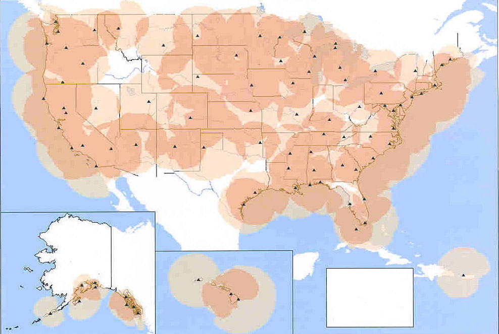
Beginning January 15, 2016, federal agencies responsible for the system plan to close and decommission 62 of the 84 operational NDGPS reference stations that since the late 1990s have transmitted differential corrections in the radiobeacon band (285–325 kHz). The notice was signed by Gary Rasicot, director of Marine Transportation Systems, U.S. Coast Guard (USCG), Gregory Winfree, assistant secretary for research and technology, U.S. Department of Transportation (DoT), and Robert Bank, chief, Civil Works Branch of Engineering and Construction, U.S. Army Corps of Engineers USACE). Persons wishing to express an opinion on these plans have until November 16 to submit comments and related materials to DoT.
The decision follows an assessment of responses to a request for public comment on a Department of Homeland Security (DHS) and DoT analysis of the current and future user needs and requirements for NDGPS.
The system arose from a USCG maritime DGPS system launched in the 1980s to provide real-time positioning accuracy sufficient to meet requirements for the harbor entrance and approach phases of coastal navigation and to support the agency’s buoy positioning mission. The system provided improved horizontal positioning accuracy (better than 10 meters) and integrity (signal accuracy and continuity of delivery) alarms for GPS.
After the Department of Defense (DoD) implemented SA in the early 1990s, NDGPS became important for numerous GPS applications — including precision agriculture — that were proliferating then. A 1997 DoT initiative to expand DGPS services across the United States led to the incorporation of an 29-station inland component to the USCG network, 7 USACE sites used to support river dredging and other operations, and nearly 50 converted U.S. Air Force Ground Wave Emergency Network (GWEN) sites.
The Federal Railroad Administration (FRA) also played an important role in implementing NDGPS when it included it as a requirement for positive train control (PTC). The FRA eliminated this requirement in 2013.
With the Federal Aviation Administration’s development of the satellite-based GPS Wide Area Augmentation System (WAAS), the elimination of SA in May 2000, and growth in the number of GPS continuously operating reference stations (CORS) by the National Geodetic Survey and other agencies, use of NDGPS has declined. Moreover, only a limited number of companies ever built commercial radiobeacon-based DGPS receivers.
The 22 DGPS operational sites will remain available to users in waterways where marine traffic is most frequent and the need for precise marine navigation is greatest. However, the Federal Register notice states that “it is possible for the reference stations to be transitioned to other Federal, state, and/or local agencies.”


