The European Space Agency (ESA)-funded FAIR project (‘Future agriculture through innovative GNSS robustness’), led by SpacEarth Technology(SET), has demonstrated a prototype system for the mitigation of scintillation and multipath effects on GNSS positioning.
The system targets precision agriculture applications and provides users with corrective data to maintain precise positioning under difficult conditions.
The solution includes a low-cost GNSS device integrated with a processing facility powered by a patented SETscintillation forecasting model, along with algorithms for scintillation and multipath mitigation developed by project partner Gter, a University of Genoa spin-off. SET is a spin-off of Italy’s National Institute of Geophysics and Volcanology.
The project was funded under the ESA NAVISP program. At a recent ESA-hosted event, Marco Fermi and Alessandro Fiorini of SET and Andrea Maffia of Gter delivered the final presentation.
As Fermi explained, digital farming faces challenges from GNSS signal disruptions caused by ionospheric scintillation and multipath errors. These disturbances are especially severe in low-latitude regions
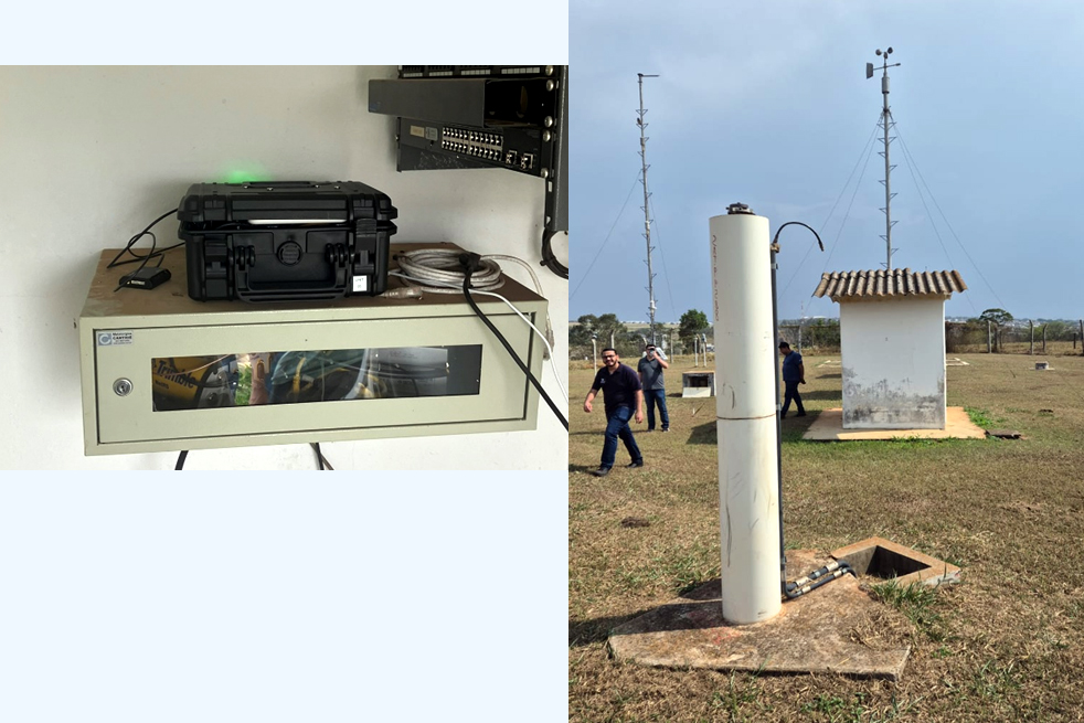
Tested in challenging terrain
Using a short-term scintillation prediction algorithm, the FAIR system can anticipate disturbances before they degrade the GNSS signal. The mitigation service then adjusts the weighting of affected satellites or substitutes corrections derived from RTK and ionospheric monitoring stations.
The system was trialed across several months in an operational digital farming setup in Brazil, where conventional correction networks are sparse and often inadequate. Field demonstrations provided valuable data on both static and moving platforms.
Scintillation mitigation algorithms improved positioning accuracy, although the density of monitoring stations was a limiting factor, highlighting the infrastructure requirements needed to fully unlock the solution’s potential.
Multipath mitigation trials also showed measurable benefits, especially in moving applications, where corrected solutions produced smoother and more reliable trajectories.
Partners said the project has attracted significant industry interest, including from a global mining leader and a major GNSS equipment manufacturer. Additional opportunities are being explored in maritime navigation, drone operations, and autonomous vehicles.
Future priorities for SET and Gter include expanding the monitoring networks needed for robust scintillation mitigation, integrating scintillation and multipath algorithms, and adapting the technology to high-latitude regions where space weather effects present similar challenges.
The FAIR project was co-funded under NAVISP Element 2, which aims to increase European competitiveness in the positioning, navigation and timing (PNT) sector.


