The European Space Agency (ESA) is bringing to bear an innovative GNSS-based method for ocean surface topography, delivering important environmental data for a range of applications.
A project supported by the Discovery element of ESA’s Basic Activities funding scheme recently investigated a GNSS-based technique to precisely measure ocean surface topography (OST). The project was based on an idea submitted by the Institute for Space Studies of Catalonia (IEEC) through the Open Space Innovation Platform.
OST is the study of the height of the ocean’s surface above the geoid, that is the shape the ocean would have if all its currents and tides were calmed. OST is important for a variety of scientific and societal applications, such as current forecasting, climate research, ship routing, cable laying, and debris tracking. Other application areas include fisheries management, navigation and offshore operations.
Space-based Earth observation is the primary, conventional means of monitoring the constantly changing shape of the sea surface. For decades, the American space administration, NASA, has been using specially designed radar altimeter systems to make such measurements, notably under the TOPEX/Poseidon, Jason-1 and Jason-2 missions.
A new approach to ocean surface topography
The GNSS-based approach taken by the ESA project involved assessing satellite navigation signals reflected off of the ocean’s surface at very low angles. At these so-called grazing angles, localized ocean waves and surface roughness have very little impact on the reflection process; the sea surface essentially acts as a very smooth mirror. Under these conditions, it is possible to achieve very precise measurement of surface altitude, to an accuracy of just a few centimeters.
Project partners, which included IEEC, imedea, SOCIB and DLR, specially designed a new GNSS receiver and collecting reflected GNSS signals around the Balearic Islands of the Western Mediterranean Sea. The team then processed the signals for optimized measurements of the shape of the sea surface.
ESA technical officer Manuel Martin-Neira said the results were very useful and prepared the way for a new project called PRETTY (Passive Reflectometry and Dosimetry), which will carry out grazing-angle GNSS altimetry from orbit. This CubeSat mission will host two scientific payloads, one of which will comprise a passive reflectometry system. It will use GNSS signals, both directly and as reflected from the ocean’s surface, to observe differences in the heights of ice and water surfaces.
The ground footprint for reflection measurements is about 15 km x 15 km, a sufficient resolution to significantly improve our understanding of overall ocean energy transport and its role in climate change. PRETTY is due to launch later in 2022.
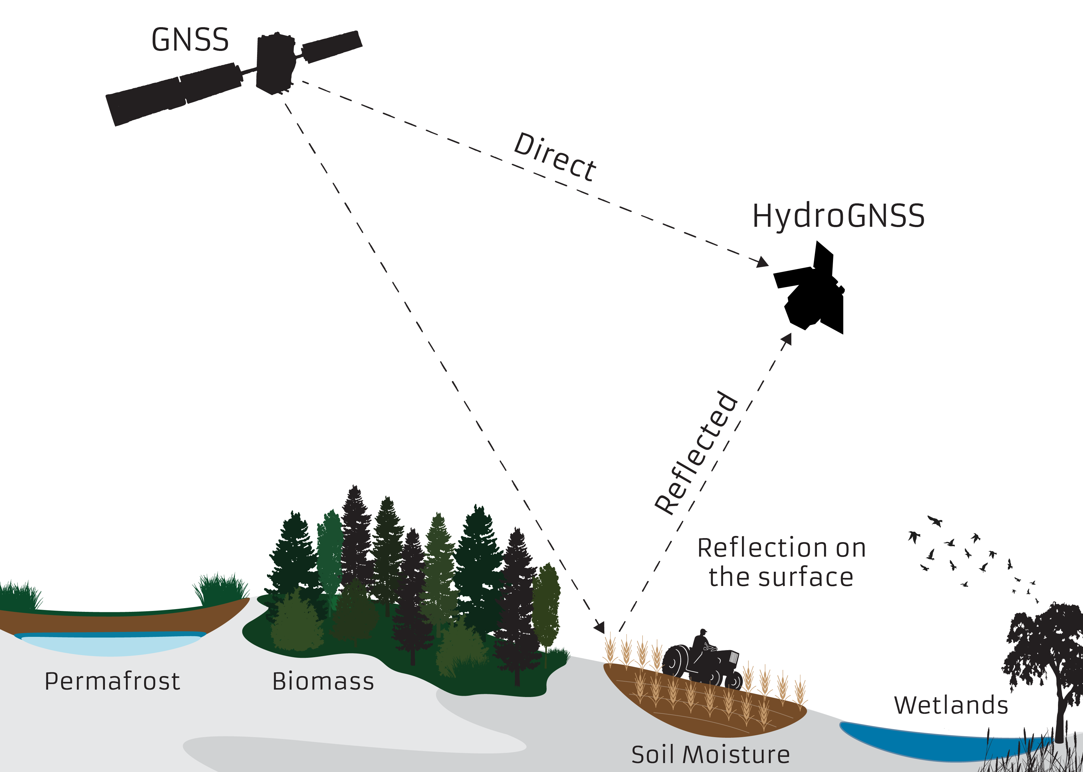
Another similar ESA-funded project now set for launch is HydroGNSS. Partners led by Surrey Satellite Technology Ltd (SSTL) will use GNSS reflectometry to provide measurements of key hydrological climate variables, including soil moisture, freeze–thaw state over permafrost, inundation and wetlands, and above-ground biomass. HydroGNSS is part of a larger series of ESA missions aimed at demonstrating the capability of small satellites to deliver value-added science, either through the miniaturization of existing technologies or by using new sensing techniques.


